TopoQuest Logo
Do you find TopoQuest useful?
Help keep TopoQuest running and adding new maps/features by donating!
Bitcoin:  19c7KJd3qBynnjoSw5npx9KScwjBe4ifkT
Litecoin:  LXs6TkuXGGXo1vDsWCkWVdjQX94eUKd6ui
Home View Maps Find Maps Find Places Resources & Links


Rogersville, Pennsylvania Topographic Map

USGS Map Title: Rogersville, PA
USGS Map MRC: 39080H3
DRG (GeoTIFF) Download: o39080h3.tif


Neighboring USGS Topographic Map Quads:


  Claysville, PA  
40080A4
 

  Prosperity, PA  
40080A3
 

  Amity, PA  
40080A2
 

  Wind Ridge, PA  
39080H4
 

  Rogersville, PA  
39080H3
 

  Waynesburg, PA  
39080H2
 

  New Freeport, PA  
39080G4
 

  Holbrook, PA  
39080G3
 

  Oak Forest, PA  
39080G2


Map MRC Location:

N40°
W81°
N40°
W80°
H8 H7 H6 H5 H4 H3 H2 H1
G8 G7 G6 G5 G4 G3 G2 G1
F8 F7 F6 F5 F4 F3 F2 F1
E8 E7 E6 E5 E4 E3 E2 E1
D8 D7 D6 D5 D4 D3 D2 D1
C8 C7 C6 C5 C4 C3 C2 C1
B8 B7 B6 B5 B4 B3 B2 B1
A8 A7 A6 A5 A4 A3 A2 A1
N39°
W81°
N39°
W80°

Rogersville, PA USGS 1:24K Topographic Map Preview:
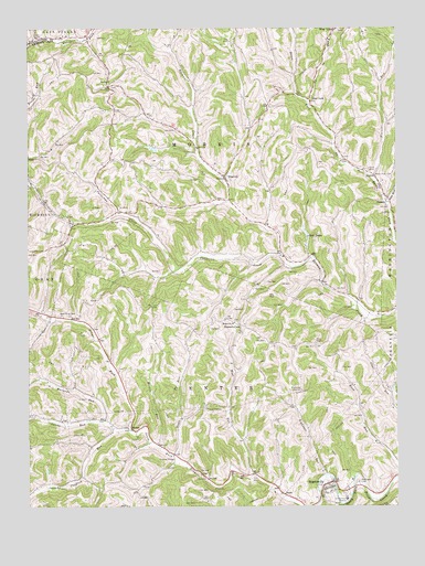
Rogersville, PA USGS Topographic Map
Click on map above to begin viewing in our Map Viewer.

This topographic map contains these locations and features:
Feature Name Type Latitude Longitude GNIS ID View Map
Bates Fork CemeteryCemeteryN39.9619°W80.2564°1168802View Map
Bear LakesLakeN39.9441°W80.2798°1168888View Map
Beulah ChurchChurchN39.9856°W80.3467°1169450View Map
Center Township Volunteer Fire Department Company 91BuildingN39.8793°W80.2661°2644900View Map
Claylick ChurchChurchN39.8804°W80.3645°1171951View Map
Claylick RunStreamN39.8954°W80.3409°1192273View Map
ClintoLocaleN39.8806°W80.2631°1207148View Map
ClintonLocaleN39.8776°W80.2565°1207000View Map
Deer LickPopulated PlaceN39.9815°W80.2790°1203397View Map
Dille RunStreamN39.9537°W80.2528°1173269View Map
Enon ChurchChurchN39.9256°W80.3609°1174277View Map
Fonner RunStreamN39.9606°W80.2578°1192472View Map
Grays ForkStreamN39.8951°W80.3412°1176031View Map
Hopewell ChurchChurchN39.9231°W80.3048°1177396View Map
Hunters CaveLocaleN39.9226°W80.3031°1177612View Map
Jacobs RunStreamN39.8951°W80.3434°1177966View Map
Lightner RunStreamN39.8834°W80.2742°1179324View Map
Maranda RunStreamN39.8967°W80.3490°1180384View Map
Morris RunStreamN39.8909°W80.3312°1181573View Map
Morris Township Volunteer Fire DepartmentBuildingN39.9623°W80.3064°2644740View Map
NinevehPopulated PlaceN39.9615°W80.3078°1182471View Map
Nineveh Post OfficePost OfficeN39.9613°W80.3077°2773226View Map
Patterson CreekStreamN39.9406°W80.2890°1183368View Map
RogersvillePopulated PlaceN39.8812°W80.2728°1200114View Map
Rogersville Census Designated PlaceCensusN39.8806°W80.2694°2630036View Map
Rogersville Post OfficePost OfficeN39.8776°W80.2715°2773251View Map
Rosemont CemeteryCemeteryN39.8815°W80.2631°1185474View Map
RutanPopulated PlaceN39.8951°W80.3398°1204563View Map
Scott RunStreamN39.8884°W80.3259°1187167View Map
SwartsPopulated PlaceN39.9556°W80.2528°1204781View Map
TimeLocaleN39.9662°W80.3723°1189576View Map
Township of CenterCivilN39.8776°W80.2975°1215252View Map
Township of MorrisCivilN39.9716°W80.3084°1215256View Map
West RunStreamN39.8831°W80.2987°1191104View Map

Note: Coordinates in the location and feature list above are referenced to NAD83 datum.


Copyright (C) 2008-2025 Ryan Niemi / Sunset Dynamics ... All Rights Reserved