TopoQuest Logo
Do you find TopoQuest useful?
Help keep TopoQuest running and adding new maps/features by donating!
Bitcoin:  19c7KJd3qBynnjoSw5npx9KScwjBe4ifkT
Litecoin:  LXs6TkuXGGXo1vDsWCkWVdjQX94eUKd6ui
Home View Maps Find Maps Find Places Resources & Links


Claysville, Pennsylvania Topographic Map

USGS Map Title: Claysville, PA
USGS Map MRC: 40080A4
DRG (GeoTIFF) Download: o40080a4.tif


Neighboring USGS Topographic Map Quads:


  Bethany, WV  
40080B5
 

  West Middletown, PA  
40080B4
 

  Washington West, PA  
40080B3
 

  Valley Grove, WV  
40080A5
 

  Claysville, PA  
40080A4
 

  Prosperity, PA  
40080A3
 

  Majorsville, WV  
39080H5
 

  Wind Ridge, PA  
39080H4
 

  Rogersville, PA  
39080H3


Map MRC Location:

N41°
W81°
N41°
W80°
H8 H7 H6 H5 H4 H3 H2 H1
G8 G7 G6 G5 G4 G3 G2 G1
F8 F7 F6 F5 F4 F3 F2 F1
E8 E7 E6 E5 E4 E3 E2 E1
D8 D7 D6 D5 D4 D3 D2 D1
C8 C7 C6 C5 C4 C3 C2 C1
B8 B7 B6 B5 B4 B3 B2 B1
A8 A7 A6 A5 A4 A3 A2 A1
N40°
W81°
N40°
W80°

Claysville, PA USGS 1:24K Topographic Map Preview:
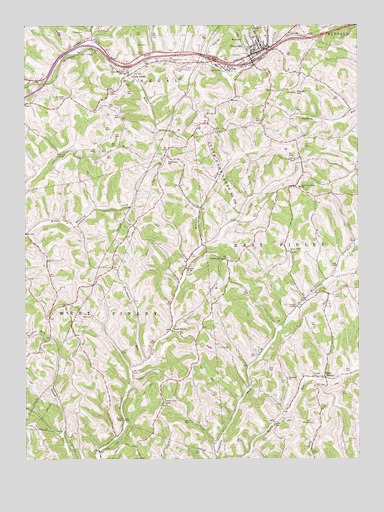
Claysville, PA USGS Topographic Map
Click on map above to begin viewing in our Map Viewer.

This topographic map contains these locations and features:
Feature Name Type Latitude Longitude GNIS ID View Map
Blockhouse RunStreamN40.0279°W80.4545°1169828View Map
Bonar CreekStreamN40.1123°W80.4617°1169971View Map
Borough of ClaysvilleCivilN40.1199°W80.4131°1215658View Map
ClaysvillePopulated PlaceN40.1179°W80.4103°1192274View Map
Claysville Fire Rescue Station 31BuildingN40.1167°W80.4129°2645416View Map
Claysville Number One DamDamN40.1184°W80.4165°1194551View Map
Claysville Number One ReservoirReservoirN40.1202°W80.4172°1211960View Map
Claysville Post OfficePost OfficeN40.1168°W80.4130°2779717View Map
Coon IslandPopulated PlaceN40.1117°W80.4615°1172411View Map
Coon Island Post Office (historical)Post OfficeN40.1117°W80.4615°1214274View Map
Crawford Covered BridgeBridgeN40.0025°W80.4725°2740677View Map
Danley Covered BridgeBridgeN40.0550°W80.4394°2740709View Map
Double Dam Golf CourseLocaleN40.0965°W80.4356°1205572View Map
East FinleyPopulated PlaceN40.0237°W80.3876°1173811View Map
East-West Finley SchoolSchoolN40.0784°W80.3967°1173907View Map
Fairmount ChurchChurchN40.0234°W80.4017°1174450View Map
Good IntentPopulated PlaceN40.0370°W80.4453°1175795View Map
Hair Schoolhouse (historical)SchoolN40.0879°W80.4056°1206032View Map
Jordan School (historical)SchoolN40.0315°W80.4115°1206031View Map
Kimmins Schoolhouse (historical)SchoolN40.0629°W80.4965°1206030View Map
Mosier HillSummitN40.1054°W80.3981°1181612View Map
Pa-661 DamDamN40.0901°W80.4248°1194526View Map
Saint James CemeteryCemeteryN40.1042°W80.4848°1186004View Map
Sampson HillSummitN40.0859°W80.4462°1186896View Map
Sawhill Schoolhouse (historical)SchoolN40.1012°W80.3773°1206033View Map
Scott Brownlee Covered BridgeBridgeN40.0439°W80.3978°2740674View Map
State Game Lands Number 245ParkN40.0842°W80.4253°1190993View Map
Stoney Point CemeteryCemeteryN40.0597°W80.3994°1188752View Map
Stony Point Schoolhouse (historical)SchoolN40.0604°W80.4006°1206029View Map
Township of East FinleyCivilN40.0506°W80.3905°1217191View Map
Township of West FinleyCivilN40.0208°W80.4745°1217211View Map
Trussel CemeteryCemeteryN40.0242°W80.3923°1189890View Map
Uphill AirportAirportN40.1065°W80.4306°2761682View Map
West Finley CemeteryCemeteryN40.0160°W80.4476°1191024View Map
Wheeling Hill ChurchChurchN40.0576°W80.4259°1191222View Map
Windy Gap ChurchChurchN40.0001°W80.4556°1191589View Map

Note: Coordinates in the location and feature list above are referenced to NAD83 datum.


Copyright (C) 2008-2025 Ryan Niemi / Sunset Dynamics ... All Rights Reserved