TopoQuest Logo
Do you find TopoQuest useful?
Help keep TopoQuest running and adding new maps/features by donating!
Bitcoin:  19c7KJd3qBynnjoSw5npx9KScwjBe4ifkT
Litecoin:  LXs6TkuXGGXo1vDsWCkWVdjQX94eUKd6ui
Home View Maps Find Maps Find Places Resources & Links


Wind Ridge, Pennsylvania Topographic Map

USGS Map Title: Wind Ridge, PA
USGS Map MRC: 39080H4
DRG (GeoTIFF) Download: o39080h4.tif


Neighboring USGS Topographic Map Quads:


  Valley Grove, WV  
40080A5
 

  Claysville, PA  
40080A4
 

  Prosperity, PA  
40080A3
 

  Majorsville, WV  
39080H5
 

  Wind Ridge, PA  
39080H4
 

  Rogersville, PA  
39080H3
 

  Cameron, WV  
39080G5
 

  New Freeport, PA  
39080G4
 

  Holbrook, PA  
39080G3


Map MRC Location:

N40°
W81°
N40°
W80°
H8 H7 H6 H5 H4 H3 H2 H1
G8 G7 G6 G5 G4 G3 G2 G1
F8 F7 F6 F5 F4 F3 F2 F1
E8 E7 E6 E5 E4 E3 E2 E1
D8 D7 D6 D5 D4 D3 D2 D1
C8 C7 C6 C5 C4 C3 C2 C1
B8 B7 B6 B5 B4 B3 B2 B1
A8 A7 A6 A5 A4 A3 A2 A1
N39°
W81°
N39°
W80°

Wind Ridge, PA USGS 1:24K Topographic Map Preview:
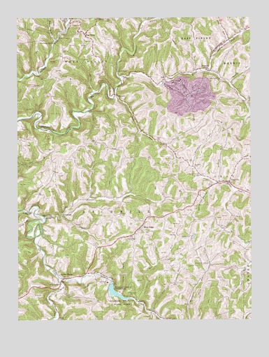
Wind Ridge, PA USGS Topographic Map
Click on map above to begin viewing in our Map Viewer.

This topographic map contains these locations and features:
Feature Name Type Latitude Longitude GNIS ID View Map
Beham RunStreamN39.9909°W80.4792°1169130View Map
Boothe RunStreamN39.9731°W80.3870°1170005View Map
Braddock CemeteryCemeteryN39.9388°W80.4054°1170121View Map
BryanPopulated PlaceN39.8754°W80.4787°1203178View Map
BurdettePopulated PlaceN39.9681°W80.4465°1203189View Map
BurnstownLocaleN39.9912°W80.4798°1207147View Map
Chapel CemeteryCemeteryN39.9973°W80.4656°1171561View Map
CrabapplePopulated PlaceN39.9198°W80.4753°1203358View Map
Crabapple CreekStreamN39.9173°W80.4853°1172578View Map
DurbinPopulated PlaceN39.9181°W80.4848°1203459View Map
EnonPopulated PlaceN39.9751°W80.4206°1203521View Map
Enon CemeteryCemeteryN39.9742°W80.4178°1174276View Map
Fairview ChurchChurchN39.9092°W80.4076°1174511View Map
Fletcher RunStreamN39.9387°W80.4070°1174900View Map
Four Seasons CampgroundLocaleN39.9584°W80.4748°1208372View Map
GraysvillePopulated PlaceN39.9320°W80.3848°1176035View Map
Graysville Post OfficePost OfficeN39.9320°W80.3871°2772727View Map
Graysville Volunteer Fire Department Company 16BuildingN39.9314°W80.3868°2645895View Map
Grinnage RunStreamN39.9312°W80.3926°1176251View Map
JacksonvilleLocaleN39.9126°W80.4331°1207572View Map
Jacksonville CemeteryCemeteryN39.9121°W80.4328°1177942View Map
Jacktown FairgroundsLocaleN39.9092°W80.4392°1177947View Map
Kent RunStreamN39.8823°W80.4356°1178382View Map
Lazear CemeteryCemeteryN39.9102°W80.4859°1179072View Map
Leslie CemeteryCemeteryN39.9731°W80.4140°1179215View Map
Long RunStreamN39.9904°W80.3856°1179891View Map
NeboPopulated PlaceN39.9456°W80.4470°1204263View Map
Nebo ChurchChurchN39.9487°W80.4587°1182201View Map
North Fork Dunkard ForkStreamN39.8931°W80.4784°1198104View Map
Owens RunStreamN39.9679°W80.4470°1183151View Map
Polen RunStreamN39.8787°W80.4284°1184196View Map
Polly HollowValleyN39.8863°W80.4449°1184216View Map
Richhill Township Volunteer Fire Department Company 28BuildingN39.9137°W80.4324°2645626View Map
Rocky RunStreamN39.9990°W80.4303°1193212View Map
Ryerson StationPopulated PlaceN39.8926°W80.4748°1185669View Map
Ryerson Station ReservoirReservoirN39.8862°W80.4474°1194408View Map
Ryerson Station State ParkParkN39.8820°W80.4442°1185670View Map
Ryerson Station State Park DamDamN39.8901°W80.4498°1194409View Map
Simpson StorePopulated PlaceN39.9784°W80.3981°1187707View Map
South Fork Dunkard ForkStreamN39.8929°W80.4781°1198127View Map
South Wheeling ChurchChurchN39.8895°W80.4773°1188120View Map
State Game Lands Number 302ParkN39.9501°W80.4970°1208373View Map
Templeton ForkStreamN39.9756°W80.4445°1200121View Map
Township of GrayCivilN39.9322°W80.3833°1216490View Map
Township of RichhillCivilN39.9121°W80.4491°1215259View Map
Union Valley ChurchChurchN39.9748°W80.3909°1190181View Map
West FinleyPopulated PlaceN39.9931°W80.4631°1191023View Map
West Finley Post OfficePost OfficeN39.9925°W80.4633°2779791View Map
West Finley Volunteer Fire Company Station 53BuildingN39.9933°W80.4672°2645426View Map
Wind RidgePopulated PlaceN39.9129°W80.4342°1191564View Map
Wind Ridge Census Designated PlaceCensusN39.9111°W80.4320°2630051View Map
Wind Ridge Post OfficePost OfficeN39.9125°W80.4354°2773288View Map
Zimmerman HollowValleyN39.9311°W80.3938°1191955View Map
Zollars CemeteryCemeteryN39.9492°W80.4237°1192029View Map

Note: Coordinates in the location and feature list above are referenced to NAD83 datum.


Copyright (C) 2008-2025 Ryan Niemi / Sunset Dynamics ... All Rights Reserved