TopoQuest Logo
Do you find TopoQuest useful?
Help keep TopoQuest running and adding new maps/features by donating!
Bitcoin:  19c7KJd3qBynnjoSw5npx9KScwjBe4ifkT
Litecoin:  LXs6TkuXGGXo1vDsWCkWVdjQX94eUKd6ui
Home View Maps Find Maps Find Places Resources & Links


Claysville, Kentucky Topographic Map

USGS Map Title: Claysville, KY
USGS Map MRC: 38084E2
DRG (GeoTIFF) Download: o38084e2.tif


Neighboring USGS Topographic Map Quads:


  Falmouth, KY  
38084F3
 

  Berlin, KY  
38084F2
 

  Brooksville, KY  
38084F1
 

  Kelat, KY  
38084E3
 

  Claysville, KY  
38084E2
 

  Mount Olivet, KY  
38084E1
 

  Cynthiana, KY  
38084D3
 

  Shady Nook, KY  
38084D2
 

  Piqua, KY  
38084D1


Map MRC Location:

N39°
W85°
N39°
W84°
H8 H7 H6 H5 H4 H3 H2 H1
G8 G7 G6 G5 G4 G3 G2 G1
F8 F7 F6 F5 F4 F3 F2 F1
E8 E7 E6 E5 E4 E3 E2 E1
D8 D7 D6 D5 D4 D3 D2 D1
C8 C7 C6 C5 C4 C3 C2 C1
B8 B7 B6 B5 B4 B3 B2 B1
A8 A7 A6 A5 A4 A3 A2 A1
N38°
W85°
N38°
W84°

Claysville, KY USGS 1:24K Topographic Map Preview:
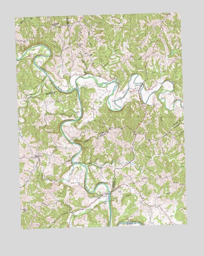
Claysville, KY USGS Topographic Map
Click on map above to begin viewing in our Map Viewer.

This topographic map contains these locations and features:
Feature Name Type Latitude Longitude GNIS ID View Map
Aulick Post Office (historical)Post OfficeN38.6009°W84.2157°2564227View Map
Barlow ChurchChurchN38.5112°W84.2477°486364View Map
Beaver CreekStreamN38.5156°W84.1835°486612View Map
Browning CemeteryCemeteryN38.6187°W84.2174°488022View Map
Browning CornerPopulated PlaceN38.6198°W84.2208°488023View Map
Charley BranchStreamN38.5884°W84.1955°489367View Map
ClaysvillePopulated PlaceN38.5192°W84.1852°489599View Map
Coleman BranchStreamN38.5840°W84.1563°489817View Map
Coleman CemeteryCemeteryN38.5898°W84.1485°489823View Map
Doggett CemeteryCemeteryN38.6009°W84.1947°490986View Map
Ernst Post Office (historical)Post OfficeN38.5868°W84.2091°2564246View Map
Fallen Rock (historical)LocaleN38.5681°W84.1805°2362814View Map
Forest Grove School (historical)SchoolN38.6004°W84.1737°2362817View Map
Garrard BranchStreamN38.5504°W84.2091°492716View Map
Greasy CreekStreamN38.5162°W84.1824°493232View Map
Harrison County Volunteer Fire Department Station 6 SunriseBuildingN38.5428°W84.2370°2637155View Map
Harrison CreekStreamN38.5373°W84.2080°493814View Map
Hitch CemeteryCemeteryN38.5203°W84.1741°494310View Map
Jackson BranchStreamN38.5115°W84.1480°495104View Map
Little Richland CreekStreamN38.5626°W84.2483°496837View Map
MilfordPopulated PlaceN38.5817°W84.1566°498188View Map
Milford Post Office (historical)Post OfficeN38.5830°W84.1566°2362831View Map
Milford School (historical)SchoolN38.5812°W84.1609°2362832View Map
Mill CreekStreamN38.5804°W84.2119°498253View Map
Mount Gilead ChurchChurchN38.5742°W84.2197°498735View Map
North Fork Licking RiverStreamN38.5826°W84.2052°499554View Map
Ogeden CemeteryCemeteryN38.5790°W84.1624°499776View Map
PetraPopulated PlaceN38.6242°W84.1338°508809View Map
Pipe CreekStreamN38.5829°W84.1408°500752View Map
Pleasant Valley CemeteryCemeteryN38.5392°W84.1505°500922View Map
Poston Saw Mill (historical)LocaleN38.5907°W84.2280°2564316View Map
Richland CreekStreamN38.5904°W84.2272°501824View Map
Rush BranchStreamN38.5717°W84.1533°502479View Map
Sante Fe School (historical)SchoolN38.5693°W84.1253°2362850View Map
Showalter CemeteryCemeteryN38.6073°W84.2024°503463View Map
Stony CreekStreamN38.5076°W84.2091°504499View Map
SunrisePopulated PlaceN38.5426°W84.2366°504803View Map
The North Fork Baptist Church (historical)ChurchN38.5820°W84.1822°2362860View Map
Travelers Rest Post Office (historical)Post OfficeN38.5810°W84.2348°2564326View Map
West CreekStreamN38.5362°W84.2005°506413View Map
Whitehead CemeteryCemeteryN38.5142°W84.1852°506654View Map
Willow Baptist ChurchChurchN38.6072°W84.1545°2362870View Map
Willow CreekStreamN38.5859°W84.1760°506866View Map
Yellow Willow CreekStreamN38.5940°W84.1830°507223View Map

Note: Coordinates in the location and feature list above are referenced to NAD83 datum.


Copyright (C) 2008-2024 Ryan Niemi / Sunset Dynamics ... All Rights Reserved