TopoQuest Logo
Do you find TopoQuest useful?
Help keep TopoQuest running and adding new maps/features by donating!
Bitcoin:  19c7KJd3qBynnjoSw5npx9KScwjBe4ifkT
Litecoin:  LXs6TkuXGGXo1vDsWCkWVdjQX94eUKd6ui
Home View Maps Find Maps Find Places Resources & Links


Shady Nook, Kentucky Topographic Map

USGS Map Title: Shady Nook, KY
USGS Map MRC: 38084D2
DRG (GeoTIFF) Download: o38084d2.tif


Neighboring USGS Topographic Map Quads:


  Kelat, KY  
38084E3
 

  Claysville, KY  
38084E2
 

  Mount Olivet, KY  
38084E1
 

  Cynthiana, KY  
38084D3
 

  Shady Nook, KY  
38084D2
 

  Piqua, KY  
38084D1
 

  Shawhan, KY  
38084C3
 

  Millersburg, KY  
38084C2
 

  Carlisle, KY  
38084C1


Map MRC Location:

N39°
W85°
N39°
W84°
H8 H7 H6 H5 H4 H3 H2 H1
G8 G7 G6 G5 G4 G3 G2 G1
F8 F7 F6 F5 F4 F3 F2 F1
E8 E7 E6 E5 E4 E3 E2 E1
D8 D7 D6 D5 D4 D3 D2 D1
C8 C7 C6 C5 C4 C3 C2 C1
B8 B7 B6 B5 B4 B3 B2 B1
A8 A7 A6 A5 A4 A3 A2 A1
N38°
W85°
N38°
W84°

Shady Nook, KY USGS 1:24K Topographic Map Preview:
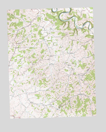
Shady Nook, KY USGS Topographic Map
Click on map above to begin viewing in our Map Viewer.

This topographic map contains these locations and features:
Feature Name Type Latitude Longitude GNIS ID View Map
Baptist Post Office (historical)Post OfficeN38.4774°W84.1857°2564156View Map
Beaver ChurchChurchN38.4765°W84.1866°486607View Map
Beckboro Post Office (historical)Post OfficeN38.3758°W84.2441°2564158View Map
Brushy ForkStreamN38.4645°W84.1972°488130View Map
Buena VistaPopulated PlaceN38.4365°W84.1680°507609View Map
Buena Vista Elementary School (historical)SchoolN38.4361°W84.1663°2564167View Map
Buena Vista Post Office (historical)Post OfficeN38.4640°W84.1678°2564168View Map
Harding CemeteryCemeteryN38.4770°W84.1471°493724View Map
Hardins Ferry (historical)CrossingN38.4778°W84.1497°2564187View Map
Hardins Ferry (historical)CrossingN38.4781°W84.1491°2555363View Map
Harrison County Volunteer Fire Department Station 4BuildingN38.4314°W84.1711°2637111View Map
James RunStreamN38.4629°W84.1966°2564190View Map
Jones Shop (historical)Populated PlaceN38.3761°W84.2441°2564191View Map
Little Beaver CreekStreamN38.4926°W84.2049°496612View Map
Little Beaver CreekStreamN38.4201°W84.1483°496614View Map
Morning GloryPopulated PlaceN38.4006°W84.1477°498603View Map
Morning Glory Post Office (historical)Post OfficeN38.4004°W84.1440°2555887View Map
Mount Pleasant ChurchChurchN38.4220°W84.1419°498852View Map
Mount Pleasant Church CemeteryCemeteryN38.4224°W84.1430°2564105View Map
Mudlick CreekStreamN38.4298°W84.1541°499064View Map
New Salem ChurchChurchN38.4451°W84.1897°499397View Map
Oak Shade Farm (historical)LocaleN38.3956°W84.2265°2564109View Map
OddvillePopulated PlaceN38.4556°W84.2388°508734View Map
Oddville ChurchChurchN38.4612°W84.2360°499773View Map
Oddville Post Office (historical)Post OfficeN38.4558°W84.2386°2564111View Map
Old Salem CemeteryCemeteryN38.4359°W84.1885°499878View Map
Pretty BranchStreamN38.4376°W84.1524°501309View Map
Rankin CemeteryCemeteryN38.3951°W84.1460°501572View Map
Republican ChurchChurchN38.4340°W84.1638°501730View Map
Republican Church CemeteryCemeteryN38.4337°W84.1640°2564123View Map
Salem Christian Church (historical)ChurchN38.4359°W84.1890°2564131View Map
Shady NookLocaleN38.3901°W84.1924°503225View Map
Silvendell Post Office (historical)Post OfficeN38.4479°W84.1589°2564133View Map
Smalley CreekStreamN38.4854°W84.2158°503719View Map
Smitsonville Post Office (historical)Post OfficeN38.4829°W84.2154°2564134View Map
South Fork Indian CreekStreamN38.4055°W84.2388°2564135View Map
SylvandellPopulated PlaceN38.4476°W84.1594°509177View Map
VenusPopulated PlaceN38.4420°W84.1924°509281View Map
Venus Post Office (historical)Post OfficeN38.4412°W84.1908°2564143View Map
Woodland Hall Farm (historical)LocaleN38.3839°W84.2207°2564149View Map

Note: Coordinates in the location and feature list above are referenced to NAD83 datum.


Copyright (C) 2008-2025 Ryan Niemi / Sunset Dynamics ... All Rights Reserved