TopoQuest Logo
Do you find TopoQuest useful?
Help keep TopoQuest running and adding new maps/features by donating!
Bitcoin:  19c7KJd3qBynnjoSw5npx9KScwjBe4ifkT
Litecoin:  LXs6TkuXGGXo1vDsWCkWVdjQX94eUKd6ui
Home View Maps Find Maps Find Places Resources & Links


Mount Olivet, Kentucky Topographic Map

USGS Map Title: Mount Olivet, KY
USGS Map MRC: 38084E1
DRG (GeoTIFF) Download: o38084e1.tif


Neighboring USGS Topographic Map Quads:


  Berlin, KY  
38084F2
 

  Brooksville, KY  
38084F1
 

  Germantown, KY  
38083F8
 

  Claysville, KY  
38084E2
 

  Mount Olivet, KY  
38084E1
 

  Sardis, KY  
38083E8
 

  Shady Nook, KY  
38084D2
 

  Piqua, KY  
38084D1
 

  Cowan, KY  
38083D8


Map MRC Location:

N39°
W85°
N39°
W84°
H8 H7 H6 H5 H4 H3 H2 H1
G8 G7 G6 G5 G4 G3 G2 G1
F8 F7 F6 F5 F4 F3 F2 F1
E8 E7 E6 E5 E4 E3 E2 E1
D8 D7 D6 D5 D4 D3 D2 D1
C8 C7 C6 C5 C4 C3 C2 C1
B8 B7 B6 B5 B4 B3 B2 B1
A8 A7 A6 A5 A4 A3 A2 A1
N38°
W85°
N38°
W84°

Mount Olivet, KY USGS 1:24K Topographic Map Preview:
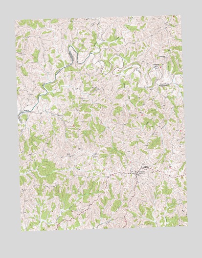
Mount Olivet, KY USGS Topographic Map
Click on map above to begin viewing in our Map Viewer.

This topographic map contains these locations and features:
Feature Name Type Latitude Longitude GNIS ID View Map
Belcourt Post Office (historical)Post OfficeN38.6188°W84.0113°2362793View Map
Belmont (historical)Populated PlaceN38.6051°W84.1192°2362794View Map
Belmont ChurchChurchN38.6048°W84.1194°486834View Map
Belmont School (historical)SchoolN38.6004°W84.1167°2362795View Map
BrattonPopulated PlaceN38.5684°W84.0952°487845View Map
Bratton Post Office (historical)Post OfficeN38.5687°W84.0947°2556052View Map
BridgevillePopulated PlaceN38.5951°W84.0199°507581View Map
Bridgeville Post Office (historical)Post OfficeN38.5953°W84.0197°2362799View Map
Bridgeville School (historical)SchoolN38.5931°W84.0203°2556067View Map
Brierly RidgeRidgeN38.5704°W84.0448°2555889View Map
Brierly Ridge (historical)Populated PlaceN38.5679°W84.0431°2556051View Map
Brushy ForkStreamN38.6164°W84.0394°2362802View Map
Camp CreekStreamN38.6101°W84.0585°488689View Map
City of Mount OlivetCivilN38.5317°W84.0359°2404322View Map
Day CemeteryCemeteryN38.5553°W84.0227°490702View Map
Drift RunStreamN38.5701°W84.1219°491116View Map
Drift Run Bridge (historical)BridgeN38.5703°W84.1216°2556055View Map
Elms RunStreamN38.5840°W84.0185°491740View Map
Flat RunStreamN38.5963°W84.0888°2362816View Map
Fosters ChapelChurchN38.5434°W84.0858°492370View Map
Fosters Chapel CemeteryCemeteryN38.5438°W84.0865°2556050View Map
Henson CemeteryCemeteryN38.5473°W84.0021°494078View Map
Hitts Post Office (historical)Post OfficeN38.5841°W84.0653°2556066View Map
Hitts School (historical)SchoolN38.5831°W84.0649°2556065View Map
HittvillePopulated PlaceN38.5831°W84.0638°508257View Map
Islands RunStreamN38.5909°W84.0472°495049View Map
Linville (historical)Populated PlaceN38.5701°W84.0316°2556054View Map
Little Panther CreekStreamN38.5790°W84.0027°496823View Map
McKindree ChurchChurchN38.5998°W84.0124°497903View Map
Mount Hope Post Office (historical)Post OfficeN38.5976°W84.1224°2362834View Map
Mount OlivetPopulated PlaceN38.5315°W84.0369°498801View Map
Mount Olivet DivisionCivilN38.5188°W84.0520°1937156View Map
Mud LickStreamN38.5801°W84.1072°498994View Map
New Corinth ChurchChurchN38.5823°W84.0633°499308View Map
New Corinth Church CemeteryCemeteryN38.5821°W84.0640°2556064View Map
Oakland (historical)Populated PlaceN38.6216°W84.0679°2362837View Map
Oakland ChurchChurchN38.6231°W84.0819°2362838View Map
Old Corinth CemeteryCemeteryN38.5773°W84.0749°499816View Map
Old Corinth Church (historical)ChurchN38.5772°W84.0753°2556063View Map
Panther CreekStreamN38.5890°W84.0066°500158View Map
Riggs SchoolSchoolN38.5445°W84.0683°501860View Map
Robertson CountyCivilN38.5188°W84.0520°516947View Map
Robertson County Sheriff's OfficeBuildingN38.5317°W84.0359°2767415View Map
Robertson Volunteer Fire DepartmentBuildingN38.5341°W84.0414°2636924View Map
Salt LickStreamN38.5815°W84.1022°502820View Map
Santa FePopulated PlaceN38.5712°W84.1216°509014View Map
Santafe Post Office (historical)Post OfficeN38.5700°W84.1217°2556053View Map
Sante Fe Post Office (historical)Post OfficeN38.5708°W84.1211°2362849View Map
Stone CreekStreamN38.6237°W84.0610°504456View Map
StonewallPopulated PlaceN38.6192°W84.0113°509138View Map
Willow BranchStreamN38.6040°W84.0683°506860View Map
Zion ChurchChurchN38.5476°W84.0783°507289View Map

Note: Coordinates in the location and feature list above are referenced to NAD83 datum.


Copyright (C) 2008-2025 Ryan Niemi / Sunset Dynamics ... All Rights Reserved