TopoQuest Logo
Do you find TopoQuest useful?
Help keep TopoQuest running and adding new maps/features by donating!
Bitcoin:  19c7KJd3qBynnjoSw5npx9KScwjBe4ifkT
Litecoin:  LXs6TkuXGGXo1vDsWCkWVdjQX94eUKd6ui
Home View Maps Find Maps Find Places Resources & Links


Clayton, Illinois Topographic Map

USGS Map Title: Clayton, IL
USGS Map MRC: 40090A8
DRG (GeoTIFF) Download: o40090a8.tif


Neighboring USGS Topographic Map Quads:


  Bowen, IL  
40091B1
 

  Augusta, IL  
40090B8
 

  Camden, IL  
40090B7
 

  Camp Point, IL  
40091A1
 

  Clayton, IL  
40090A8
 

  Lake Mount Sterling, IL  
40090A7
 

  Liberty, IL  
39091H1
 

  Kellerville, IL  
39090H8
 

  Mount Sterling, IL  
39090H7


Map MRC Location:

N41°
W91°
N41°
W90°
H8 H7 H6 H5 H4 H3 H2 H1
G8 G7 G6 G5 G4 G3 G2 G1
F8 F7 F6 F5 F4 F3 F2 F1
E8 E7 E6 E5 E4 E3 E2 E1
D8 D7 D6 D5 D4 D3 D2 D1
C8 C7 C6 C5 C4 C3 C2 C1
B8 B7 B6 B5 B4 B3 B2 B1
A8 A7 A6 A5 A4 A3 A2 A1
N40°
W91°
N40°
W90°

Clayton, IL USGS 1:24K Topographic Map Preview:
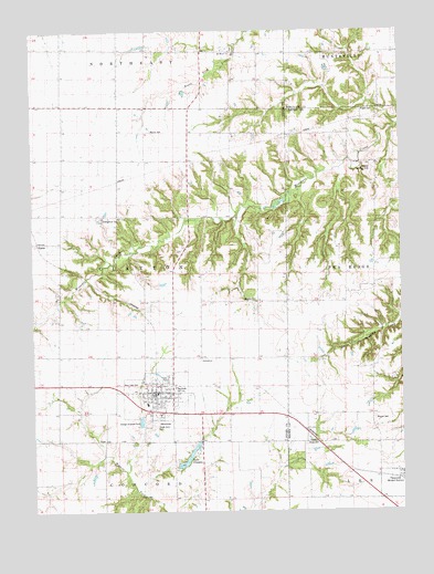
Clayton, IL USGS Topographic Map
Click on map above to begin viewing in our Map Viewer.

This topographic map contains these locations and features:
Feature Name Type Latitude Longitude GNIS ID View Map
BlacksPopulated PlaceN40.0703°W90.9982°1785255View Map
ClaytonPopulated PlaceN40.0314°W90.9607°406192View Map
Clayton Christian ChurchChurchN40.0314°W90.9568°1837319View Map
Clayton Fire Protection DistrictBuildingN40.0303°W90.9599°2640136View Map
Clayton Reservoir DamDamN40.0117°W90.9521°1691552View Map
Evangelical Lutheran CemeteryCemeteryN40.0767°W90.9765°418814View Map
First Federated ChurchChurchN40.0309°W90.9585°1837322View Map
Good Shepherd Lutheran ChurchChurchN40.0284°W90.9579°1837323View Map
Hazel Dell School (historical)SchoolN40.0034°W90.9343°409980View Map
Herren AirportAirportN40.0890°W90.8844°427869View Map
Howe CemeteryCemeteryN40.0175°W90.9087°410620View Map
Knight CemeteryCemeteryN40.1042°W90.8887°411575View Map
Lake ClaytonReservoirN40.0141°W90.9478°406195View Map
Logue School (historical)SchoolN40.0470°W90.9237°412527View Map
Meints CemeteryCemeteryN40.0989°W90.9598°413370View Map
Mound School (historical)SchoolN40.0234°W90.8857°413920View Map
Mounds CemeteryCemeteryN40.0239°W90.8848°1720807View Map
Mount Horeb CemeteryCemeteryN40.1198°W90.9315°1984974View Map
Mount Horeb ChurchChurchN40.1198°W90.9326°413987View Map
Poe School (historical)SchoolN40.0903°W90.8832°415969View Map
Sargent CemeteryCemeteryN40.0550°W90.9243°1720568View Map
Shank School (historical)SchoolN40.0581°W90.8843°418281View Map
South Prairie School (historical)SchoolN40.0923°W90.9785°418815View Map
South Side CemeteryCemeteryN40.0228°W90.9593°1720572View Map
Sulphur Springs School (historical)SchoolN40.0898°W90.9468°419341View Map
Township of ClaytonCivilN40.0619°W90.9722°428817View Map
Union School (historical)SchoolN40.1062°W90.9904°420116View Map
Village of ClaytonCivilN40.0302°W90.9581°2397640View Map
West Side CemeteryCemeteryN40.0328°W90.9662°1720579View Map

Note: Coordinates in the location and feature list above are referenced to NAD83 datum.


Copyright (C) 2008-2025 Ryan Niemi / Sunset Dynamics ... All Rights Reserved