TopoQuest Logo
Do you find TopoQuest useful?
Help keep TopoQuest running and adding new maps/features by donating!
Bitcoin:  19c7KJd3qBynnjoSw5npx9KScwjBe4ifkT
Litecoin:  LXs6TkuXGGXo1vDsWCkWVdjQX94eUKd6ui
Home View Maps Find Maps Find Places Resources & Links


Liberty, Illinois Topographic Map

USGS Map Title: Liberty, IL
USGS Map MRC: 39091H1
DRG (GeoTIFF) Download: o39091h1.tif


Neighboring USGS Topographic Map Quads:


  Coatsburg, IL  
40091A2
 

  Camp Point, IL  
40091A1
 

  Clayton, IL  
40090A8
 

  Columbus, IL  
39091H2
 

  Liberty, IL  
39091H1
 

  Kellerville, IL  
39090H8
 

  Payson, IL  
39091G2
 

  Richfield, IL  
39091G1
 

  Fishhook, IL  
39090G8


Map MRC Location:

N40°
W92°
N40°
W91°
H8 H7 H6 H5 H4 H3 H2 H1
G8 G7 G6 G5 G4 G3 G2 G1
F8 F7 F6 F5 F4 F3 F2 F1
E8 E7 E6 E5 E4 E3 E2 E1
D8 D7 D6 D5 D4 D3 D2 D1
C8 C7 C6 C5 C4 C3 C2 C1
B8 B7 B6 B5 B4 B3 B2 B1
A8 A7 A6 A5 A4 A3 A2 A1
N39°
W92°
N39°
W91°

Liberty, IL USGS 1:24K Topographic Map Preview:
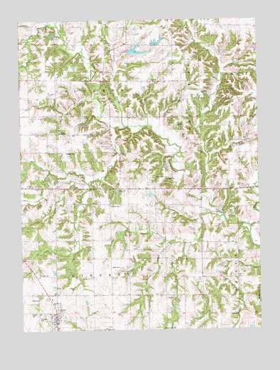
Liberty, IL USGS Topographic Map
Click on map above to begin viewing in our Map Viewer.

This topographic map contains these locations and features:
Feature Name Type Latitude Longitude GNIS ID View Map
Adams County Ambulance Emergency Medical ServicesBuildingN39.8774°W91.1078°2673980View Map
Camp CallahanLocaleN39.9548°W91.1043°1720504View Map
Camp MohawkLocaleN39.9575°W91.0410°1720505View Map
Center Union School (historical)SchoolN39.9470°W91.1004°405840View Map
Chaplin School (historical)SchoolN39.9020°W91.0782°405967View Map
Clark Family CemeteryCemeteryN39.8817°W91.0737°1720510View Map
Coats CemeteryCemeteryN39.9317°W91.0732°1720511View Map
Columbus Dry Gulch Club LakeReservoirN39.9940°W91.1077°1691557View Map
Columbus Dry Gulch Club Lake DamDamN39.9950°W91.1068°1691556View Map
Concord CemeteryCemeteryN39.9492°W91.0107°1720512View Map
Curl CreekStreamN39.9309°W91.0265°406899View Map
Earel CemeteryCemeteryN39.9756°W91.0560°1720518View Map
East Union School (historical)SchoolN39.8964°W91.0396°407706View Map
Elmwood School (historical)SchoolN39.9978°W91.0143°407962View Map
Excelsior School (historical)SchoolN39.9739°W91.0601°408139View Map
Figley BranchStreamN39.9575°W91.0693°408363View Map
Fisher BranchStreamN39.9203°W91.0199°408397View Map
Goertz CemeteryCemeteryN39.8812°W91.0126°1720524View Map
Grubb Family CemeteryCemeteryN39.8975°W91.1151°1720529View Map
Harrell Lake Dam SouthDamN39.9867°W91.0685°1692546View Map
Harrell Lake NorthReservoirN39.9902°W91.0524°1692489View Map
Harrell Lake North DamDamN39.9900°W91.0518°1692488View Map
Harrell Lake SouthReservoirN39.9867°W91.0685°1692547View Map
Hazel Bluff School (historical)SchoolN39.9548°W91.0065°409969View Map
Hufnagel CemeteryCemeteryN39.9470°W91.1007°1720534View Map
Hughes Family CemeteryCemeteryN39.8753°W91.0815°1720535View Map
LibertyPopulated PlaceN39.8795°W91.1079°411982View Map
Liberty Fire Protection DistrictBuildingN39.8774°W91.1079°2640893View Map
Liberty High SchoolSchoolN39.8859°W91.1082°1785299View Map
Liberty Old CemeteryCemeteryN39.8875°W91.1154°1785298View Map
Liberty Post OfficePost OfficeN39.8789°W91.1073°2788428View Map
Lierle CreekStreamN39.9573°W91.0762°412072View Map
Lost Prairie ChurchChurchN39.9359°W91.0504°412666View Map
Lost Prairie School (historical)SchoolN39.9253°W91.0607°412668View Map
Nation CemeteryCemeteryN39.9256°W91.0779°1720553View Map
North Rock School (historical)SchoolN39.9025°W91.0124°414656View Map
Robinson School (historical)SchoolN39.9692°W91.1196°416776View Map
Saint Brigids CemeteryCemeteryN39.8798°W91.1160°1785334View Map
Saint Peters Evangelical Lutheran CemeteryCemeteryN39.9359°W91.0487°1720567View Map
Sims PondReservoirN39.9067°W91.0518°1691547View Map
Sims Pond DamDamN39.9067°W91.0518°1691546View Map
Township of ColumbusCivilN39.9759°W91.0891°428834View Map
Township of LibertyCivilN39.8888°W91.0888°429253View Map
Village of LibertyCivilN39.8800°W91.1067°2398433View Map
Walker BranchStreamN39.9087°W91.0390°420396View Map
Walker CemeteryCemeteryN39.9003°W91.0735°1720578View Map
Walnut ForkStreamN39.9156°W91.0060°420450View Map
Williams Family CemeteryCemeteryN39.8920°W91.0976°1720581View Map
Willow BranchStreamN39.9106°W91.0493°421232View Map
Wolf Ridge CemeteryCemeteryN39.9664°W91.0412°1720582View Map
Zander CemeteryCemeteryN39.8817°W91.1210°1785366View Map

Note: Coordinates in the location and feature list above are referenced to NAD83 datum.


Copyright (C) 2008-2025 Ryan Niemi / Sunset Dynamics ... All Rights Reserved