TopoQuest Logo
Do you find TopoQuest useful?
Help keep TopoQuest running and adding new maps/features by donating!
Bitcoin:  19c7KJd3qBynnjoSw5npx9KScwjBe4ifkT
Litecoin:  LXs6TkuXGGXo1vDsWCkWVdjQX94eUKd6ui
Home View Maps Find Maps Find Places Resources & Links


Clayville, Virginia Topographic Map

USGS Map Title: Clayville, VA
USGS Map MRC: 37077D7
DRG (GeoTIFF) Download: o37077d7.tif


Neighboring USGS Topographic Map Quads:


  Powhatan, VA  
37077E8
 

  Fine Creek Mills, VA  
37077E7
 

  Midlothian, VA  
37077E6
 

  Chula, VA  
37077D8
 

  Clayville, VA  
37077D7
 

  Hallsboro, VA  
37077D6
 

  Amelia Court House, VA  
37077C8
 

  Mannboro, VA  
37077C7
 

  Winterpock, VA  
37077C6


Map MRC Location:

N38°
W78°
N38°
W77°
H8 H7 H6 H5 H4 H3 H2 H1
G8 G7 G6 G5 G4 G3 G2 G1
F8 F7 F6 F5 F4 F3 F2 F1
E8 E7 E6 E5 E4 E3 E2 E1
D8 D7 D6 D5 D4 D3 D2 D1
C8 C7 C6 C5 C4 C3 C2 C1
B8 B7 B6 B5 B4 B3 B2 B1
A8 A7 A6 A5 A4 A3 A2 A1
N37°
W78°
N37°
W77°

Clayville, VA USGS 1:24K Topographic Map Preview:
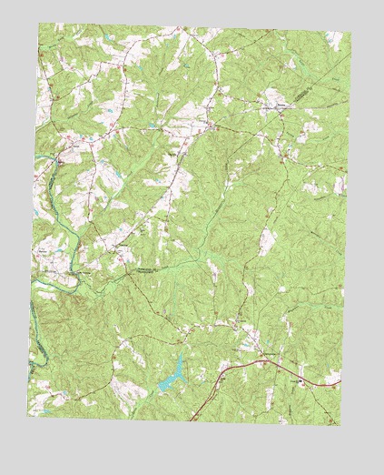
Clayville, VA USGS Topographic Map
Click on map above to begin viewing in our Map Viewer.

This topographic map contains these locations and features:
Feature Name Type Latitude Longitude GNIS ID View Map
Antioch ChurchChurchN37.4746°W77.8067°1462507View Map
Bethel ChurchChurchN37.4360°W77.8314°1463181View Map
Beulah ChurchChurchN37.3890°W77.7983°1463268View Map
Beulah School (historical)SchoolN37.3876°W77.7994°1759840View Map
Butterwood CreekStreamN37.4321°W77.8558°1464186View Map
ClayvillePopulated PlaceN37.4599°W77.8169°1464965View Map
Crawford DamDamN37.4385°W77.8731°1489134View Map
District 2CivilN37.4774°W77.8203°1927210View Map
DorsetPopulated PlaceN37.4682°W77.8053°1492874View Map
Flat CreekStreamN37.3918°W77.8731°1466649View Map
GenitoPopulated PlaceN37.4621°W77.8592°1477343View Map
Genito Presbyterian ChurchChurchN37.4646°W77.8483°1759835View Map
Goode CrossingPopulated PlaceN37.4213°W77.8581°1493012View Map
Goode HouseBuildingN37.3929°W77.8292°1759865View Map
Grace CemeteryCemeteryN37.4660°W77.8656°1467303View Map
Graceland ChurchChurchN37.4699°W77.8058°1467329View Map
Grange Hall Elementary SchoolSchoolN37.3887°W77.7662°1467347View Map
Hebron Church (historical)ChurchN37.3890°W77.7503°1759867View Map
Liberty CemeteryCemeteryN37.4279°W77.8411°1469349View Map
MattoaxPopulated PlaceN37.4271°W77.8725°1493259View Map
Mattoax Company 4BuildingN37.4492°W77.8750°2075597View Map
MoseleyPopulated PlaceN37.4751°W77.7789°1470776View Map
Moseley Post OfficePost OfficeN37.3864°W77.7991°2767241View Map
PilkintonPopulated PlaceN37.4301°W77.8414°1477624View Map
SkinquarterPopulated PlaceN37.3971°W77.7814°1493603View Map
Skinquarter Baptist Church CemeteryCemeteryN37.4095°W77.7922°1759889View Map
Skinquarter ChurchChurchN37.4074°W77.7928°1474655View Map
Skinquarter CreekStreamN37.4185°W77.8550°1474656View Map
Skippers CreekStreamN37.4588°W77.8747°1474275View Map
Tates DamDamN37.3851°W77.8231°1489465View Map
Tates PondSwampN37.3884°W77.8177°1489466View Map
Worsham HouseBuildingN37.3899°W77.7969°1759898View Map

Note: Coordinates in the location and feature list above are referenced to NAD83 datum.


Copyright (C) 2008-2025 Ryan Niemi / Sunset Dynamics ... All Rights Reserved