TopoQuest Logo
Do you find TopoQuest useful?
Help keep TopoQuest running and adding new maps/features by donating!
Bitcoin:  19c7KJd3qBynnjoSw5npx9KScwjBe4ifkT
Litecoin:  LXs6TkuXGGXo1vDsWCkWVdjQX94eUKd6ui
Home View Maps Find Maps Find Places Resources & Links


Clementsville, Kentucky Topographic Map

USGS Map Title: Clementsville, KY
USGS Map MRC: 37085C1
DRG (GeoTIFF) Download: o37085c1.tif


Neighboring USGS Topographic Map Quads:


  Bradfordsville, KY  
37085D2
 

  Bradfordsville NE, KY  
37085D1
 

  Ellisburg, KY  
37084D8
 

  Mannsville, KY  
37085C2
 

  Clementsville, KY  
37085C1
 

  Liberty, KY  
37084C8
 

  Knifley, KY  
37085B2
 

  Dunnville, KY  
37085B1
 

  Phil, KY  
37084B8


Map MRC Location:

N38°
W86°
N38°
W85°
H8 H7 H6 H5 H4 H3 H2 H1
G8 G7 G6 G5 G4 G3 G2 G1
F8 F7 F6 F5 F4 F3 F2 F1
E8 E7 E6 E5 E4 E3 E2 E1
D8 D7 D6 D5 D4 D3 D2 D1
C8 C7 C6 C5 C4 C3 C2 C1
B8 B7 B6 B5 B4 B3 B2 B1
A8 A7 A6 A5 A4 A3 A2 A1
N37°
W86°
N37°
W85°

Clementsville, KY USGS 1:24K Topographic Map Preview:
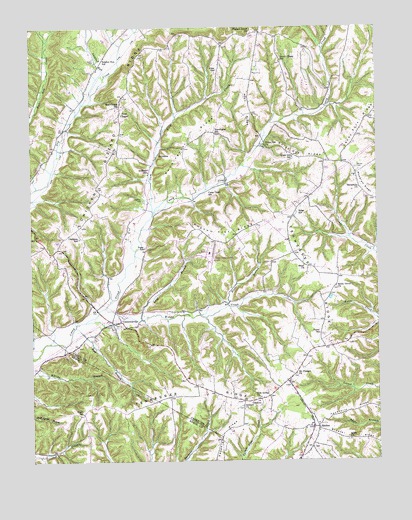
Clementsville, KY USGS Topographic Map
Click on map above to begin viewing in our Map Viewer.

This topographic map contains these locations and features:
Feature Name Type Latitude Longitude GNIS ID View Map
Alien RidgeRidgeN37.3512°W85.0461°485836View Map
Allen SchoolSchoolN37.3628°W85.0566°485872View Map
Antioch ChurchChurchN37.2656°W85.0488°485980View Map
Antioch Church CemeteryCemeteryN37.2658°W85.0493°2568317View Map
Apostolic RidgeRidgeN37.2651°W85.0091°486007View Map
AttersonPopulated PlaceN37.3384°W85.0780°507426View Map
Atterson Post Office (historical)Post OfficeN37.3387°W85.0787°2568321View Map
Atterson School (historical)SchoolN37.3333°W85.0824°486125View Map
Belton CemeteryCemeteryN37.3251°W85.0841°486836View Map
Bem BranchStreamN37.2887°W85.1094°486837View Map
Bethlehem ChurchChurchN37.3287°W85.0061°487022View Map
Block ChurchChurchN37.3062°W85.0263°487486View Map
Buckeye School (historical)SchoolN37.2883°W85.0958°2568339View Map
Casey Amish Elementary School (historical)SchoolN37.3037°W85.1116°2568348View Map
Casey Creek SchoolSchoolN37.3281°W85.0600°489046View Map
Chicken Gizzard RidgeRidgeN37.3476°W85.0933°489468View Map
Clements SchoolSchoolN37.3142°W85.1075°489657View Map
ClementsvillePopulated PlaceN37.2901°W85.0930°489658View Map
Clementsville DivisionCivilN37.3386°W85.0661°1936937View Map
Clementsville Post Office (historical)Post OfficeN37.2900°W85.0960°2568352View Map
Clementsville Volunteer Fire DepartmentBuildingN37.2839°W85.0804°2636756View Map
Cole Spring CemeteryCemeteryN37.2681°W85.0438°2568355View Map
Cole Spring ChurchChurchN37.2680°W85.0433°489813View Map
CrestonPopulated PlaceN37.2667°W85.0422°507781View Map
Creston Post Office (historical)Post OfficeN37.2678°W85.0447°2568362View Map
Creston School (historical)SchoolN37.2670°W85.0491°2568363View Map
Ed Post Office (historical)Post OfficeN37.3733°W85.0427°2568375View Map
Foster (historical)Populated PlaceN37.2862°W85.0211°2568383View Map
Foster SchoolSchoolN37.2865°W85.0208°492369View Map
Gilpin CemeteryCemeteryN37.3656°W85.1011°492858View Map
Grant SchoolSchoolN37.2637°W85.1072°493119View Map
Gum Lick CreekStreamN37.3215°W85.0802°493486View Map
Hicks BranchStreamN37.2948°W85.0536°494158View Map
Liberty-Casey County AirportAirportN37.3089°W85.0593°517417View Map
Long BranchStreamN37.2909°W85.0852°497026View Map
McClures ForkStreamN37.3698°W85.0919°2568427View Map
Mount Pleasant CemeteryCemeteryN37.2747°W85.0297°2568436View Map
Mount Pleasant ChurchChurchN37.2751°W85.0291°498842View Map
Noel ChapelLocaleN37.3506°W85.0916°499499View Map
Noel Chapel SchoolSchoolN37.3520°W85.0922°499500View Map
Pennington RidgeRidgeN37.3423°W85.0666°500384View Map
Pennington SchoolSchoolN37.3442°W85.0580°500385View Map
Pleasant Grove ChurchChurchN37.3734°W85.0450°500823View Map
Posey SchoolSchoolN37.3115°W85.0836°501161View Map
Possum Trot RidgeRidgeN37.3170°W85.0566°501169View Map
RheberPopulated PlaceN37.2592°W85.0219°508928View Map
Rheber Post Office (historical)Post OfficeN37.2595°W85.0214°2568462View Map
Rheber School (historical)SchoolN37.2606°W85.0219°2568463View Map
Ridge Post Office (historical)Post OfficeN37.3476°W85.0038°2568466View Map
Ridge SchoolSchoolN37.3215°W85.0280°501840View Map
Salem ChurchChurchN37.2556°W85.0111°502783View Map
Salem Church CemeteryCemeteryN37.2559°W85.0112°2568474View Map
Scotts Chapel (historical)ChurchN37.3652°W85.0346°2568476View Map
Scotts Chapel (historical)Populated PlaceN37.3652°W85.0340°2568477View Map
Scotts Chapel CemeteryCemeteryN37.3649°W85.0345°2568478View Map
Scotts Chapel SchoolSchoolN37.3656°W85.0333°503110View Map
Shady Grove CemeteryCemeteryN37.2999°W85.0151°2568480View Map
Shady Grove ChurchChurchN37.3003°W85.0150°503217View Map
Sulphur RunStreamN37.3562°W85.1027°504746View Map
Sulphur Run (historical)Populated PlaceN37.3656°W85.0991°2568485View Map
Sulphur Run SchoolSchoolN37.3662°W85.0988°504748View Map
Tennessee RidgeRidgeN37.3017°W85.0241°505073View Map
Wethington (historical)Populated PlaceN37.2660°W85.1033°2743417View Map
White Oak ChurchChurchN37.3409°W85.0397°506605View Map
White Oak Ridge (historical)Populated PlaceN37.3376°W85.0277°2568502View Map
White Oak SchoolSchoolN37.3376°W85.0294°506633View Map
Whited CemeteryCemeteryN37.3345°W85.0072°506652View Map
Woodrum Ridge (historical)Populated PlaceN37.3301°W85.0068°2568507View Map
Woodrum SchoolSchoolN37.3303°W85.0072°517523View Map
Woods CreekStreamN37.2942°W85.0986°507118View Map
Woods Creek SchoolSchoolN37.3009°W85.0630°507119View Map

Note: Coordinates in the location and feature list above are referenced to NAD83 datum.


Copyright (C) 2008-2024 Ryan Niemi / Sunset Dynamics ... All Rights Reserved