TopoQuest Logo
Do you find TopoQuest useful?
Help keep TopoQuest running and adding new maps/features by donating!
Bitcoin:  19c7KJd3qBynnjoSw5npx9KScwjBe4ifkT
Litecoin:  LXs6TkuXGGXo1vDsWCkWVdjQX94eUKd6ui
Home View Maps Find Maps Find Places Resources & Links


Dunnville, Kentucky Topographic Map

USGS Map Title: Dunnville, KY
USGS Map MRC: 37085B1
DRG (GeoTIFF) Download: o37085b1.tif


Neighboring USGS Topographic Map Quads:


  Mannsville, KY  
37085C2
 

  Clementsville, KY  
37085C1
 

  Liberty, KY  
37084C8
 

  Knifley, KY  
37085B2
 

  Dunnville, KY  
37085B1
 

  Phil, KY  
37084B8
 

  Montpelier, KY  
37085A2
 

  Russell Springs, KY  
37085A1
 

  Eli, KY  
37084A8


Map MRC Location:

N38°
W86°
N38°
W85°
H8 H7 H6 H5 H4 H3 H2 H1
G8 G7 G6 G5 G4 G3 G2 G1
F8 F7 F6 F5 F4 F3 F2 F1
E8 E7 E6 E5 E4 E3 E2 E1
D8 D7 D6 D5 D4 D3 D2 D1
C8 C7 C6 C5 C4 C3 C2 C1
B8 B7 B6 B5 B4 B3 B2 B1
A8 A7 A6 A5 A4 A3 A2 A1
N37°
W86°
N37°
W85°

Dunnville, KY USGS 1:24K Topographic Map Preview:
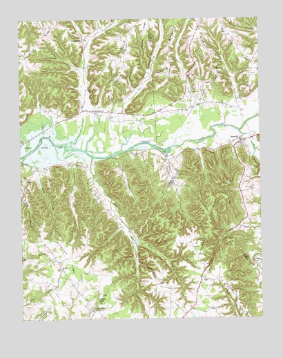
Dunnville, KY USGS Topographic Map
Click on map above to begin viewing in our Map Viewer.

This topographic map contains these locations and features:
Feature Name Type Latitude Longitude GNIS ID View Map
Absher RidgeRidgeN37.2337°W85.0702°485740View Map
Adkins CemeteryCemeteryN37.1301°W85.1233°485779View Map
Austin CemeteryCemeteryN37.2167°W85.0305°486148View Map
Barnett CreekStreamN37.1973°W85.1008°485666View Map
Barnett Creek ChurchChurchN37.2303°W85.0891°486406View Map
Barnett SpringsPopulated PlaceN37.2420°W85.0913°507456View Map
Bear CreekStreamN37.2015°W85.1127°486549View Map
Busby HollowValleyN37.1876°W85.1158°488485View Map
Damron CreekStreamN37.1926°W85.0875°490551View Map
Dawson CreekStreamN37.2059°W85.0194°490691View Map
Dickerson RidgeRidgeN37.1659°W85.0269°490879View Map
DunnvillePopulated PlaceN37.2001°W85.0100°491339View Map
Dunnville School (historical)SchoolN37.1980°W85.0155°2568373View Map
Dunnville Volunteer Fire DepartmentBuildingN37.1940°W85.0120°2637019View Map
Ellis ForkStreamN37.1573°W85.0661°491717View Map
EunicePopulated PlaceN37.1831°W85.1222°507955View Map
Ewing RidgeRidgeN37.2376°W85.0472°491862View Map
Good Tidings ChurchChurchN37.1287°W85.0863°492965View Map
Goose CreekStreamN37.2028°W85.0108°493010View Map
Gundy HollowValleyN37.1915°W85.0953°493498View Map
Hatfield CemeteryCemeteryN37.2495°W85.0307°2568397View Map
Heiter CemeteryCemeteryN37.2478°W85.0677°494004View Map
Jones BranchStreamN37.1984°W85.0325°495453View Map
Jones CemeteryCemeteryN37.2095°W85.0783°495473View Map
Luttrell CreekStreamN37.1940°W85.0486°497354View Map
Millerfield (historical)Populated PlaceN37.1460°W85.1041°2743389View Map
Millerfield ChurchChurchN37.1462°W85.1044°498355View Map
Millerfield RidgeRidgeN37.1506°W85.1002°498356View Map
Mount Calvary ChurchChurchN37.1395°W85.0530°498692View Map
Normans Chapel United Brethren Church (historical)ChurchN37.2493°W85.0305°2568439View Map
Nubbin RidgeRidgeN37.2353°W85.0247°499629View Map
PellytonPopulated PlaceN37.2117°W85.0841°508795View Map
Pellyton Volunteer Fire DepartmentBuildingN37.2122°W85.0873°2637014View Map
Red HillPopulated PlaceN37.2287°W85.0035°2742277View Map
Red Hill RidgeRidgeN37.2395°W85.0119°501660View Map
Red Hill School (historical)SchoolN37.2266°W85.0044°2568461View Map
Rice CemeteryCemeteryN37.1978°W85.0098°2568464View Map
Rife Creek Post Office (historical)Post OfficeN37.2132°W85.0347°2568467View Map
Riffe CreekStreamN37.1973°W85.0444°501850View Map
Riffe Creek (historical)Populated PlaceN37.2162°W85.0362°2742278View Map
Riffe Creek School (historical)SchoolN37.2160°W85.0362°2568468View Map
Rifle Creek ChurchChurchN37.2195°W85.0347°501855View Map
Sanders RidgeRidgeN37.2492°W85.0572°502951View Map
Shady Grove ChurchChurchN37.2376°W85.0702°503216View Map
Short CreekStreamN37.1931°W85.0777°503441View Map
Spruce Pine CreekStreamN37.1948°W85.0711°504176View Map
Thomastown CemeteryCemeteryN37.1787°W85.0030°505178View Map
Williams CemeteryCemeteryN37.1895°W85.1002°506780View Map
Wilson SchoolSchoolN37.1415°W85.0291°506916View Map

Note: Coordinates in the location and feature list above are referenced to NAD83 datum.


Copyright (C) 2008-2025 Ryan Niemi / Sunset Dynamics ... All Rights Reserved