TopoQuest Logo
Do you find TopoQuest useful?
Help keep TopoQuest running and adding new maps/features by donating!
Bitcoin:  19c7KJd3qBynnjoSw5npx9KScwjBe4ifkT
Litecoin:  LXs6TkuXGGXo1vDsWCkWVdjQX94eUKd6ui
Home View Maps Find Maps Find Places Resources & Links


Clinton North, North Carolina Topographic Map

USGS Map Title: Clinton North, NC
USGS Map MRC: 35078A3
DRG (GeoTIFF) Download: o35078a3.tif


Neighboring USGS Topographic Map Quads:


  Timothy, NC  
35078B4
 

  Newton Grove South, NC  
35078B3
 

  Dobbersville, NC  
35078B2
 

  Bearskin, NC  
35078A4
 

  Clinton North, NC  
35078A3
 

  Faison, NC  
35078A2
 

  Bonnetsville, NC  
34078H4
 

  Clinton South, NC  
34078H3
 

  Turkey, NC  
34078H2


Map MRC Location:

N36°
W79°
N36°
W78°
H8 H7 H6 H5 H4 H3 H2 H1
G8 G7 G6 G5 G4 G3 G2 G1
F8 F7 F6 F5 F4 F3 F2 F1
E8 E7 E6 E5 E4 E3 E2 E1
D8 D7 D6 D5 D4 D3 D2 D1
C8 C7 C6 C5 C4 C3 C2 C1
B8 B7 B6 B5 B4 B3 B2 B1
A8 A7 A6 A5 A4 A3 A2 A1
N35°
W79°
N35°
W78°

Clinton North, NC USGS 1:24K Topographic Map Preview:
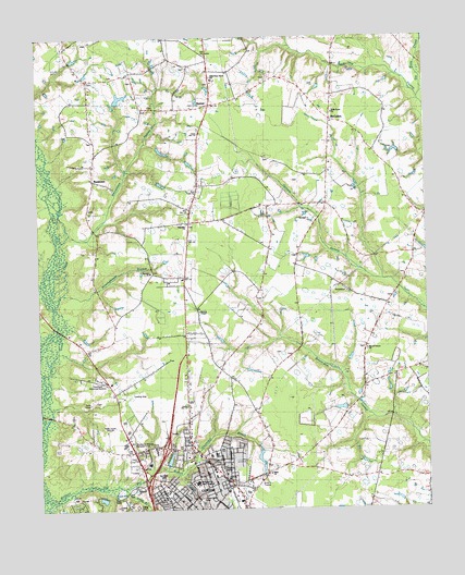
Clinton North, NC USGS Topographic Map
Click on map above to begin viewing in our Map Viewer.

This topographic map contains these locations and features:
Feature Name Type Latitude Longitude GNIS ID View Map
BasstownPopulated PlaceN35.0871°W78.3564°1026188View Map
Beaverdam BranchStreamN35.0124°W78.3253°1025985View Map
Beaverdam SwampStreamN35.0704°W78.3686°980862View Map
Bible ChurchChurchN35.0093°W78.3008°1026192View Map
Browns ChapelChurchN35.0524°W78.3228°1026189View Map
Browns ChurchChurchN35.0627°W78.3392°982033View Map
Cattail BranchStreamN35.0093°W78.3303°1026303View Map
Church of ChristChurchN35.0190°W78.3017°2505849View Map
City of ClintonCivilN35.0005°W78.3312°2404081View Map
Clinton PlazaLocaleN35.0110°W78.3169°1007691View Map
Clinton Police SubstationBuildingN35.0004°W78.3119°2130907View Map
Crossroad Baptist ChurchChurchN35.0603°W78.2567°2505868View Map
Dollar BranchStreamN35.0057°W78.3472°1025097View Map
First Baptist Church of ClintonChurchN35.0047°W78.3148°2505826View Map
Fisher Drive ParkParkN35.0027°W78.3231°1026194View Map
Full Gospel Chapel ChurchChurchN35.0081°W78.3383°2505946View Map
Grace United Methodist ChurchChurchN35.0101°W78.3191°2506138View Map
Grandview Memorial GardensCemeteryN35.0343°W78.3544°1026196View Map
Halls Fire DepartmentBuildingN35.1132°W78.3181°2639157View Map
Halls-Piney Grove SchoolSchoolN35.1141°W78.3178°1026187View Map
Hoe SwampStreamN35.1104°W78.2506°986873View Map
Holly Grove ChurchChurchN35.1052°W78.2794°1026186View Map
Jordan Shopping CenterLocaleN35.0071°W78.3122°1007693View Map
KeenerPopulated PlaceN35.1071°W78.3186°1025447View Map
Keener Census Designated PlaceCensusN35.1130°W78.3093°2403165View Map
Kerr SchoolSchoolN35.0143°W78.3200°1026190View Map
Kings BranchStreamN35.1229°W78.2503°987991View Map
Lakewood Plaza Shopping CenterLocaleN35.0111°W78.3171°2505194View Map
Larkins Wastewater Treatment PlantLocaleN35.0046°W78.3444°1006940View Map
Lowers Airport (historical)AirportN35.0391°W78.3247°997879View Map
McCullenPopulated PlaceN35.1035°W78.2797°1026185View Map
Meetinghouse BranchStreamN35.0554°W78.3700°989705View Map
Morning Star Holy ChurchChurchN35.0071°W78.3359°2505523View Map
Mount Vernon ChurchChurchN35.0424°W78.2692°1026191View Map
New BridgeBridgeN35.0243°W78.3711°990947View Map
North Carolina Division of PrisonsBuildingN35.0188°W78.3458°1026195View Map
North Carolina State Highway Patrol Troop B District 2BuildingN35.0165°W78.3324°2131067View Map
Olivet Institutional Baptist ChurchChurchN35.0045°W78.3329°2506204View Map
One For All International Christian ChurchChurchN35.0187°W78.3275°2506205View Map
Pigford SchoolSchoolN35.0346°W78.3133°992186View Map
Plainview ChurchChurchN35.0754°W78.3264°992444View Map
Refuges Temple Church of God and ChristChurchN35.0210°W78.3251°2505628View Map
Rivenbark Shopping CenterLocaleN35.0029°W78.3178°1007694View Map
Rivers of Life Free Will Baptist ChurchChurchN35.0050°W78.3144°2505630View Map
Royal Mill BranchStreamN35.0057°W78.3522°1026306View Map
Saint Jude United Holiness ChurchChurchN35.0340°W78.3110°2505649View Map
Saint Peter United Holy ChurchChurchN35.1207°W78.3198°2506251View Map
Sampson Correctional InstitutionBuildingN35.0129°W78.3413°2769869View Map
Sampson County Emergency Medical ServicesBuildingN35.0083°W78.3145°2720381View Map
Sampson Group HomeBuildingN35.0020°W78.3126°2505755View Map
Sampson Memorial Hospital AirportAirportN35.0085°W78.3192°997873View Map
Sampson Regional Medical CenterHospitalN35.0073°W78.3243°1026193View Map
Sandhills CemeteryCemeteryN35.0090°W78.3358°1026197View Map
Stevens BridgeBridgeN35.0463°W78.3661°995476View Map
Township of HallsCivilN35.1149°W78.3178°1027171View Map
Township of North ClintonCivilN35.0258°W78.2990°1027179View Map
WCLN-AM (Clinton)TowerN35.0227°W78.3492°1018389View Map
Williams Old Mill BranchStreamN35.0018°W78.3744°1025802View Map

Note: Coordinates in the location and feature list above are referenced to NAD83 datum.


Copyright (C) 2008-2024 Ryan Niemi / Sunset Dynamics ... All Rights Reserved