TopoQuest Logo
Do you find TopoQuest useful?
Help keep TopoQuest running and adding new maps/features by donating!
Bitcoin:  19c7KJd3qBynnjoSw5npx9KScwjBe4ifkT
Litecoin:  LXs6TkuXGGXo1vDsWCkWVdjQX94eUKd6ui
Home View Maps Find Maps Find Places Resources & Links


Clinton South, North Carolina Topographic Map

USGS Map Title: Clinton South, NC
USGS Map MRC: 34078H3
DRG (GeoTIFF) Download: o34078h3.tif


Neighboring USGS Topographic Map Quads:


  Bearskin, NC  
35078A4
 

  Clinton North, NC  
35078A3
 

  Faison, NC  
35078A2
 

  Bonnetsville, NC  
34078H4
 

  Clinton South, NC  
34078H3
 

  Turkey, NC  
34078H2
 

  Garland, NC  
34078G4
 

  Ingold, NC  
34078G3
 

  Delway, NC  
34078G2


Map MRC Location:

N35°
W79°
N35°
W78°
H8 H7 H6 H5 H4 H3 H2 H1
G8 G7 G6 G5 G4 G3 G2 G1
F8 F7 F6 F5 F4 F3 F2 F1
E8 E7 E6 E5 E4 E3 E2 E1
D8 D7 D6 D5 D4 D3 D2 D1
C8 C7 C6 C5 C4 C3 C2 C1
B8 B7 B6 B5 B4 B3 B2 B1
A8 A7 A6 A5 A4 A3 A2 A1
N34°
W79°
N34°
W78°

Clinton South, NC USGS 1:24K Topographic Map Preview:
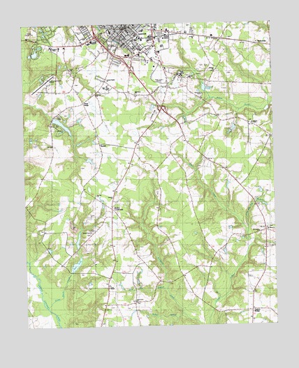
Clinton South, NC USGS Topographic Map
Click on map above to begin viewing in our Map Viewer.

This topographic map contains these locations and features:
Feature Name Type Latitude Longitude GNIS ID View Map
Andrews ChapelChurchN34.9588°W78.2592°980188View Map
Best PondReservoirN34.9007°W78.3496°1025139View Map
Best Pond DamDamN34.8985°W78.3514°998193View Map
Bethany ChurchChurchN34.9804°W78.2786°981067View Map
BeulahPopulated PlaceN34.9502°W78.3367°1026219View Map
Boney PondReservoirN34.8935°W78.3042°981717View Map
Bridge BranchStreamN34.8802°W78.2967°1025181View Map
Butlers CrossroadsPopulated PlaceN34.9232°W78.3308°1025208View Map
Chestnut PondReservoirN34.9734°W78.2840°983122View Map
ClintonPopulated PlaceN34.9979°W78.3233°983293View Map
Clinton - Sampson Rescue and Emergency Medical ServicesBuildingN34.9941°W78.3231°2720720View Map
Clinton Chapel African Methodist Episcopal Zion ChurchChurchN34.9931°W78.3183°2505857View Map
Clinton City HallBuildingN34.9963°W78.3214°1006937View Map
Clinton Family Worship CenterChurchN34.9914°W78.3273°2505858View Map
Clinton Fire DepartmentBuildingN34.9960°W78.3228°2638239View Map
Clinton High SchoolSchoolN34.9735°W78.3325°1006939View Map
Clinton Lookout TowerTowerN34.9566°W78.3578°1023634View Map
Clinton Police DepartmentBuildingN34.9962°W78.3213°2131069View Map
Clinton Police DepartmentBuildingN34.9959°W78.3218°2130901View Map
Clinton Post OfficePost OfficeN34.9931°W78.3398°2505347View Map
Clinton-Sampson County AirportAirportN34.9743°W78.3643°997868View Map
Coharie Country ClubLocaleN34.9985°W78.3669°983345View Map
Collage Street SchoolSchoolN34.9999°W78.3183°1007589View Map
Colonial Heights ChurchChurchN34.9768°W78.3339°1026217View Map
Epworth ChurchChurchN34.9282°W78.3306°984827View Map
Federal Bureau of InvestigationBuildingN34.9975°W78.3231°2131068View Map
First United Methodist ChurchChurchN34.9998°W78.3241°2505839View Map
Forest Trail Retirement CenterBuildingN34.9972°W78.3373°2505792View Map
Graves Memorial Presbyterian ChurchChurchN34.9982°W78.3277°2506140View Map
Holy Grove ChurchChurchN34.9713°W78.3186°1025389View Map
Immaculate Conception Catholic ChurchChurchN34.9956°W78.3213°2506164View Map
JohnsontownPopulated PlaceN34.9971°W78.3439°1020969View Map
Jump and Run BranchStreamN34.9132°W78.2636°1025436View Map
Kirtwood ParkParkN34.9704°W78.2850°1026216View Map
Mary Gran Nursing CenterBuildingN34.9813°W78.3086°2505803View Map
MoltonvillePopulated PlaceN34.9910°W78.2506°1025560View Map
Mount Carmel ChurchChurchN34.9135°W78.2578°1026220View Map
Mount Gilead ChurchChurchN34.9149°W78.2536°990380View Map
Mount Sinai United Holiness ChurchChurchN34.9868°W78.3146°2505707View Map
New Life Baptist ChurchChurchN34.9698°W78.3026°2506124View Map
Pentecostal Holiness ChurchChurchN34.9919°W78.3631°2506219View Map
Piney RidgePopulated PlaceN34.9677°W78.3442°1026218View Map
Red Hill ChurchChurchN34.9293°W78.3386°993114View Map
Red Hill Missionary Baptist ChurchChurchN34.9711°W78.3379°2505626View Map
Rocky Marsh CreekStreamN34.8832°W78.3639°993601View Map
Rowan ChurchChurchN34.9779°W78.2911°993769View Map
Royal Lane ParkParkN34.9974°W78.3469°1007578View Map
Saint Paul ChurchChurchN34.9949°W78.2881°1026215View Map
Saint Pauls Episcopal ChurchChurchN34.9972°W78.3247°2506245View Map
Sampson CollegeSchoolN34.9910°W78.3603°1026214View Map
Sampson CountyCivilN34.9915°W78.3714°1026131View Map
Sampson County NarcoticsBuildingN34.9880°W78.3125°2130939View Map
Sampson County Sheriff's OfficeBuildingN34.9924°W78.3028°2130953View Map
Sampson Middle SchoolSchoolN34.9974°W78.3308°1006938View Map
Shamrock PlazaLocaleN34.9913°W78.3344°1007695View Map
South Clinton Mobile Home ParkPopulated PlaceN34.9639°W78.3531°2505655View Map
Spirit of Life Church of GodChurchN34.9892°W78.3537°2506273View Map
Springdale CemeteryCemeteryN34.9921°W78.3286°1026213View Map
Taylors BridgePopulated PlaceN34.8810°W78.2619°995896View Map
The Church of Jesus Christ of Latter Day SaintsChurchN34.9769°W78.3339°2506179View Map
Township of South ClintonCivilN34.9425°W78.3098°1027182View Map
Tyndall Grove ChurchChurchN34.9135°W78.3414°996397View Map
Union ChapelChurchN34.8910°W78.3333°1026221View Map
Union Grove ChurchChurchN34.8854°W78.3197°996475View Map
Union Star Original Free Will Baptist ChurchChurchN34.9923°W78.3224°2506293View Map
United Chapel African Methodist Episcopal Zion ChurchChurchN34.8912°W78.3334°2506295View Map
Wolf Pit BranchStreamN34.8896°W78.3042°997539View Map
WRRZ-AM (Clinton)TowerN34.9779°W78.3039°1018384View Map
WRRZ-FM (Clinton)TowerN34.9779°W78.3039°1018630View Map

Note: Coordinates in the location and feature list above are referenced to NAD83 datum.


Copyright (C) 2008-2024 Ryan Niemi / Sunset Dynamics ... All Rights Reserved