TopoQuest Logo
Do you find TopoQuest useful?
Help keep TopoQuest running and adding new maps/features by donating!
Bitcoin:  19c7KJd3qBynnjoSw5npx9KScwjBe4ifkT
Litecoin:  LXs6TkuXGGXo1vDsWCkWVdjQX94eUKd6ui
Home View Maps Find Maps Find Places Resources & Links


Coaling, Alabama Topographic Map

USGS Map Title: Coaling, AL
USGS Map MRC: 33087B3
DRG (GeoTIFF) Download: o33087b3.tif


Neighboring USGS Topographic Map Quads:


  Lake Nicol, AL  
33087C4
 

  Brookwood, AL  
33087C3
 

  Abernant, AL  
33087C2
 

  Cottondale, AL  
33087B4
 

  Coaling, AL  
33087B3
 

  Woodstock, AL  
33087B2
 

  Duncanville, AL  
33087A4
 

  Pearson, AL  
33087A3
 

  West Blocton West, AL  
33087A2


Map MRC Location:

N34°
W88°
N34°
W87°
H8 H7 H6 H5 H4 H3 H2 H1
G8 G7 G6 G5 G4 G3 G2 G1
F8 F7 F6 F5 F4 F3 F2 F1
E8 E7 E6 E5 E4 E3 E2 E1
D8 D7 D6 D5 D4 D3 D2 D1
C8 C7 C6 C5 C4 C3 C2 C1
B8 B7 B6 B5 B4 B3 B2 B1
A8 A7 A6 A5 A4 A3 A2 A1
N33°
W88°
N33°
W87°

Coaling, AL USGS 1:24K Topographic Map Preview:
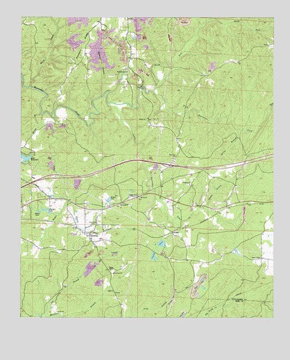
Coaling, AL USGS Topographic Map
Click on map above to begin viewing in our Map Viewer.

This topographic map contains these locations and features:
Feature Name Type Latitude Longitude GNIS ID View Map
Beatty BranchStreamN33.1748°W87.3517°113706View Map
Bethel School (historical)SchoolN33.2373°W87.2606°147862View Map
Big Hurricane CemeteryCemeteryN33.2290°W87.3228°147875View Map
Big Hurricane ChurchChurchN33.2276°W87.3225°114288View Map
Black CreekStreamN33.2212°W87.3706°114417View Map
Blacks LakeLakeN33.1700°W87.3629°114452View Map
Blanchet BranchStreamN33.2173°W87.3353°114482View Map
Boyds CrossingLocaleN33.1712°W87.2778°147894View Map
Cedar CovePopulated PlaceN33.1748°W87.3219°158806View Map
Cedar Cove ChurchChurchN33.1923°W87.2986°115739View Map
Clements (historical)LocaleN33.1662°W87.3167°147989View Map
Clements Station (historical)LocaleN33.1621°W87.3292°147991View Map
CoalingPopulated PlaceN33.1590°W87.3408°116314View Map
Coaling Baptist ChurchChurchN33.1579°W87.3406°148913View Map
Coaling CemeteryCemeteryN33.1543°W87.3453°148914View Map
Coaling Fire Department Station 1BuildingN33.1719°W87.3464°2683020View Map
Coaling Fire Department Station 2BuildingN33.1560°W87.3394°2682978View Map
Coaling Post OfficePost OfficeN33.1597°W87.3405°169138View Map
Coaling United Methodist ChurchChurchN33.1601°W87.3433°148915View Map
Coaling-Vance DivisionCivilN33.1743°W87.3087°165973View Map
Cones Mill (historical)LocaleN33.2104°W87.3475°151544View Map
Coxs Mill (historical)LocaleN33.2143°W87.3264°148030View Map
Daly CreekStreamN33.2123°W87.2517°117028View Map
DudleyPopulated PlaceN33.1610°W87.3000°156283View Map
Dudley Station (historical)LocaleN33.1643°W87.2864°148068View Map
Emery ChurchChurchN33.1660°W87.2522°148101View Map
Enterprise Baptist ChurchChurchN33.1721°W87.3261°118008View Map
Enterprise CemeteryCemeteryN33.1715°W87.3258°148104View Map
Evergreen Baptist ChurchChurchN33.1807°W87.2917°118085View Map
Evergreen CemeteryCemeteryN33.1804°W87.2925°148111View Map
Flatwood ChurchChurchN33.1490°W87.2564°166199View Map
Fleming (historical)LocaleN33.1654°W87.3639°148152View Map
Gilgal ChurchChurchN33.1360°W87.3292°155076View Map
Gilmore MineMineN33.2446°W87.3181°148177View Map
Hurricane Creek Pit MineMineN33.2279°W87.3153°148265View Map
Hurricane School (historical)SchoolN33.2271°W87.3233°148267View Map
Interchange 86CrossingN33.1885°W87.3014°155718View Map
Jemison Mill CreekStreamN33.2187°W87.3317°148280View Map
Jimy CreekStreamN33.2465°W87.2861°120897View Map
Kepple CreekStreamN33.2082°W87.3586°121160View Map
Lake WildwoodReservoirN33.1915°W87.3730°128976View Map
Lake Wildwood DamDamN33.1918°W87.3700°131291View Map
Little Hurricane CreekStreamN33.2143°W87.3314°158861View Map
Marchant BranchStreamN33.1251°W87.3617°160033View Map
Midway ChurchChurchN33.2079°W87.3136°122712View Map
Mount Calvary School (historical)SchoolN33.1365°W87.3292°157862View Map
Mount Zion CemeteryCemeteryN33.1751°W87.3161°158743View Map
Mount Zion ChurchChurchN33.1751°W87.3158°123479View Map
New Asia CemeteryCemeteryN33.1643°W87.3381°148363View Map
New Asia Missionary Baptist ChurchChurchN33.1640°W87.3381°123711View Map
North Fork Hurricane CreekStreamN33.2198°W87.3097°123999View Map
Pineview School (historical)SchoolN33.1437°W87.3289°124862View Map
Pleasant RidgeRidgeN33.2385°W87.3428°125030View Map
Pleasant Ridge Church (historical)ChurchN33.2332°W87.3436°148456View Map
Rock Bluff Church (historical)ChurchN33.1826°W87.2889°148496View Map
Shanty BranchStreamN33.1710°W87.2844°126628View Map
Sniders LakeReservoirN33.1691°W87.3664°127076View Map
Spring BranchStreamN33.2037°W87.2661°127213View Map
Spring BranchStreamN33.2096°W87.3656°127214View Map
Thomas ChapelChurchN33.1448°W87.3303°127863View Map
Thomas Chapel CemeteryCemeteryN33.1451°W87.3314°158758View Map
Town of BrookwoodCivilN33.2398°W87.3277°2405333View Map
Town of CoalingCivilN33.1641°W87.3489°2406286View Map
Toxeys Spring BranchStreamN33.1726°W87.3053°148645View Map
Tuscaloosa Fire and Rescue Station 11BuildingN33.1843°W87.3056°2683292View Map
Tuscaloosa QuarryMineN33.1322°W87.2794°2568277View Map
Vance Volunteer Fire Department Station 2BuildingN33.1500°W87.2537°2683096View Map
Vining PondLakeN33.1559°W87.3053°128466View Map
Vining Pond DamDamN33.1551°W87.3067°131248View Map
Walker LakeReservoirN33.1742°W87.3315°128524View Map
Wallace ChapelChurchN33.1498°W87.2564°153871View Map
Ward CemeteryCemeteryN33.1254°W87.3692°158760View Map
Wards Mill (historical)LocaleN33.1312°W87.3625°148712View Map
Weldon CreekStreamN33.2496°W87.2814°128731View Map

Note: Coordinates in the location and feature list above are referenced to NAD83 datum.


Copyright (C) 2008-2025 Ryan Niemi / Sunset Dynamics ... All Rights Reserved