TopoQuest Logo
Do you find TopoQuest useful?
Help keep TopoQuest running and adding new maps/features by donating!
Bitcoin:  19c7KJd3qBynnjoSw5npx9KScwjBe4ifkT
Litecoin:  LXs6TkuXGGXo1vDsWCkWVdjQX94eUKd6ui
Home View Maps Find Maps Find Places Resources & Links


Coalville, Utah Topographic Map

USGS Map Title: Coalville, UT
USGS Map MRC: 40111H4
DRG (GeoTIFF) Download: o40111h4.tif


Neighboring USGS Topographic Map Quads:


  Devils Slide, UT  
41111A5
 

  Henefer, UT  
41111A4
 

  Heiners Creek, UT  
41111A3
 

  East Canyon Reservoir, UT  
40111H5
 

  Coalville, UT  
40111H4
 

  Turner Hollow, UT  
40111H3
 

  Big Dutch Hollow, UT  
40111G5
 

  Wanship, UT  
40111G4
 

  Crandall Canyon, UT  
40111G3


Map MRC Location:

N41°
W112°
N41°
W111°
H8 H7 H6 H5 H4 H3 H2 H1
G8 G7 G6 G5 G4 G3 G2 G1
F8 F7 F6 F5 F4 F3 F2 F1
E8 E7 E6 E5 E4 E3 E2 E1
D8 D7 D6 D5 D4 D3 D2 D1
C8 C7 C6 C5 C4 C3 C2 C1
B8 B7 B6 B5 B4 B3 B2 B1
A8 A7 A6 A5 A4 A3 A2 A1
N40°
W112°
N40°
W111°

Coalville, UT USGS 1:24K Topographic Map Preview:
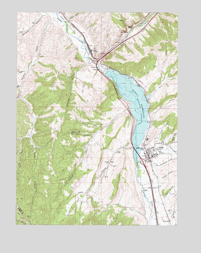
Coalville, UT USGS Topographic Map
Click on map above to begin viewing in our Map Viewer.

This topographic map contains these locations and features:
Feature Name Type Latitude Longitude GNIS ID View Map
Allen HollowValleyN40.9238°W111.3941°1425085View Map
Bachelor CanyonValleyN40.9980°W111.4802°1425220View Map
Beckwith SpringSpringN40.9912°W111.4147°1425392View Map
Bell HollowValleyN40.9566°W111.4977°1425410View Map
Bromleys CanyonValleyN40.9699°W111.4452°1425995View Map
Carruth CanyonValleyN40.9436°W111.4149°1426365View Map
Cedar HollowValleyN40.8905°W111.3855°1426455View Map
Chalk CreekStreamN40.9197°W111.4044°1439637View Map
City of CoalvilleCivilN40.9152°W111.3942°2409496View Map
CoalvillePopulated PlaceN40.9177°W111.3994°1426770View Map
Coalville CemeteryCemeteryN40.9241°W111.3919°1435327View Map
Coalville Post OfficePost OfficeN40.9170°W111.3977°1455224View Map
Dexter HollowValleyN40.9022°W111.3885°1427385View Map
Dry Fork Franklin CanyonValleyN40.9269°W111.4910°1427548View Map
Dry HollowValleyN40.9399°W111.3958°1427557View Map
EchoPopulated PlaceN40.9777°W111.4433°1427740View Map
Echo CanyonValleyN40.9716°W111.4380°1440860View Map
Echo Census Designated PlaceCensusN40.9803°W111.4392°2584763View Map
Echo CreekStreamN40.9713°W111.4383°1440861View Map
Echo DamDamN40.9633°W111.4324°1434864View Map
Echo Historical CemeteryCemeteryN40.9789°W111.4413°1435497View Map
Echo Post OfficePost OfficeN40.9783°W111.4436°2769049View Map
Echo ReservoirReservoirN40.9450°W111.4102°1427742View Map
Echo ResortPopulated PlaceN40.9624°W111.4116°1455255View Map
Franklin CanyonValleyN40.9947°W111.4735°1428084View Map
Grass CreekStreamN40.9519°W111.3963°1428344View Map
Grass Valley CanyonValleyN40.9519°W111.3963°1428348View Map
Hayes SpringSpringN40.9883°W111.4145°1428605View Map
Holiday Hills CampgroundLocaleN40.9133°W111.3991°1435688View Map
Hoytsville AirportAirportN40.8779°W111.3766°2717115View Map
Hoytsville CemeteryCemeteryN40.8752°W111.3760°1435717View Map
Hoytsville Census Designated PlaceCensusN40.8754°W111.3847°2584768View Map
Knight Hawk Helicopter ServiceAirportN40.9333°W111.3841°1435828View Map
Leonards CanyonValleyN40.9958°W111.4616°1429588View Map
Lewis CanyonValleyN40.9202°W111.4099°1429596View Map
Mill CanyonValleyN40.9997°W111.4002°1455394View Map
Narrows CanyonValleyN40.9333°W111.4291°1455419View Map
Narrows HollowValleyN40.9324°W111.4327°1430639View Map
North Summit EMS AmbulanceBuildingN40.9170°W111.3964°2768471View Map
North Summit Fire District Station 21 CoalvilleBuildingN40.9170°W111.3963°2627331View Map
North Summit High SchoolSchoolN40.9160°W111.3942°1430865View Map
North Summit Middle SchoolSchoolN40.9161°W111.3959°1436049View Map
North Summit PreschoolSchoolN40.9157°W111.3955°1436050View Map
Red Rock CanyonValleyN40.9277°W111.4405°1431692View Map
Right Fork Franklin CanyonValleyN40.9508°W111.4969°1431801View Map
Spring CanyonValleyN40.8813°W111.3802°1432832View Map
Spring CreekStreamN40.8808°W111.4016°1432843View Map
Spring HollowValleyN40.9261°W111.3908°1432860View Map
Summit County Hospital HeliportAirportN40.9166°W111.4008°1436445View Map
The Church of Jesus Christ of Latter Day SaintsChurchN40.9174°W111.3985°1436868View Map
The Church of Jesus Christ of Latter Day SaintsChurchN40.8777°W111.3816°1450773View Map
Tom Harris HollowValleyN40.9647°W111.4938°1433567View Map
Witch RocksCliffN40.9972°W111.4499°1455584View Map

Note: Coordinates in the location and feature list above are referenced to NAD83 datum.


Copyright (C) 2008-2024 Ryan Niemi / Sunset Dynamics ... All Rights Reserved