TopoQuest Logo
Do you find TopoQuest useful?
Help keep TopoQuest running and adding new maps/features by donating!
Bitcoin:  19c7KJd3qBynnjoSw5npx9KScwjBe4ifkT
Litecoin:  LXs6TkuXGGXo1vDsWCkWVdjQX94eUKd6ui
Home View Maps Find Maps Find Places Resources & Links


Henefer, Utah Topographic Map

USGS Map Title: Henefer, UT
USGS Map MRC: 41111A4
DRG (GeoTIFF) Download: o41111a4.tif


Neighboring USGS Topographic Map Quads:


  Bybee Knoll, UT  
41111B5
 

  Lost Creek Dam, UT  
41111B4
 

  Francis Canyon, UT  
41111B3
 

  Devils Slide, UT  
41111A5
 

  Henefer, UT  
41111A4
 

  Heiners Creek, UT  
41111A3
 

  East Canyon Reservoir, UT  
40111H5
 

  Coalville, UT  
40111H4
 

  Turner Hollow, UT  
40111H3


Map MRC Location:

N42°
W112°
N42°
W111°
H8 H7 H6 H5 H4 H3 H2 H1
G8 G7 G6 G5 G4 G3 G2 G1
F8 F7 F6 F5 F4 F3 F2 F1
E8 E7 E6 E5 E4 E3 E2 E1
D8 D7 D6 D5 D4 D3 D2 D1
C8 C7 C6 C5 C4 C3 C2 C1
B8 B7 B6 B5 B4 B3 B2 B1
A8 A7 A6 A5 A4 A3 A2 A1
N41°
W112°
N41°
W111°

Henefer, UT USGS 1:24K Topographic Map Preview:
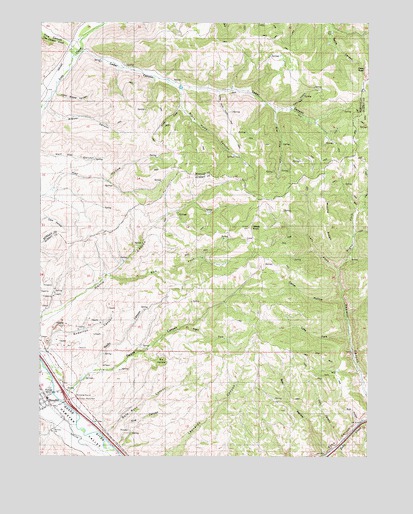
Henefer, UT USGS Topographic Map
Click on map above to begin viewing in our Map Viewer.

This topographic map contains these locations and features:
Feature Name Type Latitude Longitude GNIS ID View Map
Anderton CanyonValleyN41.0319°W111.4966°1425112View Map
Bald Rock CanyonValleyN41.0069°W111.4746°1425263View Map
Bear HollowValleyN41.0008°W111.3919°1437296View Map
Big Pine ForkStreamN41.0997°W111.4113°1425530View Map
Black Hawk CanyonValleyN41.1058°W111.4474°1425663View Map
Brewer CanyonValleyN41.1002°W111.4988°1425953View Map
Bull HollowValleyN41.0097°W111.3794°1426118View Map
Cedar CanyonValleyN41.1177°W111.4844°1426440View Map
China TownPillarN41.1119°W111.3771°1426594View Map
Fire CanyonValleyN41.0038°W111.4702°1437295View Map
Fire CanyonValleyN41.0019°W111.4683°1427937View Map
HeneferPopulated PlaceN41.0166°W111.4983°1428658View Map
Henefer CemeteryCemeteryN41.0083°W111.4960°1437372View Map
Henefer Post OfficePost OfficeN41.0162°W111.4974°2767349View Map
Henefer-Echo Wildlife Management AreaParkN41.0236°W111.4452°1435665View Map
Left Fork Sawmill CanyonValleyN41.0536°W111.3869°1429548View Map
Little Brewer CanyonValleyN41.1049°W111.4949°1429685View Map
Little Pine ForkStreamN41.1047°W111.4327°1429781View Map
Middle RidgeRidgeN41.0669°W111.3919°1430298View Map
North Summit EMS AmbulanceBuildingN41.0136°W111.4955°2768470View Map
North Summit Fire District Station 22 HeneferBuildingN41.0138°W111.4956°2627344View Map
Owens CanyonValleyN41.0180°W111.4883°1431051View Map
Pine CanyonValleyN41.1188°W111.4899°1444365View Map
Pine CanyonValleyN41.0047°W111.3863°1455453View Map
Pole HollowValleyN41.1005°W111.4046°1431387View Map
Red ForkStreamN41.0519°W111.4741°1431639View Map
Right Fork Sawmill CanyonValleyN41.0536°W111.3869°1431812View Map
Spring HollowValleyN41.1249°W111.4849°1446041View Map
The Church of Jesus Christ of Latter Day SaintsChurchN41.0166°W111.4977°1436940View Map
Tom Condies CreekStreamN41.1155°W111.4880°1446635View Map
Town of HeneferCivilN41.0138°W111.4933°2412745View Map
Windy KnollSummitN41.0661°W111.4210°1437466View Map
Windy KnollSummitN41.0858°W111.3783°1455582View Map

Note: Coordinates in the location and feature list above are referenced to NAD83 datum.


Copyright (C) 2008-2025 Ryan Niemi / Sunset Dynamics ... All Rights Reserved