TopoQuest Logo
Do you find TopoQuest useful?
Help keep TopoQuest running and adding new maps/features by donating!
Bitcoin:  19c7KJd3qBynnjoSw5npx9KScwjBe4ifkT
Litecoin:  LXs6TkuXGGXo1vDsWCkWVdjQX94eUKd6ui
Home View Maps Find Maps Find Places Resources & Links


Coffeeville, Texas Topographic Map

USGS Map Title: Coffeeville, TX
USGS Map MRC: 32094G7
DRG (GeoTIFF) Download: o32094g7.tif


Neighboring USGS Topographic Map Quads:


  Pittsburg, TX  
32094H8
 

  Lafayette, TX  
32094H7
 

  Lone Star, TX  
32094H6
 

  Bettie, TX  
32094G8
 

  Coffeeville, TX  
32094G7
 

  Ore City, TX  
32094G6
 

  Gilmer, TX  
32094F8
 

  Glenwood, TX  
32094F7
 

  Ashland, TX  
32094F6


Map MRC Location:

N33°
W95°
N33°
W94°
H8 H7 H6 H5 H4 H3 H2 H1
G8 G7 G6 G5 G4 G3 G2 G1
F8 F7 F6 F5 F4 F3 F2 F1
E8 E7 E6 E5 E4 E3 E2 E1
D8 D7 D6 D5 D4 D3 D2 D1
C8 C7 C6 C5 C4 C3 C2 C1
B8 B7 B6 B5 B4 B3 B2 B1
A8 A7 A6 A5 A4 A3 A2 A1
N32°
W95°
N32°
W94°

Coffeeville, TX USGS 1:24K Topographic Map Preview:
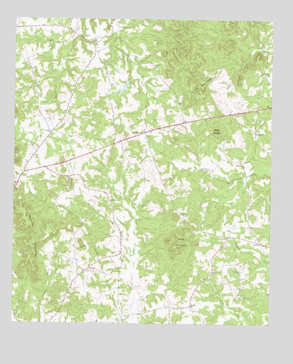
Coffeeville, TX USGS Topographic Map
Click on map above to begin viewing in our Map Viewer.

This topographic map contains these locations and features:
Feature Name Type Latitude Longitude GNIS ID View Map
Barnwell MountainsSummitN32.7957°W94.8699°1330077View Map
Beard LakeReservoirN32.8461°W94.8236°1861611View Map
Beard Lake DamDamN32.8485°W94.8202°1861610View Map
BoxwoodPopulated PlaceN32.7837°W94.7549°1378040View Map
Brown MountainSummitN32.8293°W94.7766°1331353View Map
Camp MountainSummitN32.7821°W94.7955°1331992View Map
Coal Mine HollowValleyN32.8559°W94.7742°1333025View Map
CoffeevillePopulated PlaceN32.8293°W94.7577°1378140View Map
Coffeeville CemeteryCemeteryN32.8349°W94.7547°1333062View Map
CoxPopulated PlaceN32.8646°W94.8380°2034839View Map
Duffey LakeReservoirN32.7546°W94.7745°1865361View Map
Duffey Lake DamDamN32.7551°W94.7752°1865360View Map
Holly Springs ChurchChurchN32.8004°W94.8272°1337963View Map
New MountainPopulated PlaceN32.8287°W94.8105°1378750View Map
New Mountain Volunteer Fire DepartmentBuildingN32.8245°W94.8263°2655144View Map
Ore City DivisionCivilN32.7895°W94.7794°1939065View Map
Paradise ChurchChurchN32.8287°W94.8569°1343576View Map
Prince ChapelChurchN32.8529°W94.7538°1344569View Map
Russell LakeReservoirN32.8331°W94.8587°1865359View Map
Russell Lake DamDamN32.8335°W94.8585°1865358View Map
Sand HillLocaleN32.7718°W94.8397°1346515View Map
Sand HillPopulated PlaceN32.7718°W94.8405°2034731View Map
Snow HillPopulated PlaceN32.7749°W94.7655°2034762View Map
Snow Hill ChurchChurchN32.7721°W94.7644°1347336View Map
Spratt CreekStreamN32.8679°W94.8474°1347680View Map
StampsPopulated PlaceN32.7576°W94.7880°1379108View Map

Note: Coordinates in the location and feature list above are referenced to NAD83 datum.


Copyright (C) 2008-2025 Ryan Niemi / Sunset Dynamics ... All Rights Reserved