TopoQuest Logo
Do you find TopoQuest useful?
Help keep TopoQuest running and adding new maps/features by donating!
Bitcoin:  19c7KJd3qBynnjoSw5npx9KScwjBe4ifkT
Litecoin:  LXs6TkuXGGXo1vDsWCkWVdjQX94eUKd6ui
Home View Maps Find Maps Find Places Resources & Links


Pittsburg, Texas Topographic Map

USGS Map Title: Pittsburg, TX
USGS Map MRC: 32094H8
DRG (GeoTIFF) Download: o32094h8.tif


Neighboring USGS Topographic Map Quads:


  Monticello, TX  
33095A1
 

  Harvard, TX  
33094A8
 

  Cason, TX  
33094A7
 

  Leesburg, TX  
32095H1
 

  Pittsburg, TX  
32094H8
 

  Lafayette, TX  
32094H7
 

  Thomas, TX  
32095G1
 

  Bettie, TX  
32094G8
 

  Coffeeville, TX  
32094G7


Map MRC Location:

N33°
W95°
N33°
W94°
H8 H7 H6 H5 H4 H3 H2 H1
G8 G7 G6 G5 G4 G3 G2 G1
F8 F7 F6 F5 F4 F3 F2 F1
E8 E7 E6 E5 E4 E3 E2 E1
D8 D7 D6 D5 D4 D3 D2 D1
C8 C7 C6 C5 C4 C3 C2 C1
B8 B7 B6 B5 B4 B3 B2 B1
A8 A7 A6 A5 A4 A3 A2 A1
N32°
W95°
N32°
W94°

Pittsburg, TX USGS 1:24K Topographic Map Preview:
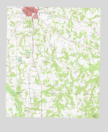
Pittsburg, TX USGS Topographic Map
Click on map above to begin viewing in our Map Viewer.

This topographic map contains these locations and features:
Feature Name Type Latitude Longitude GNIS ID View Map
Bennett DamDamN32.9485°W94.9685°1862116View Map
Bennett LakeReservoirN32.9483°W94.9698°1330422View Map
Bolton CemeteryCemeteryN32.9526°W94.9338°1331030View Map
Bolton ChurchChurchN32.9304°W94.9155°1331031View Map
Camp CountyCivilN32.9732°W94.9785°1383817View Map
Camp County Constable's OfficeBuildingN32.9960°W94.9658°2751410View Map
Camp County Emergency Medical ServiceBuildingN32.9958°W94.9663°2720922View Map
Camp County JailBuildingN32.9963°W94.9657°2738683View Map
Camp County Sheriff's OfficeBuildingN32.9962°W94.9657°2751264View Map
Cary Martin SpringsSpringN32.9429°W94.9709°1332260View Map
Christian Hope CemeteryCemeteryN32.8835°W94.9527°1332807View Map
City of PittsburgCivilN32.9996°W94.9668°2411431View Map
CrossroadsPopulated PlaceN32.9321°W94.9610°1378185View Map
Crossroads ChurchChurchN32.9373°W94.9460°1333731View Map
Darby CreekStreamN32.9357°W94.9341°1334042View Map
Darby CreekStreamN32.9360°W94.9338°1334043View Map
Douglas High SchoolSchoolN32.9926°W94.9760°1334556View Map
EbenezerPopulated PlaceN32.9721°W94.8810°1378240View Map
Faith Baptist ChurchChurchN32.9962°W94.9633°2016681View Map
First Baptist ChurchChurchN32.9937°W94.9599°2016682View Map
First Presbyterian ChurchChurchN32.9951°W94.9658°2016688View Map
Franklin Street Church of ChristChurchN32.9937°W94.9755°2016685View Map
Hadenfield BranchStreamN32.8785°W94.9660°1337207View Map
Highland Club DamDamN32.9401°W94.9852°1862114View Map
Highland Club LakeReservoirN32.9389°W94.9826°1337733View Map
Howell MountainSummitN32.8776°W94.8808°1338196View Map
Independent Hope ChurchChurchN32.9262°W94.9091°1338392View Map
Lawton CemeteryCemeteryN32.8954°W94.9772°1339747View Map
Little CreekStreamN32.9746°W94.9619°1340066View Map
Metropolitian Baptist ChurchChurchN32.9910°W94.9708°2016683View Map
Mile BranchStreamN32.9807°W94.9688°1341601View Map
Perry CreekStreamN32.9482°W94.9663°1343875View Map
PinePopulated PlaceN32.9132°W94.9694°1378863View Map
Pine Bluff Baptist ChurchChurchN32.9923°W94.9747°2016684View Map
Pine ChurchChurchN32.9126°W94.9577°1344040View Map
PittsburgPopulated PlaceN32.9954°W94.9658°1344152View Map
Pittsburg Central Fire DepartmentBuildingN32.9883°W94.9652°2655339View Map
Pittsburg City HallBuildingN32.9947°W94.9672°2753881View Map
Pittsburg DivisionCivilN32.9757°W94.9420°1939091View Map
Pittsburg High SchoolSchoolN32.9951°W94.9730°2003654View Map
Pittsburg Intermediate SchoolSchoolN32.9846°W94.9588°2003655View Map
Pittsburg Police DepartmentBuildingN32.9879°W94.9654°2751134View Map
Pittsburg Post OfficePost OfficeN32.9940°W94.9662°2732133View Map
Pittsburg-Camp County MuseumBuildingN32.9960°W94.9680°2014267View Map
Rosehill CemeteryCemeteryN32.9968°W94.9577°1345577View Map
Saint Merner ChurchChurchN32.8821°W94.9694°1346050View Map
Smart CemeteryCemeteryN32.9571°W94.9408°1347248View Map
Sparks BranchStreamN32.9873°W94.9152°1347629View Map
Texas Forest Service Pittsburg OfficeBuildingN32.9957°W94.9650°2655656View Map
Twin LakesReservoirN32.9892°W94.9425°1348956View Map
Union ChapelChurchN32.9621°W94.9105°1349046View Map
United Pentecostal ChurchChurchN32.9882°W94.9602°2016687View Map
Wallace BranchStreamN32.8940°W94.9613°1349388View Map
Wallace ChapelChurchN32.8849°W94.9691°1349393View Map
Willow Oak ChurchChurchN32.8862°W94.9377°1350204View Map

Note: Coordinates in the location and feature list above are referenced to NAD83 datum.


Copyright (C) 2008-2024 Ryan Niemi / Sunset Dynamics ... All Rights Reserved