TopoQuest Logo
Do you find TopoQuest useful?
Help keep TopoQuest running and adding new maps/features by donating!
Bitcoin:  19c7KJd3qBynnjoSw5npx9KScwjBe4ifkT
Litecoin:  LXs6TkuXGGXo1vDsWCkWVdjQX94eUKd6ui
Home View Maps Find Maps Find Places Resources & Links


Colfax, Indiana Topographic Map

USGS Map Title: Colfax, IN
USGS Map MRC: 40086B6
DRG (GeoTIFF) Download: o40086b6.tif


Neighboring USGS Topographic Map Quads:


  Stockwell, IN  
40086C7
 

  Mulberry, IN  
40086C6
 

  Frankfort, IN  
40086C5
 

  Kirkpatrick, IN  
40086B7
 

  Colfax, IN  
40086B6
 

  Thorntown, IN  
40086B5
 

  Darlington, IN  
40086A7
 

  Shannondale, IN  
40086A6
 

  Hazelrigg, IN  
40086A5


Map MRC Location:

N41°
W87°
N41°
W86°
H8 H7 H6 H5 H4 H3 H2 H1
G8 G7 G6 G5 G4 G3 G2 G1
F8 F7 F6 F5 F4 F3 F2 F1
E8 E7 E6 E5 E4 E3 E2 E1
D8 D7 D6 D5 D4 D3 D2 D1
C8 C7 C6 C5 C4 C3 C2 C1
B8 B7 B6 B5 B4 B3 B2 B1
A8 A7 A6 A5 A4 A3 A2 A1
N40°
W87°
N40°
W86°

Colfax, IN USGS 1:24K Topographic Map Preview:
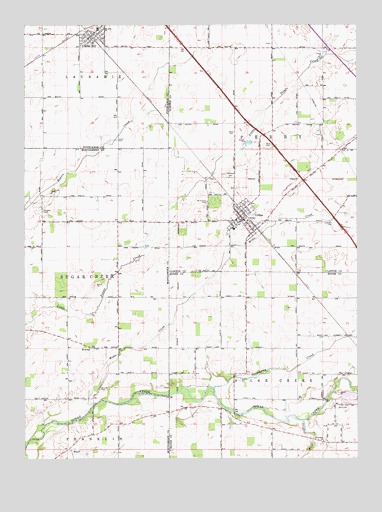
Colfax, IN USGS Topographic Map
Click on map above to begin viewing in our Map Viewer.

This topographic map contains these locations and features:
Feature Name Type Latitude Longitude GNIS ID View Map
BowersPopulated PlaceN40.1570°W86.7247°431396View Map
Bowers CemeteryCemeteryN40.1964°W86.7429°431397View Map
Clarks HillPopulated PlaceN40.2470°W86.7250°449638View Map
Clarks Hill Elementary SchoolSchoolN40.2489°W86.7222°447592View Map
Clarks Hill Volunteer Fire DepartmentBuildingN40.2465°W86.7247°2625637View Map
Clouser CemeteryCemeteryN40.1456°W86.7217°432683View Map
ColfaxPopulated PlaceN40.1950°W86.6672°432758View Map
Colfax Community Emergency Medical ServicesBuildingN40.1945°W86.6664°2719414View Map
Colfax Police DepartmentBuildingN40.1937°W86.6680°2758376View Map
Davis CemeteryCemeteryN40.2195°W86.6706°433346View Map
Goldsberry CreekStreamN40.1456°W86.6786°435160View Map
Hazel CreekStreamN40.1264°W86.7303°435935View Map
Lauramie Township Emergency Medical ServicesBuildingN40.2474°W86.7290°2719357View Map
Loveless CemeteryCemeteryN40.1932°W86.6353°438348View Map
McKendra CemeteryCemeteryN40.1991°W86.6812°438935View Map
Perry Township Colfax Fire DepartmentBuildingN40.1939°W86.6668°2626003View Map
Plainview CemeteryCemeteryN40.2066°W86.6723°441221View Map
Plainview ChurchChurchN40.1300°W86.6372°441222View Map
Shiloh CemeteryCemeteryN40.2154°W86.6567°443379View Map
Town of Clarks HillCivilN40.2472°W86.7244°2396648View Map
Town of ColfaxCivilN40.1943°W86.6672°2396658View Map
Township of PerryCivilN40.2181°W86.6383°453718View Map
Township of Sugar CreekCivilN40.1384°W86.6386°453880View Map
Union CemeteryCemeteryN40.2169°W86.7154°445061View Map
Withe CreekStreamN40.1400°W86.7245°446218View Map
Wolf CreekStreamN40.1359°W86.6447°446244View Map

Note: Coordinates in the location and feature list above are referenced to NAD83 datum.


Copyright (C) 2008-2025 Ryan Niemi / Sunset Dynamics ... All Rights Reserved