TopoQuest Logo
Do you find TopoQuest useful?
Help keep TopoQuest running and adding new maps/features by donating!
Bitcoin:  19c7KJd3qBynnjoSw5npx9KScwjBe4ifkT
Litecoin:  LXs6TkuXGGXo1vDsWCkWVdjQX94eUKd6ui
Home View Maps Find Maps Find Places Resources & Links


Colony, Missouri Topographic Map

USGS Map Title: Colony, MO
USGS Map MRC: 40091C8
DRG (GeoTIFF) Download: o40091c8.tif


Neighboring USGS Topographic Map Quads:


  Arbela, MO  
40092D1
 

  Wyaconda, MO  
40091D8
 

  Medill, MO  
40091D7
 

  Rutledge, MO  
40092C1
 

  Colony, MO  
40091C8
 

  Neeper, MO  
40091C7
 

  Knox City, MO  
40092B1
 

  Deer Ridge, MO  
40091B8
 

  Williamstown, MO  
40091B7


Map MRC Location:

N41°
W92°
N41°
W91°
H8 H7 H6 H5 H4 H3 H2 H1
G8 G7 G6 G5 G4 G3 G2 G1
F8 F7 F6 F5 F4 F3 F2 F1
E8 E7 E6 E5 E4 E3 E2 E1
D8 D7 D6 D5 D4 D3 D2 D1
C8 C7 C6 C5 C4 C3 C2 C1
B8 B7 B6 B5 B4 B3 B2 B1
A8 A7 A6 A5 A4 A3 A2 A1
N40°
W92°
N40°
W91°

Colony, MO USGS 1:24K Topographic Map Preview:
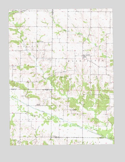
Colony, MO USGS Topographic Map
Click on map above to begin viewing in our Map Viewer.

This topographic map contains these locations and features:
Feature Name Type Latitude Longitude GNIS ID View Map
Arkansas SchoolLocaleN40.2820°W91.9260°713383View Map
Bailey CemeteryCemeteryN40.2581°W91.9460°713542View Map
Bear Creek ChurchChurchN40.3120°W91.9324°713815View Map
Bear Creek Watershed Dam D-1DamN40.3234°W91.9718°761357View Map
Bear Creek Watershed Dam D-2DamN40.3284°W91.9652°761358View Map
Bear Creek Watershed Dam D-25DamN40.3500°W91.9618°760793View Map
Bear Creek Watershed Structure F-1 DamDamN40.2984°W91.9335°762250View Map
Bear Creek Watershed Structure F-20 DamDamN40.3384°W91.9352°760388View Map
Clapp's FordLocaleN40.2559°W91.8843°732795View Map
Clark F-20 LakeReservoirN40.3384°W91.9352°760389View Map
ColonyPopulated PlaceN40.2539°W91.9907°735563View Map
Colony CemeteryCemeteryN40.2541°W91.9965°2777502View Map
D-25 LakeReservoirN40.3500°W91.9618°760794View Map
Davis School (historical)SchoolN40.2867°W91.9680°716740View Map
FairmontPopulated PlaceN40.3314°W91.9099°717740View Map
Fairmont Census Designated PlaceCensusN40.3256°W91.9049°2587069View Map
Hines AirportAirportN40.3624°W91.9741°758699View Map
Mark Twain Planning RegionAreaN40.2503°W91.8753°754102View Map
Narrow Grove SchoolSchoolN40.3450°W91.9663°723120View Map
Price SchoolSchoolN40.3198°W91.9960°724927View Map
Shaffer CreekStreamN40.2817°W91.9013°726256View Map
Standiford CemeteryCemeteryN40.2948°W91.9841°726999View Map
Sutter CemeteryCemeteryN40.3292°W91.9524°727345View Map
Tanyard SchoolSchoolN40.3292°W91.9104°731738View Map
Township of WashingtonCivilN40.3214°W91.8927°766502View Map
Vernon BranchStreamN40.2737°W91.9518°728171View Map

Note: Coordinates in the location and feature list above are referenced to NAD83 datum.


Copyright (C) 2008-2025 Ryan Niemi / Sunset Dynamics ... All Rights Reserved