TopoQuest Logo
Do you find TopoQuest useful?
Help keep TopoQuest running and adding new maps/features by donating!
Bitcoin:  19c7KJd3qBynnjoSw5npx9KScwjBe4ifkT
Litecoin:  LXs6TkuXGGXo1vDsWCkWVdjQX94eUKd6ui
Home View Maps Find Maps Find Places Resources & Links


Neeper, Missouri Topographic Map

USGS Map Title: Neeper, MO
USGS Map MRC: 40091C7
DRG (GeoTIFF) Download: o40091c7.tif


Neighboring USGS Topographic Map Quads:


  Wyaconda, MO  
40091D8
 

  Medill, MO  
40091D7
 

  Kahoka, MO  
40091D6
 

  Colony, MO  
40091C8
 

  Neeper, MO  
40091C7
 

  Saint Patrick, MO  
40091C6
 

  Deer Ridge, MO  
40091B8
 

  Williamstown, MO  
40091B7
 

  Benjamin, MO  
40091B6


Map MRC Location:

N41°
W92°
N41°
W91°
H8 H7 H6 H5 H4 H3 H2 H1
G8 G7 G6 G5 G4 G3 G2 G1
F8 F7 F6 F5 F4 F3 F2 F1
E8 E7 E6 E5 E4 E3 E2 E1
D8 D7 D6 D5 D4 D3 D2 D1
C8 C7 C6 C5 C4 C3 C2 C1
B8 B7 B6 B5 B4 B3 B2 B1
A8 A7 A6 A5 A4 A3 A2 A1
N40°
W92°
N40°
W91°

Neeper, MO USGS 1:24K Topographic Map Preview:
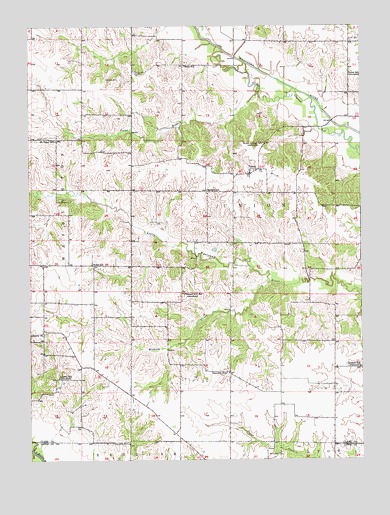
Neeper, MO USGS Topographic Map
Click on map above to begin viewing in our Map Viewer.

This topographic map contains these locations and features:
Feature Name Type Latitude Longitude GNIS ID View Map
Ballard ChurchChurchN40.3273°W91.8082°731741View Map
Ballard SchoolSchoolN40.3275°W91.8079°713608View Map
Bear CreekStreamN40.2528°W91.8749°713809View Map
Black SchoolSchoolN40.3637°W91.8160°714310View Map
Brewer Lake DamDamN40.3184°W91.8102°762222View Map
Brush College School (historical)SchoolN40.3414°W91.7863°735535View Map
Carlin CemeteryCemeteryN40.2517°W91.7818°715398View Map
Ebeline Lake DamDamN40.3234°W91.8585°762221View Map
Evans Lake DamDamN40.3017°W91.8485°762220View Map
Fairview SchoolSchoolN40.2753°W91.8016°717819View Map
Fishback Lake DamDamN40.2974°W91.7796°762219View Map
Foree BranchStreamN40.3550°W91.7879°735616View Map
Hickory CreekStreamN40.3012°W91.7846°735645View Map
Liberty SchoolLocaleN40.2739°W91.8643°721006View Map
Mount Tabor SchoolSchoolN40.3420°W91.8649°722905View Map
NeeperPopulated PlaceN40.3325°W91.7916°741092View Map
Nichols School (historical)SchoolN40.2767°W91.7513°723364View Map
Old German CemeteryCemeteryN40.3614°W91.8341°723752View Map
Pleasant Hill SchoolLocaleN40.2981°W91.8179°735788View Map
Schuster CemeteryCemeteryN40.3600°W91.8413°726128View Map
Steinmann Lake DamDamN40.3467°W91.7918°762223View Map
Township of UnionCivilN40.3200°W91.7790°766500View Map
UnionPopulated PlaceN40.3628°W91.7543°731740View Map
Union SchoolLocaleN40.3617°W91.7532°728047View Map
Wells SchoolSchoolN40.3067°W91.8516°728502View Map

Note: Coordinates in the location and feature list above are referenced to NAD83 datum.


Copyright (C) 2008-2025 Ryan Niemi / Sunset Dynamics ... All Rights Reserved