TopoQuest Logo
Do you find TopoQuest useful?
Help keep TopoQuest running and adding new maps/features by donating!
Bitcoin:  19c7KJd3qBynnjoSw5npx9KScwjBe4ifkT
Litecoin:  LXs6TkuXGGXo1vDsWCkWVdjQX94eUKd6ui
Home View Maps Find Maps Find Places Resources & Links


Kalida, Ohio Topographic Map

USGS Map Title: Kalida, OH
USGS Map MRC: 40084H2
DRG (GeoTIFF) Download: o40084h2.tif


Neighboring USGS Topographic Map Quads:


  Continental, OH  
41084A3
 

  Miller City, OH  
41084A2
 

  Ottawa, OH  
41084A1
 

  Ottoville, OH  
40084H3
 

  Kalida, OH  
40084H2
 

  Columbus Grove, OH  
40084H1
 

  Delphos, OH  
40084G3
 

  Elida, OH  
40084G2
 

  Cairo, OH  
40084G1


Map MRC Location:

N41°
W85°
N41°
W84°
H8 H7 H6 H5 H4 H3 H2 H1
G8 G7 G6 G5 G4 G3 G2 G1
F8 F7 F6 F5 F4 F3 F2 F1
E8 E7 E6 E5 E4 E3 E2 E1
D8 D7 D6 D5 D4 D3 D2 D1
C8 C7 C6 C5 C4 C3 C2 C1
B8 B7 B6 B5 B4 B3 B2 B1
A8 A7 A6 A5 A4 A3 A2 A1
N40°
W85°
N40°
W84°

Kalida, OH USGS 1:24K Topographic Map Preview:
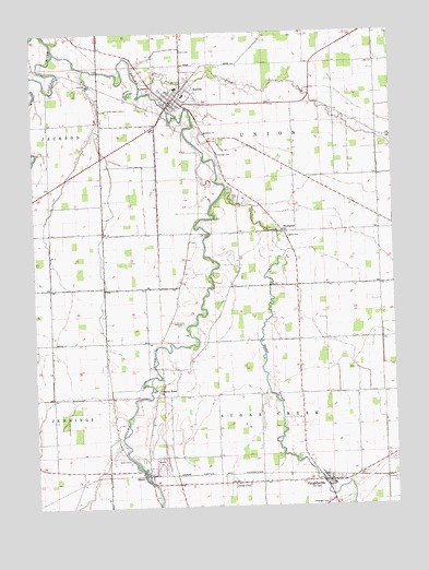
Kalida, OH USGS Topographic Map
Click on map above to begin viewing in our Map Viewer.

This topographic map contains these locations and features:
Feature Name Type Latitude Longitude GNIS ID View Map
Arrowhead Trailer Park Number 1Populated PlaceN40.9906°W84.2033°2648373View Map
Clerenger CemeteryCemeteryN40.8754°W84.1500°1070717View Map
Clevenger CemeteryCemeteryN40.9679°W84.1858°1039185View Map
Clevengers (historical)Populated PlaceN40.9584°W84.1780°1063576View Map
Hughes CemeteryCemeteryN40.9462°W84.1622°1041859View Map
Jones CityPopulated PlaceN40.8814°W84.1816°1048876View Map
KalidaPopulated PlaceN40.9828°W84.1994°1042172View Map
Kalida Elementary SchoolSchoolN40.9853°W84.1997°1050109View Map
Kalida High SchoolSchoolN40.9834°W84.1969°1050108View Map
Kalida Post OfficePost OfficeN40.9834°W84.1999°2056192View Map
Kalida Volunteer Fire DepartmentBuildingN40.9826°W84.2009°2550392View Map
Keirns CemeteryCemeteryN40.8879°W84.2178°1070799View Map
Ottawa RiverStreamN40.9951°W84.2413°1070882View Map
Ottawa River CemeteryCemeteryN40.9062°W84.2080°1071352View Map
Ottawa River ChurchChurchN40.9059°W84.2080°1070883View Map
Plum CreekStreamN40.9873°W84.2119°1044636View Map
Remlinger Fish FarmLocaleN40.9711°W84.2189°2564645View Map
Reynolds CemeteryCemeteryN40.9234°W84.1980°1044958View Map
RimerPopulated PlaceN40.8845°W84.2113°1061607View Map
Rimer Post Office (historical)Post OfficeN40.8848°W84.2111°2056203View Map
Saint Michaels Catholic ChurchChurchN40.9839°W84.1977°1071362View Map
Saint Michaels CemeteryCemeteryN40.9849°W84.2100°1045710View Map
SeitzPopulated PlaceN40.9187°W84.1763°1050107View Map
Sugar CreekStreamN40.9592°W84.1822°1046795View Map
Thompson ChurchChurchN40.9478°W84.1627°1047033View Map
Township of Sugar CreekCivilN40.8965°W84.1677°1086869View Map
Township of UnionCivilN40.9697°W84.1687°1086870View Map
VaughnsvillePopulated PlaceN40.8817°W84.1505°1065432View Map
Vaughnsville Census Designated PlaceCensusN40.8814°W84.1460°2628982View Map
Vaughnsville Post OfficePost OfficeN40.8820°W84.1499°2056209View Map
Village of KalidaCivilN40.9850°W84.1951°2398321View Map

Note: Coordinates in the location and feature list above are referenced to NAD83 datum.


Copyright (C) 2008-2025 Ryan Niemi / Sunset Dynamics ... All Rights Reserved