TopoQuest Logo
Do you find TopoQuest useful?
Help keep TopoQuest running and adding new maps/features by donating!
Bitcoin:  19c7KJd3qBynnjoSw5npx9KScwjBe4ifkT
Litecoin:  LXs6TkuXGGXo1vDsWCkWVdjQX94eUKd6ui
Home View Maps Find Maps Find Places Resources & Links


Constantine, Kentucky Topographic Map

USGS Map Title: Constantine, KY
USGS Map MRC: 37086F2
DRG (GeoTIFF) Download: o37086f2.tif


Neighboring USGS Topographic Map Quads:


  Garfield, KY  
37086G3
 

  Big Spring, KY  
37086G2
 

  Flaherty, KY  
37086G1
 

  Custer, KY  
37086F3
 

  Constantine, KY  
37086F2
 

  Howe Valley, KY  
37086F1
 

  Madrid, KY  
37086E3
 

  Big Clifty, KY  
37086E2
 

  Summit, KY  
37086E1


Map MRC Location:

N38°
W87°
N38°
W86°
H8 H7 H6 H5 H4 H3 H2 H1
G8 G7 G6 G5 G4 G3 G2 G1
F8 F7 F6 F5 F4 F3 F2 F1
E8 E7 E6 E5 E4 E3 E2 E1
D8 D7 D6 D5 D4 D3 D2 D1
C8 C7 C6 C5 C4 C3 C2 C1
B8 B7 B6 B5 B4 B3 B2 B1
A8 A7 A6 A5 A4 A3 A2 A1
N37°
W87°
N37°
W86°

Constantine, KY USGS 1:24K Topographic Map Preview:
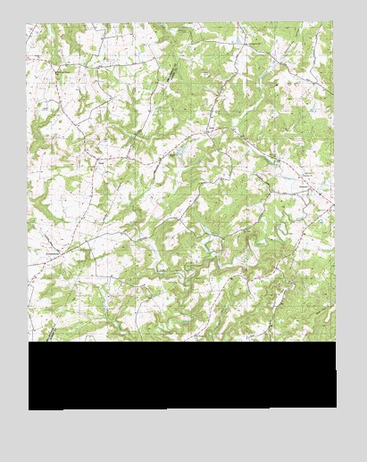
Constantine, KY USGS Topographic Map
Click on map above to begin viewing in our Map Viewer.

This topographic map contains these locations and features:
Feature Name Type Latitude Longitude GNIS ID View Map
ArchLocaleN37.7145°W86.1772°486018View Map
ConstantinePopulated PlaceN37.6753°W86.2364°489989View Map
Custer ChurchChurchN37.7387°W86.2416°509500View Map
Custer Fire DepartmentBuildingN37.7169°W86.2297°2636866View Map
Drakes CreekStreamN37.6431°W86.2025°491094View Map
Dry Bed BranchStreamN37.6495°W86.1752°491133View Map
DyerPopulated PlaceN37.7062°W86.2214°491384View Map
Fair Farm ChurchChurchN37.6823°W86.1614°509498View Map
Grandview CemeteryCemeteryN37.7473°W86.1841°493098View Map
Grandview ChurchChurchN37.7431°W86.1594°493100View Map
Gray CemeteryCemeteryN37.7126°W86.2191°493196View Map
Holbert CemeteryCemeteryN37.6692°W86.1636°509501View Map
Horn CemeteryCemeteryN37.6801°W86.1905°509502View Map
Kane BranchStreamN37.6334°W86.1855°495568View Map
Keesee BranchStreamN37.6662°W86.1861°495596View Map
Laurel RidgeRidgeN37.6609°W86.1486°496057View Map
Liberty ChapelChurchN37.7070°W86.1914°509499View Map
Linders CreekStreamN37.6370°W86.2016°496567View Map
Losenville ValleyValleyN37.7365°W86.1477°497173View Map
Lyon CemeteryCemeteryN37.7198°W86.2380°497388View Map
McGuffin BranchStreamN37.6753°W86.1758°497874View Map
Memorial ChapelChurchN37.7345°W86.2377°498057View Map
Mount Olive Cumberland ChurchChurchN37.6317°W86.2428°498798View Map
Old Union CemeteryCemeteryN37.7062°W86.1472°509503View Map
Pierce MillPopulated PlaceN37.6406°W86.2000°508817View Map
Pole Bridge ChurchChurchN37.6487°W86.1827°500998View Map
Preston CemeteryCemeteryN37.7381°W86.2150°509504View Map
Smith Chapel CemeteryCemeteryN37.6262°W86.1486°503775View Map
Summit DivisionCivilN37.6320°W86.1453°1937283View Map
Sutzer CreekStreamN37.6334°W86.1452°504823View Map
VertreesPopulated PlaceN37.6965°W86.1344°509283View Map
Vertrees ChurchChurchN37.7004°W86.1376°506029View Map
Vertrees CreekStreamN37.6901°W86.1366°506030View Map

Note: Coordinates in the location and feature list above are referenced to NAD83 datum.


Copyright (C) 2008-2024 Ryan Niemi / Sunset Dynamics ... All Rights Reserved