TopoQuest Logo
Do you find TopoQuest useful?
Help keep TopoQuest running and adding new maps/features by donating!
Bitcoin:  19c7KJd3qBynnjoSw5npx9KScwjBe4ifkT
Litecoin:  LXs6TkuXGGXo1vDsWCkWVdjQX94eUKd6ui
Home View Maps Find Maps Find Places Resources & Links


Damascus, Georgia Topographic Map

USGS Map Title: Damascus, GA
USGS Map MRC: 31084C6
DRG (GeoTIFF) Download: o31084c6.tif


Neighboring USGS Topographic Map Quads:


  Bancroft, GA  
31084D7
 

  Arlington, GA  
31084D6
 

  Leary, GA  
31084D5
 

  Hentown, GA  
31084C7
 

  Damascus, GA  
31084C6
 

  Bethany, GA  
31084C5
 

  Donalsonville NE, GA  
31084B7
 

  Colquitt, GA  
31084B6
 

  Cooktown, GA  
31084B5


Map MRC Location:

N32°
W85°
N32°
W84°
H8 H7 H6 H5 H4 H3 H2 H1
G8 G7 G6 G5 G4 G3 G2 G1
F8 F7 F6 F5 F4 F3 F2 F1
E8 E7 E6 E5 E4 E3 E2 E1
D8 D7 D6 D5 D4 D3 D2 D1
C8 C7 C6 C5 C4 C3 C2 C1
B8 B7 B6 B5 B4 B3 B2 B1
A8 A7 A6 A5 A4 A3 A2 A1
N31°
W85°
N31°
W84°

Damascus, GA USGS 1:24K Topographic Map Preview:
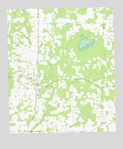
Damascus, GA USGS Topographic Map
Click on map above to begin viewing in our Map Viewer.

This topographic map contains these locations and features:
Feature Name Type Latitude Longitude GNIS ID View Map
Benevolence Church (historical)ChurchN31.2721°W84.6752°344861View Map
Big PondLakeN31.3391°W84.6591°354722View Map
Billings CemeteryCemeteryN31.3038°W84.7377°311429View Map
Christ ChurchChurchN31.3427°W84.6280°312654View Map
City of DamascusCivilN31.2989°W84.7170°2404181View Map
County Line ChurchChurchN31.2949°W84.6399°355334View Map
CrossroadsPopulated PlaceN31.3377°W84.7402°331482View Map
DamascusPopulated PlaceN31.2991°W84.7188°355426View Map
Damascus CemeteryCemeteryN31.3229°W84.7385°335302View Map
Damascus DivisionCivilN31.3467°W84.7300°1936214View Map
Damascus Police DepartmentBuildingN31.3005°W84.7185°2733807View Map
Damascus Post OfficePost OfficeN31.2991°W84.7177°352258View Map
Damascus Volunteer Fire DepartmentBuildingN31.2993°W84.7176°2604178View Map
Douglass CrossroadsPopulated PlaceN31.3035°W84.6733°326248View Map
DouglasvillePopulated PlaceN31.3599°W84.6702°331583View Map
Early County Fire Department Damascus StationBuildingN31.2993°W84.7175°2604177View Map
Gordon CemeteryCemeteryN31.2582°W84.7158°314709View Map
Gordon School (historical)SchoolN31.2627°W84.7138°344898View Map
Gross CemeteryCemeteryN31.2646°W84.6758°314933View Map
Hillside School (historical)SchoolN31.3735°W84.6685°344903View Map
Macedonia CemeteryCemeteryN31.2505°W84.6605°335325View Map
Macedonia ChurchChurchN31.2505°W84.6602°335168View Map
Mount Zion ChurchChurchN31.3038°W84.6677°318945View Map
Old DamascusPopulated PlaceN31.3074°W84.7371°319964View Map
Old Damascus ChurchChurchN31.3099°W84.7338°344931View Map
Plattsville ChurchChurchN31.3418°W84.7141°320785View Map
Pullen CemeteryCemeteryN31.2730°W84.6713°321222View Map
Rowena Lookout TowerTowerN31.3471°W84.7138°344333View Map
Salem ChurchChurchN31.2774°W84.7371°322341View Map
Shady Grove ChurchChurchN31.3596°W84.6799°322741View Map
Sheffield CemeteryCemeteryN31.2580°W84.6321°335182View Map
Southwest Georgia AcademySchoolN31.3052°W84.7252°323312View Map
Tabb CemeteryCemeteryN31.2591°W84.6644°323867View Map

Note: Coordinates in the location and feature list above are referenced to NAD83 datum.


Copyright (C) 2008-2024 Ryan Niemi / Sunset Dynamics ... All Rights Reserved