TopoQuest Logo
Do you find TopoQuest useful?
Help keep TopoQuest running and adding new maps/features by donating!
Bitcoin:  19c7KJd3qBynnjoSw5npx9KScwjBe4ifkT
Litecoin:  LXs6TkuXGGXo1vDsWCkWVdjQX94eUKd6ui
Home View Maps Find Maps Find Places Resources & Links


Browns Lake, Montana Topographic Map

USGS Map Title: Browns Lake, MT
USGS Map MRC: 46113H1
DRG (GeoTIFF) Download: o46113h1.tif


Neighboring USGS Topographic Map Quads:


  Ovando, MT  
47113A2
 

  Ovando Mountain, MT  
47113A1
 

  Coopers Lake, MT  
47112A8
 

  Chamberlain Mountain, MT  
46113H2
 

  Browns Lake, MT  
46113H1
 

  Marcum Mountain, MT  
46112H8
 

  Wild Horse Parks, MT  
46113G2
 

  Chimney Lakes, MT  
46113G1
 

  Helmville, MT  
46112G8


Map MRC Location:

N47°
W114°
N47°
W113°
H8 H7 H6 H5 H4 H3 H2 H1
G8 G7 G6 G5 G4 G3 G2 G1
F8 F7 F6 F5 F4 F3 F2 F1
E8 E7 E6 E5 E4 E3 E2 E1
D8 D7 D6 D5 D4 D3 D2 D1
C8 C7 C6 C5 C4 C3 C2 C1
B8 B7 B6 B5 B4 B3 B2 B1
A8 A7 A6 A5 A4 A3 A2 A1
N46°
W114°
N46°
W113°

Browns Lake, MT USGS 1:24K Topographic Map Preview:
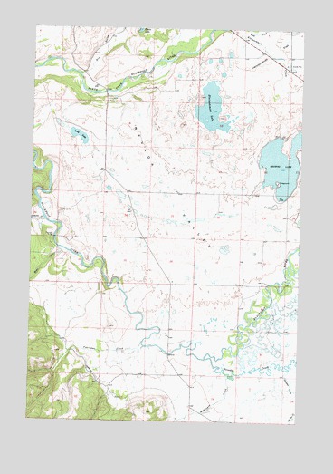
Browns Lake, MT USGS Topographic Map
Click on map above to begin viewing in our Map Viewer.

This topographic map contains these locations and features:
Feature Name Type Latitude Longitude GNIS ID View Map
13N12W12CAAA02 WellWellN46.8966°W113.0620°819239View Map
13N12W12CAAB01 WellWellN46.8966°W113.0620°819238View Map
13N12W12DCDD01 WellWellN46.8905°W113.0559°819164View Map
14N11W08ADAC01 WellWellN46.9863°W113.0081°819959View Map
14N12W22DBAD01 WellWellN46.9535°W113.0976°819642View Map
14N12W36DCCC01 WellWellN46.9197°W113.0584°819376View Map
Aunt Molly Fishing Access SiteLocaleN46.9163°W113.0123°1744397View Map
Browns LakeLakeN46.9569°W113.0103°780465View Map
Browns Lake Fishing Access SiteLocaleN46.9510°W113.0114°1744390View Map
Cedar Meadow Fishing Access SiteLocaleN46.8985°W113.0587°1744402View Map
Company DitchCanalN46.8866°W113.0895°781552View Map
Douglas CreekStreamN46.8919°W113.0051°782511View Map
Dry GulchValleyN46.9855°W113.1039°782636View Map
First Chance Creek Placer MineMineN46.9499°W113.0176°802839View Map
Frazier CreekStreamN46.9394°W113.1201°783698View Map
Harry Morgan Fishing Access SiteLocaleN46.9808°W113.0973°1744380View Map
Kleinschmidt CreekStreamN46.9999°W113.0359°785787View Map
Kleinschmidt LakeLakeN46.9747°W113.0432°785789View Map
Lake City Post Office (historical)Post OfficeN46.9513°W113.0209°1803433View Map
Long LakeLakeN46.9661°W113.1042°2760737View Map
McElwain CreekStreamN46.8891°W113.0328°787041View Map
Nevada CreekStreamN46.8947°W113.0439°801217View Map
Nevada ValleyValleyN46.9758°W113.0842°787958View Map
Raymond BridgeBridgeN46.9333°W113.1148°789422View Map
Rock CreekStreamN46.9999°W113.0367°789677View Map
Wales CreekStreamN46.9302°W113.1134°792759View Map
Ward CreekStreamN46.9666°W113.0006°792813View Map
Yourname CreekStreamN46.9002°W113.0731°793627View Map

Note: Coordinates in the location and feature list above are referenced to NAD83 datum.


Copyright (C) 2008-2025 Ryan Niemi / Sunset Dynamics ... All Rights Reserved