TopoQuest Logo
Do you find TopoQuest useful?
Help keep TopoQuest running and adding new maps/features by donating!
Bitcoin:  19c7KJd3qBynnjoSw5npx9KScwjBe4ifkT
Litecoin:  LXs6TkuXGGXo1vDsWCkWVdjQX94eUKd6ui
Home View Maps Find Maps Find Places Resources & Links


Ovando Mountain, Montana Topographic Map

USGS Map Title: Ovando Mountain, MT
USGS Map MRC: 47113A1
DRG (GeoTIFF) Download: o47113a1.tif


Neighboring USGS Topographic Map Quads:


  Dunham Point, MT  
47113B2
 

  Spread Mountain, MT  
47113B1
 

  Lake Mountain, MT  
47112B8
 

  Ovando, MT  
47113A2
 

  Ovando Mountain, MT  
47113A1
 

  Coopers Lake, MT  
47112A8
 

  Chamberlain Mountain, MT  
46113H2
 

  Browns Lake, MT  
46113H1
 

  Marcum Mountain, MT  
46112H8


Map MRC Location:

N48°
W114°
N48°
W113°
H8 H7 H6 H5 H4 H3 H2 H1
G8 G7 G6 G5 G4 G3 G2 G1
F8 F7 F6 F5 F4 F3 F2 F1
E8 E7 E6 E5 E4 E3 E2 E1
D8 D7 D6 D5 D4 D3 D2 D1
C8 C7 C6 C5 C4 C3 C2 C1
B8 B7 B6 B5 B4 B3 B2 B1
A8 A7 A6 A5 A4 A3 A2 A1
N47°
W114°
N47°
W113°

Ovando Mountain, MT USGS 1:24K Topographic Map Preview:
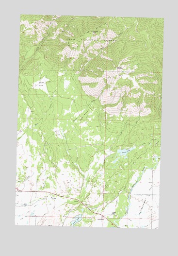
Ovando Mountain, MT USGS Topographic Map
Click on map above to begin viewing in our Map Viewer.

This topographic map contains these locations and features:
Feature Name Type Latitude Longitude GNIS ID View Map
15N11W28BBBB01 WellWellN47.0341°W113.0059°820314View Map
15N11W29BDCA01 WellWellN47.0283°W113.0209°820260View Map
15N11W31CDBA01 WellWellN47.0088°W113.0423°820121View Map
15N11W32BBAB01 WellWellN47.0197°W113.0242°820196View Map
15N12W25CADD01 WellWellN47.0238°W113.0606°820228View Map
15N12W25CDAD01 WellWellN47.0222°W113.0606°820214View Map
15N12W36BCDD01 WellWellN47.0136°W113.0659°820149View Map
15N12W36DDDA01 WellWellN47.0063°W113.0501°820103View Map
15N13W12CACA01 WellWellN47.0533°W113.0298°820428View Map
Blackfoot Clearwater Game RangeReserveN47.0830°W113.0426°798930View Map
Cedar Falls DitchCanalN47.0094°W113.1117°781107View Map
Copenhaver ParkParkN47.0133°W113.0645°781639View Map
Copenhaver Rest AreaLocaleN47.0133°W113.0645°1803451View Map
Day DitchCanalN47.0091°W113.0942°782126View Map
Doney LakeLakeN47.0452°W113.0320°782470View Map
Doney Lake Number 2 DamDamN47.0449°W113.0342°796518View Map
Doney MeadowsFlatN47.0661°W113.0678°782471View Map
East Fork McCabe CreekStreamN47.1116°W113.1028°782873View Map
Evans LakeLakeN47.0037°W113.0725°783255View Map
Evans Lake DamDamN47.0049°W113.0709°798372View Map
Flat School (historical)SchoolN47.0272°W113.0070°783506View Map
GearyPopulated PlaceN47.0313°W113.0212°798937View Map
Hoffland LateralCanalN47.0199°W113.0142°784914View Map
Jacobsen DitchCanalN47.0211°W113.0345°772783View Map
Jacobsen RanchLocaleN47.0086°W113.0412°785405View Map
Jacobsen SpringSpringN47.0053°W113.0484°772784View Map
Krutar DitchCanalN47.0027°W113.0228°785855View Map
Martin ParkFlatN47.0555°W113.0898°786895View Map
McCabe MountainSummitN47.1158°W113.0614°786988View Map
McCabe PointSummitN47.1161°W113.0617°786989View Map
Mollet ParkFlatN47.0841°W113.1056°787541View Map
Murphy DitchCanalN47.0511°W113.0120°787861View Map
Murphy RanchLocaleN47.0119°W113.1162°787870View Map
Ovando MountainSummitN47.0947°W113.0401°788529View Map
Smith CreekStreamN47.0163°W113.1081°790711View Map
Spring CreekStreamN47.0361°W113.0064°791268View Map

Note: Coordinates in the location and feature list above are referenced to NAD83 datum.


Copyright (C) 2008-2024 Ryan Niemi / Sunset Dynamics ... All Rights Reserved