TopoQuest Logo
Do you find TopoQuest useful?
Help keep TopoQuest running and adding new maps/features by donating!
Bitcoin:  19c7KJd3qBynnjoSw5npx9KScwjBe4ifkT
Litecoin:  LXs6TkuXGGXo1vDsWCkWVdjQX94eUKd6ui
Home View Maps Find Maps Find Places Resources & Links


Warren, Indiana Topographic Map

USGS Map Title: Warren, IN
USGS Map MRC: 40085F4
DRG (GeoTIFF) Download: o40085f4.tif


Neighboring USGS Topographic Map Quads:


  Andrews, IN  
40085G5
 

  Majenica, IN  
40085G4
 

  Markle, IN  
40085G3
 

  Mount Etna, IN  
40085F5
 

  Warren, IN  
40085F4
 

  Liberty Center, IN  
40085F3
 

  Van Buren, IN  
40085E5
 

  Roll, IN  
40085E4
 

  Montpelier, IN  
40085E3


Map MRC Location:

N41°
W86°
N41°
W85°
H8 H7 H6 H5 H4 H3 H2 H1
G8 G7 G6 G5 G4 G3 G2 G1
F8 F7 F6 F5 F4 F3 F2 F1
E8 E7 E6 E5 E4 E3 E2 E1
D8 D7 D6 D5 D4 D3 D2 D1
C8 C7 C6 C5 C4 C3 C2 C1
B8 B7 B6 B5 B4 B3 B2 B1
A8 A7 A6 A5 A4 A3 A2 A1
N40°
W86°
N40°
W85°

Warren, IN USGS 1:24K Topographic Map Preview:
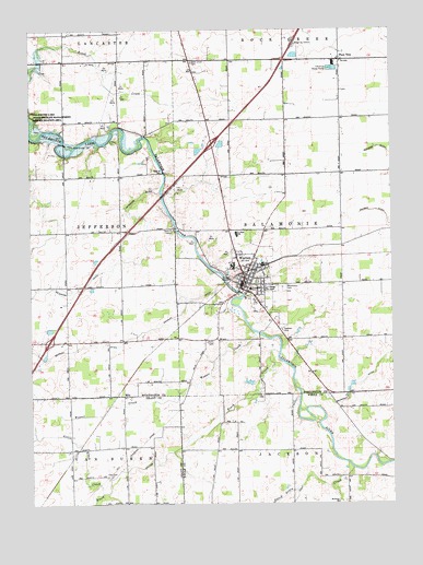
Warren, IN USGS Topographic Map
Click on map above to begin viewing in our Map Viewer.

This topographic map contains these locations and features:
Feature Name Type Latitude Longitude GNIS ID View Map
Black CreekStreamN40.6648°W85.4147°431127View Map
Corey CemeteryCemeteryN40.6322°W85.4731°433000View Map
David DrainStreamN40.6287°W85.4086°433332View Map
Detamore DitchCanalN40.6823°W85.4922°433494View Map
Little Black CreekStreamN40.6281°W85.4761°437990View Map
McNatts ChurchChurchN40.6250°W85.3944°438925View Map
MiloPopulated PlaceN40.6539°W85.4683°439253View Map
Morrison DitchCanalN40.6595°W85.3811°439459View Map
Owl CreekStreamN40.6345°W85.3889°440806View Map
Plum TreePopulated PlaceN40.7423°W85.3925°441372View Map
Red Men CemeteryCemeteryN40.6707°W85.4132°441837View Map
Salamonie SchoolSchoolN40.6814°W85.4241°447039View Map
Taylor CemeteryCemeteryN40.6976°W85.4513°444582View Map
Tower ParkParkN40.6820°W85.4164°444824View Map
Town of WarrenCivilN40.6877°W85.4248°2397723View Map
Township of SalamonieCivilN40.6981°W85.3923°453822View Map
WarrenPopulated PlaceN40.6828°W85.4272°445479View Map
Warren Police DepartmentBuildingN40.6825°W85.4267°2758176View Map
Warren Salamonie Township Volunteer Fire DepartmentBuildingN40.6908°W85.4295°2626477View Map
Wearley DitchCanalN40.6675°W85.4683°445588View Map
Weasel CreekStreamN40.6709°W85.4236°445590View Map
West Union CemeteryCemeteryN40.7416°W85.4438°445819View Map
Woodlawn CemeteryCemeteryN40.6817°W85.4127°446291View Map

Note: Coordinates in the location and feature list above are referenced to NAD83 datum.


Copyright (C) 2008-2025 Ryan Niemi / Sunset Dynamics ... All Rights Reserved