TopoQuest Logo
Do you find TopoQuest useful?
Help keep TopoQuest running and adding new maps/features by donating!
Bitcoin:  19c7KJd3qBynnjoSw5npx9KScwjBe4ifkT
Litecoin:  LXs6TkuXGGXo1vDsWCkWVdjQX94eUKd6ui
Home View Maps Find Maps Find Places Resources & Links


Cornplanter Run, Pennsylvania Topographic Map

USGS Map Title: Cornplanter Run, PA
USGS Map MRC: 41078H8
DRG (GeoTIFF) Download: o41078h8.tif


Neighboring USGS Topographic Map Quads:


  Ivory, NY  
42079A1
 

  Steamburg, NY  
42078A8
 

  Red House, NY  
42078A7
 

  Scandia, PA  
41079H1
 

  Cornplanter Run, PA  
41078H8
 

  Stickney, PA  
41078H7
 

  Clarendon, PA  
41079G1
 

  Cornplanter Bridge, PA  
41078G8
 

  Westline, PA  
41078G7


Map MRC Location:

N42°
W79°
N42°
W78°
H8 H7 H6 H5 H4 H3 H2 H1
G8 G7 G6 G5 G4 G3 G2 G1
F8 F7 F6 F5 F4 F3 F2 F1
E8 E7 E6 E5 E4 E3 E2 E1
D8 D7 D6 D5 D4 D3 D2 D1
C8 C7 C6 C5 C4 C3 C2 C1
B8 B7 B6 B5 B4 B3 B2 B1
A8 A7 A6 A5 A4 A3 A2 A1
N41°
W79°
N41°
W78°

Cornplanter Run, PA USGS 1:24K Topographic Map Preview:
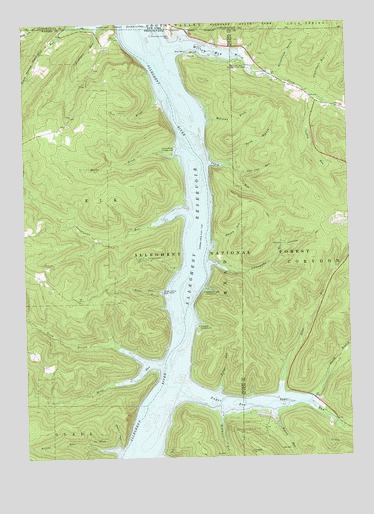
Cornplanter Run, PA USGS Topographic Map
Click on map above to begin viewing in our Map Viewer.

This topographic map contains these locations and features:
Feature Name Type Latitude Longitude GNIS ID View Map
Allegheny ReservoirReservoirN41.9527°W78.9285°1217454View Map
Billies RunStreamN41.8770°W78.9642°1209425View Map
Brothwell RunStreamN41.8873°W78.9242°1209447View Map
Camp OlmstedLocaleN41.9323°W78.9523°1209474View Map
Carr BrookStreamN41.9773°W78.9462°1209483View Map
Coffey RunStreamN41.9792°W78.8878°1209519View Map
Cornplanter (historical)Populated PlaceN41.9417°W78.9331°1210342View Map
Cornplanter Indian Reservation (historical)AreaN41.9451°W78.9348°1210341View Map
Cornplanter RunStreamN41.9456°W78.9367°1210158View Map
Corydon (historical)Populated PlaceN41.9878°W78.9803°1210340View Map
Deer Lick RunStreamN41.9562°W78.9161°1209554View Map
Fishburn RunStreamN41.9987°W78.9700°1209600View Map
Gowango (historical)Populated PlaceN41.9323°W78.9292°1210343View Map
Handsome Lake CampgroundLocaleN41.9226°W78.9300°1209658View Map
Hodge RunStreamN41.9023°W78.9475°1209674View Map
Hooks BrookStreamN41.9620°W78.9403°1210181View Map
Hooks Brook CampgroundLocaleN41.9626°W78.9414°1209679View Map
Hopewell CampgroundLocaleN41.9126°W78.9323°1209681View Map
Johnnycake RunStreamN41.9306°W78.9264°1209709View Map
Johnnycake TrailTrailN41.9378°W78.8906°1209710View Map
Land of Many USES Interpretive TrailTrailN41.9376°W78.8753°1210466View Map
Nelse RunStreamN41.8937°W78.9014°1209852View Map
North Branch Hodge RunStreamN41.9028°W78.9531°1209858View Map
North Branch Sugar RunStreamN41.8917°W78.8886°1209859View Map
North Branch Tracy RunStreamN41.9601°W78.9209°1209860View Map
Olmstead (historical)Populated PlaceN41.9281°W78.9492°1210345View Map
Pennsylvania TrailTrailN41.9467°W78.9089°1210420View Map
Pigeon RunStreamN41.8881°W78.9039°1209887View Map
Pollys RunStreamN41.8939°W78.9253°1209899View Map
Reservation Island (historical)IslandN41.9251°W78.9345°1210344View Map
Riverview - Corydon CemeteryCemeteryN41.9965°W78.9415°1210422View Map
Roper HollowValleyN41.9230°W78.9468°1209942View Map
Roper Hollow Boat RampLocaleN41.9223°W78.9461°1213349View Map
Roper Hollow Recreation AreaAreaN41.9231°W78.9825°1212129View Map
Schoolhouse HollowValleyN41.9845°W78.9021°964610View Map
South Branch State Line RunStreamN41.9998°W78.9790°965706View Map
Sugar BayBayN41.8906°W78.9209°1210022View Map
Sugar RunStreamN41.8942°W78.9400°1210218View Map
Sugar Run (historical)Populated PlaceN41.8967°W78.9436°1210346View Map
Tinkertown RunStreamN41.9792°W78.8875°1210044View Map
Township of ElkCivilN41.9443°W78.9959°1217163View Map
Tracy Ridge CampgroundLocaleN41.9431°W78.8775°1210467View Map
Tracy RunStreamN41.9598°W78.9270°1210055View Map
Webbs Ferry Boat AccessLocaleN41.9962°W78.9625°1210421View Map
Webbs Ferry Recreation AreaAreaN41.9964°W78.9628°1212128View Map
Weed HollowValleyN41.8785°W78.9648°1210092View Map
Whisky RunStreamN41.9367°W78.9253°1210108View Map
Williams BrookStreamN41.9720°W78.9275°1210119View Map
Willow BayBayN41.9920°W78.9256°1210121View Map
Willow Bay Recreation AreaParkN41.9726°W78.9175°1210413View Map
Willow CreekStreamN41.9934°W78.9389°1210122View Map

Note: Coordinates in the location and feature list above are referenced to NAD83 datum.


Copyright (C) 2008-2025 Ryan Niemi / Sunset Dynamics ... All Rights Reserved