TopoQuest Logo
Do you find TopoQuest useful?
Help keep TopoQuest running and adding new maps/features by donating!
Bitcoin:  19c7KJd3qBynnjoSw5npx9KScwjBe4ifkT
Litecoin:  LXs6TkuXGGXo1vDsWCkWVdjQX94eUKd6ui
Home View Maps Find Maps Find Places Resources & Links


Cottonport, Louisiana Topographic Map

USGS Map Title: Cottonport, LA
USGS Map MRC: 30092H1
DRG (GeoTIFF) Download: o30092h1.tif


Neighboring USGS Topographic Map Quads:


  Belle d'Eau, LA  
31092A2
 

  Marksville South, LA  
31092A1
 

  Moreauville, LA  
31091A8
 

  Bunkie, LA  
30092H2
 

  Cottonport, LA  
30092H1
 

  Plaucheville, LA  
30091H8
 

  Whiteville, LA  
30092G2
 

  Morrow, LA  
30092G1
 

  Bayou Jack, LA  
30091G8


Map MRC Location:

N31°
W93°
N31°
W92°
H8 H7 H6 H5 H4 H3 H2 H1
G8 G7 G6 G5 G4 G3 G2 G1
F8 F7 F6 F5 F4 F3 F2 F1
E8 E7 E6 E5 E4 E3 E2 E1
D8 D7 D6 D5 D4 D3 D2 D1
C8 C7 C6 C5 C4 C3 C2 C1
B8 B7 B6 B5 B4 B3 B2 B1
A8 A7 A6 A5 A4 A3 A2 A1
N30°
W93°
N30°
W92°

Cottonport, LA USGS 1:24K Topographic Map Preview:
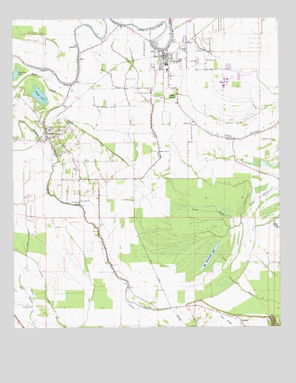
Cottonport, LA USGS Topographic Map
Click on map above to begin viewing in our Map Viewer.

This topographic map contains these locations and features:
Feature Name Type Latitude Longitude GNIS ID View Map
Avoyelles Correctional Center Special Services District FacilitySchoolN30.9728°W92.0257°2462936View Map
Avoyelles Parish Women's Correctional CenterBuildingN30.9755°W92.0509°2739780View Map
Bayou BruceStreamN30.9091°W92.0185°532472View Map
Bayou HuffpowerStreamN30.9521°W92.1090°553470View Map
Big Buttonwood LakeLakeN30.9032°W92.0333°553634View Map
Big Cane Gas FieldOilfieldN30.8996°W92.0596°545487View Map
Boggy LakeLakeN30.9701°W92.1129°553741View Map
Central Louisiana Technical Community College Cottonport CampusSchoolN30.9796°W92.0525°2462940View Map
Coco CanalCanalN30.9627°W92.0701°534020View Map
CottonportPopulated PlaceN30.9841°W92.0535°554097View Map
Cottonport Elementary SchoolSchoolN30.9816°W92.0530°545499View Map
Cottonport High School (historical)SchoolN30.9796°W92.0526°545500View Map
Cottonport Police DepartmentBuildingN30.9856°W92.0533°2755243View Map
Cottonport Post OfficePost OfficeN30.9841°W92.0524°1630198View Map
Cottonport Volunteer Fire and RescueBuildingN30.9846°W92.0517°2672952View Map
Deats (historical)Populated PlaceN30.9660°W92.0971°545504View Map
Dora (historical)Populated PlaceN30.9794°W92.0787°545505View Map
Dry Bayou ChurchChurchN30.8844°W92.1165°534594View Map
EnterprisePopulated PlaceN30.9749°W92.0954°549600View Map
EvergreenPopulated PlaceN30.9527°W92.1087°543192View Map
Evergreen High School (historical)SchoolN30.9555°W92.1076°545508View Map
Evergreen Post OfficePost OfficeN30.9523°W92.1083°1630203View Map
Evergreen Volunteer Fire DepartmentBuildingN30.9544°W92.1104°2672820View Map
First Evening Star Baptist ChurchChurchN30.9920°W92.0441°2601957View Map
Golden Chain ChurchChurchN30.9469°W92.0562°535260View Map
Goudeau Volunteer Fire DepartmentBuildingN30.8785°W92.0198°2673071View Map
HickoryPopulated PlaceN30.9516°W92.0210°543291View Map
Indian BayouStreamN30.9171°W92.0185°535902View Map
Jerusalem ChurchChurchN30.9891°W92.0940°536029View Map
Jews-harp LakeLakeN30.9784°W92.1241°554879View Map
KaroPopulated PlaceN30.9838°W92.0937°543350View Map
KRBG-FM (Bunkie)TowerN30.9791°W92.1207°1632432View Map
Magnolia ChurchChurchN30.9585°W92.1110°536838View Map
Max AirportAirportN30.9938°W92.0487°2676790View Map
Morning Star ChurchChurchN30.9513°W92.0037°537223View Map
New Light ChurchChurchN30.9271°W92.0926°537597View Map
Old Zion ChurchChurchN30.9874°W92.0351°555558View Map
Parish Governing Authority District 11 (historical)CivilN30.9199°W92.0037°1929798View Map
Raymond Laborde Correctional CenterBuildingN30.9742°W92.0272°2739774View Map
Saint Anthony CemeteryCemeteryN30.9838°W92.0340°538802View Map
Saint Anthony SchoolSchoolN30.9874°W92.0435°555880View Map
Saint Johns ChurchChurchN30.9260°W92.0943°538893View Map
Saint Mary's Assumption SchoolSchoolN30.9867°W92.0553°545576View Map
Saint Marys Catholic ChurchChurchN30.9870°W92.0555°2602712View Map
Town of CottonportCivilN30.9892°W92.0510°2406320View Map
Town of EvergreenCivilN30.9528°W92.1052°2406474View Map
Ward NineCivilN30.9644°W92.0785°544918View Map

Note: Coordinates in the location and feature list above are referenced to NAD83 datum.


Copyright (C) 2008-2025 Ryan Niemi / Sunset Dynamics ... All Rights Reserved