TopoQuest Logo
Do you find TopoQuest useful?
Help keep TopoQuest running and adding new maps/features by donating!
Bitcoin:  19c7KJd3qBynnjoSw5npx9KScwjBe4ifkT
Litecoin:  LXs6TkuXGGXo1vDsWCkWVdjQX94eUKd6ui
Home View Maps Find Maps Find Places Resources & Links


Mud Spring, Oregon Topographic Map

USGS Map Title: Mud Spring, OR
USGS Map MRC: 44119B7
DRG (GeoTIFF) Download: o44119b7.tif


Neighboring USGS Topographic Map Quads:


  Little Summit Prairie, OR  
44119C8
 

  Six Corners, OR  
44119C7
 

  Wolf Mountain, OR  
44119C6
 

  Paulina, OR  
44119B8
 

  Mud Spring, OR  
44119B7
 

  Powell Mountain, OR  
44119B6
 

  Maupin Butte, OR  
44119A8
 

  Angell Butte, OR  
44119A7
 

  Suplee, OR  
44119A6


Map MRC Location:

N45°
W120°
N45°
W119°
H8 H7 H6 H5 H4 H3 H2 H1
G8 G7 G6 G5 G4 G3 G2 G1
F8 F7 F6 F5 F4 F3 F2 F1
E8 E7 E6 E5 E4 E3 E2 E1
D8 D7 D6 D5 D4 D3 D2 D1
C8 C7 C6 C5 C4 C3 C2 C1
B8 B7 B6 B5 B4 B3 B2 B1
A8 A7 A6 A5 A4 A3 A2 A1
N44°
W120°
N44°
W119°

Mud Spring, OR USGS 1:24K Topographic Map Preview:
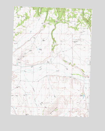
Mud Spring, OR USGS Topographic Map
Click on map above to begin viewing in our Map Viewer.

This topographic map contains these locations and features:
Feature Name Type Latitude Longitude GNIS ID View Map
Allyn DrawValleyN44.1401°W119.8316°1157598View Map
Beaver Creek CemeteryCemeteryN44.1846°W119.8344°1153108View Map
Cordella RimCliffN44.1860°W119.7816°1157602View Map
Dahlgren RimCliffN44.1735°W119.7508°1157563View Map
Durgan RanchLocaleN44.2068°W119.8686°1157592View Map
Dutchman FlatFlatN44.2332°W119.7789°1141442View Map
Elkins ButteSummitN44.1396°W119.8233°1157597View Map
Grindstone CreekStreamN44.1754°W119.8572°1143093View Map
Juniper Basin SpringSpringN44.2478°W119.7814°1153826View Map
Laughlin RanchLocaleN44.1865°W119.8169°1157599View Map
Laughlin TableSummitN44.2053°W119.7613°1157564View Map
Lister RanchLocaleN44.1818°W119.8428°1157600View Map
Logan RidgeRidgeN44.2388°W119.8636°1157593View Map
Marshy ReservoirReservoirN44.2017°W119.8336°1157595View Map
Miles CreekStreamN44.2290°W119.8378°1146205View Map
Miller RanchLocaleN44.2310°W119.8280°1156293View Map
Miller RanchLocaleN44.2318°W119.8289°1157591View Map
Mud SpringSpringN44.1481°W119.8065°1157596View Map
Mud Spring ButteSummitN44.1457°W119.7779°1146607View Map
Myers RanchLocaleN44.1804°W119.7878°1157601View Map
Noble WellWellN44.1705°W119.7818°1157603View Map
North Fork Beaver CreekStreamN44.1724°W119.7628°1146905View Map
Palmer DamDamN44.1503°W119.7579°1155636View Map
Palmer ReservoirReservoirN44.1488°W119.7590°1157604View Map
Powell Valley ButteSummitN44.2054°W119.7608°1158593View Map
Puett Ranch (historical)LocaleN44.1654°W119.7580°1156292View Map
Rager Airstrip (historical)AirportN44.2221°W119.7678°1157589View Map
Rattlesnake ButteSummitN44.2115°W119.7780°1157590View Map
Salem RidgeRidgeN44.1468°W119.8650°1157558View Map
South Fork Beaver CreekStreamN44.1724°W119.7628°1149929View Map
Sugar CreekStreamN44.1801°W119.8166°1150531View Map
Sugar Creek Recreation SiteLocaleN44.2338°W119.8055°1156294View Map
Sugar Creek SpringSpringN44.2465°W119.8109°1156298View Map
United States Forest Service Rager Ranger StationBuildingN44.2293°W119.8263°2577057View Map
Widow SpringSpringN44.2490°W119.8646°1157594View Map

Note: Coordinates in the location and feature list above are referenced to NAD83 datum.


Copyright (C) 2008-2025 Ryan Niemi / Sunset Dynamics ... All Rights Reserved