TopoQuest Logo
Do you find TopoQuest useful?
Help keep TopoQuest running and adding new maps/features by donating!
Bitcoin:  19c7KJd3qBynnjoSw5npx9KScwjBe4ifkT
Litecoin:  LXs6TkuXGGXo1vDsWCkWVdjQX94eUKd6ui
Home View Maps Find Maps Find Places Resources & Links


Coudersport, Pennsylvania Topographic Map

USGS Map Title: Coudersport, PA
USGS Map MRC: 41078G1
DRG (GeoTIFF) Download: o41078g1.tif


Neighboring USGS Topographic Map Quads:


  Shinglehouse, PA  
41078H2
 

  Oswayo, PA  
41078H1
 

  Ellisburg, PA  
41077H8
 

  Roulette, PA  
41078G2
 

  Coudersport, PA  
41078G1
 

  Sweden Valley, PA  
41077G8
 

  Keating Summit, PA  
41078F2
 

  Austin, PA  
41078F1
 

  Ayers Hill, PA  
41077F8


Map MRC Location:

N42°
W79°
N42°
W78°
H8 H7 H6 H5 H4 H3 H2 H1
G8 G7 G6 G5 G4 G3 G2 G1
F8 F7 F6 F5 F4 F3 F2 F1
E8 E7 E6 E5 E4 E3 E2 E1
D8 D7 D6 D5 D4 D3 D2 D1
C8 C7 C6 C5 C4 C3 C2 C1
B8 B7 B6 B5 B4 B3 B2 B1
A8 A7 A6 A5 A4 A3 A2 A1
N41°
W79°
N41°
W78°

Coudersport, PA USGS 1:24K Topographic Map Preview:
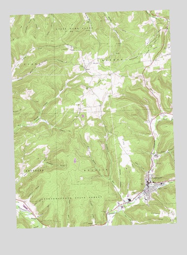
Coudersport, PA USGS Topographic Map
Click on map above to begin viewing in our Map Viewer.

This topographic map contains these locations and features:
Feature Name Type Latitude Longitude GNIS ID View Map
Baker CreekStreamN41.8101°W78.0008°1168596View Map
Borough of CoudersportCivilN41.7758°W78.0160°1215537View Map
CoudersportPopulated PlaceN41.7748°W78.0206°1172494View Map
Coudersport and Port Allegheny Railroad Historic SiteLocaleN41.7676°W78.0256°1212756View Map
Coudersport Area Elementary SchoolSchoolN41.7734°W78.0219°1211699View Map
Coudersport Area Junior Senior High SchoolSchoolN41.7734°W78.0103°1211700View Map
Coudersport Borough Police DepartmentBuildingN41.7706°W78.0223°2776984View Map
Coudersport Court House Historic SiteLocaleN41.7745°W78.0203°1212746View Map
Coudersport Post OfficePost OfficeN41.7757°W78.0212°2772650View Map
Coudersport Volunteer Ambulance AssociationBuildingN41.7742°W78.0166°2719636View Map
Coudersport Volunteer Fire DepartmentBuildingN41.7691°W78.0258°2645488View Map
Crandal HillSummitN41.8537°W78.0747°1172637View Map
Dingman RunStreamN41.7631°W78.0378°1173287View Map
Dingman Run SchoolSchoolN41.8045°W78.0506°1206482View Map
Dutchman HillSummitN41.7553°W78.0014°1173663View Map
Earl HollowValleyN41.7580°W78.0421°1173708View Map
Eulalia CemeteryCemeteryN41.7684°W78.0297°1174335View Map
Greenman HillSummitN41.8492°W78.0197°1192555View Map
Greenman Hill School (historical)SchoolN41.8628°W78.0133°1211701View Map
HebronPopulated PlaceN41.8420°W78.0667°1203769View Map
Hogpen HollowValleyN41.8074°W78.0887°1177183View Map
Kavanaugh HollowValleyN41.7882°W78.1021°1178258View Map
Knowlton HollowValleyN41.7659°W78.1164°1178619View Map
LamontLocaleN41.8459°W78.0147°1206830View Map
Mill CreekStreamN41.7728°W78.0181°1181149View Map
Mountain Springs HeliportAirportN41.7701°W78.0108°1213808View Map
Negro HillSummitN41.8587°W78.0858°1201691View Map
Niles HillSummitN41.8017°W78.0408°1193026View Map
Niles HollowValleyN41.7808°W78.0212°1182456View Map
OlmstedPopulated PlaceN41.7506°W78.0656°1204329View Map
Potter County Sheriff's OfficeBuildingN41.7748°W78.0204°2777008View Map
Reed RunStreamN41.7512°W78.1075°1184823View Map
Reese HollowValleyN41.7899°W78.0131°1184848View Map
Saint Eulalias CemeteryCemeteryN41.7584°W78.0536°1185932View Map
Sherwood RunStreamN41.7556°W78.1089°1187501View Map
Smith HollowValleyN41.7627°W78.1125°1187878View Map
Sperl HollowValleyN41.8744°W78.1059°1188167View Map
State Game Lands Number 204ParkN41.8667°W78.0831°1208077View Map
Steer RunStreamN41.8073°W78.0139°1188593View Map
Toles HollowValleyN41.7520°W78.0322°1189625View Map
Township of ClaraCivilN41.8659°W78.1193°1216970View Map
Township of EulaliaCivilN41.7767°W78.0602°1216971View Map
Township of HebronCivilN41.8650°W78.0270°1216974View Map
West Branch Dingman RunStreamN41.7778°W78.0508°1190902View Map
WFRM-AM (Coudersport)TowerN41.7531°W78.0006°1200513View Map
White HollowValleyN41.8368°W78.1245°1191280View Map

Note: Coordinates in the location and feature list above are referenced to NAD83 datum.


Copyright (C) 2008-2025 Ryan Niemi / Sunset Dynamics ... All Rights Reserved