TopoQuest Logo
Do you find TopoQuest useful?
Help keep TopoQuest running and adding new maps/features by donating!
Bitcoin:  19c7KJd3qBynnjoSw5npx9KScwjBe4ifkT
Litecoin:  LXs6TkuXGGXo1vDsWCkWVdjQX94eUKd6ui
Home View Maps Find Maps Find Places Resources & Links


Shinglehouse, Pennsylvania Topographic Map

USGS Map Title: Shinglehouse, PA
USGS Map MRC: 41078H2
DRG (GeoTIFF) Download: o41078h2.tif


Neighboring USGS Topographic Map Quads:


  Portville, NY  
42078A3
 

  Bolivar, NY  
42078A2
 

  Allentown, NY  
42078A1
 

  Bullis Mills, PA  
41078H3
 

  Shinglehouse, PA  
41078H2
 

  Oswayo, PA  
41078H1
 

  Port Allegany, PA  
41078G3
 

  Roulette, PA  
41078G2
 

  Coudersport, PA  
41078G1


Map MRC Location:

N42°
W79°
N42°
W78°
H8 H7 H6 H5 H4 H3 H2 H1
G8 G7 G6 G5 G4 G3 G2 G1
F8 F7 F6 F5 F4 F3 F2 F1
E8 E7 E6 E5 E4 E3 E2 E1
D8 D7 D6 D5 D4 D3 D2 D1
C8 C7 C6 C5 C4 C3 C2 C1
B8 B7 B6 B5 B4 B3 B2 B1
A8 A7 A6 A5 A4 A3 A2 A1
N41°
W79°
N41°
W78°

Shinglehouse, PA USGS 1:24K Topographic Map Preview:
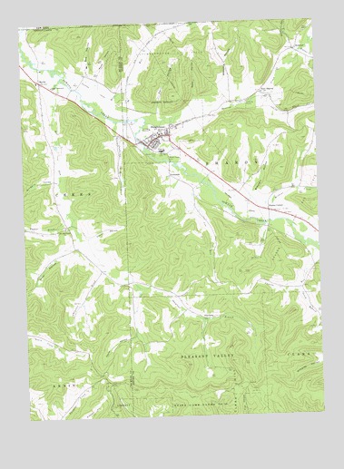
Shinglehouse, PA USGS Topographic Map
Click on map above to begin viewing in our Map Viewer.

This topographic map contains these locations and features:
Feature Name Type Latitude Longitude GNIS ID View Map
Bee HollowValleyN41.9837°W78.2219°943495View Map
Bell RunStreamN41.9817°W78.2331°1169153View Map
Bell Run SchoolSchoolN41.9365°W78.2297°1206501View Map
Bell Run Union ChurchChurchN41.9351°W78.2320°1169155View Map
Blauvelt HollowValleyN41.9464°W78.1516°1169814View Map
Borough of ShinglehouseCivilN41.9662°W78.1908°1215541View Map
Butter CreekStreamN41.9903°W78.1306°1170809View Map
Chapman BrookStreamN41.9217°W78.2156°1171570View Map
Church HollowValleyN41.9317°W78.2228°1171858View Map
Coon HollowValleyN41.9276°W78.2340°1172408View Map
Cow RunStreamN41.9484°W78.1731°1172545View Map
Cow Run SchoolSchoolN41.9390°W78.1720°1206496View Map
Doyle HollowValleyN41.9005°W78.2031°1173437View Map
East SharonPopulated PlaceN41.9778°W78.1478°1203483View Map
Gospel Tabernacle ChurchChurchN41.9801°W78.2367°1175852View Map
HoneoyePopulated PlaceN41.9909°W78.1331°1177339View Map
Honeoye CreekStreamN41.9684°W78.1961°953133View Map
Horse RunStreamN41.9776°W78.2239°953229View Map
Horse Run SchoolSchoolN41.9937°W78.1942°1206495View Map
Janders RunStreamN41.9687°W78.2042°1177989View Map
Karr HollowValleyN41.9714°W78.1918°1178238View Map
Maple Grove CemeteryCemeteryN41.9582°W78.1874°1180329View Map
Maple Grove CemeteryCemeteryN41.9590°W78.1930°1180330View Map
MyrtlePopulated PlaceN41.9817°W78.2417°1182144View Map
Oswayo Valley Elementary SchoolSchoolN41.9623°W78.1861°1211748View Map
Oswayo Valley High SchoolSchoolN41.9592°W78.1908°1211706View Map
Plank CreekStreamN41.9759°W78.1483°1193141View Map
Raub HollowValleyN41.9830°W78.2175°1184695View Map
Scott HollowValleyN41.9928°W78.1349°964679View Map
Seely HollowValleyN41.9766°W78.1759°1187222View Map
Sharon CenterPopulated PlaceN41.9403°W78.1456°1187370View Map
ShaytownPopulated PlaceN41.9062°W78.1725°1204631View Map
Shaytown BranchStreamN41.9173°W78.2022°1187414View Map
ShinglehousePopulated PlaceN41.9637°W78.1908°1187543View Map
Shinglehouse Volunteer Ambulance AssociationBuildingN41.9632°W78.1901°2719639View Map
Shinglehouse Volunteer Fire DepartmentBuildingN41.9631°W78.1914°2645484View Map
Shinglhouse Post OfficePost OfficeN41.9631°W78.1939°2779921View Map
South Branch Canada RunStreamN41.9165°W78.1331°1188019View Map
SunnysidePopulated PlaceN41.9515°W78.1861°1204776View Map
Taylor BrookStreamN41.9401°W78.2308°1189298View Map
Township of SharonCivilN41.9561°W78.1453°1216983View Map
Wapsena HollowValleyN41.9803°W78.1612°1190581View Map
Wildcat CreekStreamN41.9370°W78.1500°1191401View Map
Wingard HollowValleyN41.9509°W78.2373°1191595View Map

Note: Coordinates in the location and feature list above are referenced to NAD83 datum.


Copyright (C) 2008-2024 Ryan Niemi / Sunset Dynamics ... All Rights Reserved