TopoQuest Logo
Do you find TopoQuest useful?
Help keep TopoQuest running and adding new maps/features by donating!
Bitcoin:  19c7KJd3qBynnjoSw5npx9KScwjBe4ifkT
Litecoin:  LXs6TkuXGGXo1vDsWCkWVdjQX94eUKd6ui
Home View Maps Find Maps Find Places Resources & Links


Council, North Carolina Topographic Map

USGS Map Title: Council, NC
USGS Map MRC: 34078D4
DRG (GeoTIFF) Download: o34078d4.tif


Neighboring USGS Topographic Map Quads:


  Elizabethtown South, NC  
34078E5
 

  Singletary Lake, NC  
34078E4
 

  Rowan, NC  
34078E3
 

  Emerson, NC  
34078D5
 

  Council, NC  
34078D4
 

  Kelly, NC  
34078D3
 

  Lake Waccamaw West, NC  
34078C5
 

  Lake Waccamaw East, NC  
34078C4
 

  Freeman, NC  
34078C3


Map MRC Location:

N35°
W79°
N35°
W78°
H8 H7 H6 H5 H4 H3 H2 H1
G8 G7 G6 G5 G4 G3 G2 G1
F8 F7 F6 F5 F4 F3 F2 F1
E8 E7 E6 E5 E4 E3 E2 E1
D8 D7 D6 D5 D4 D3 D2 D1
C8 C7 C6 C5 C4 C3 C2 C1
B8 B7 B6 B5 B4 B3 B2 B1
A8 A7 A6 A5 A4 A3 A2 A1
N34°
W79°
N34°
W78°

Council, NC USGS 1:24K Topographic Map Preview:
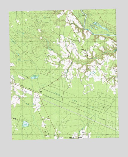
Council, NC USGS Topographic Map
Click on map above to begin viewing in our Map Viewer.

This topographic map contains these locations and features:
Feature Name Type Latitude Longitude GNIS ID View Map
Ashwood ChurchChurchN34.4554°W78.4086°980344View Map
BaltimorePopulated PlaceN34.4366°W78.4403°980508View Map
Boggy BranchStreamN34.4093°W78.4783°981682View Map
CarversPopulated PlaceN34.4610°W78.4136°1006156View Map
Carvers Creek ChurchChurchN34.4554°W78.4081°1004149View Map
Carvers Creek Volunteer Fire DepartmentBuildingN34.4397°W78.4377°2638657View Map
CouncilPopulated PlaceN34.4210°W78.4675°983601View Map
Council Mill Pond DamDamN34.4352°W78.4747°998090View Map
Council MillpondReservoirN34.4354°W78.4720°1025257View Map
Council Post OfficePost OfficeN34.4196°W78.4686°2774331View Map
Deepwater PointCapeN34.4941°W78.4108°984108View Map
Dismal BaySwampN34.4938°W78.4595°984201View Map
Dodds MillpondReservoirN34.4518°W78.4050°984245View Map
Donoho CreekStreamN34.4810°W78.4133°984268View Map
Drunken RunStreamN34.4838°W78.4139°1025290View Map
Gilliam LakeReservoirN34.4868°W78.4281°998095View Map
Gilliam Lake DamDamN34.4868°W78.4281°998096View Map
Horseshoe BaySwampN34.4971°W78.4800°987142View Map
Juniper BaySwampN34.4818°W78.4856°987830View Map
Keeter BaySwampN34.3829°W78.3772°987884View Map
Kitchens BranchStreamN34.4504°W78.4261°1025456View Map
Lighthouse ChurchChurchN34.4093°W78.4633°1004150View Map
Long BaySwampN34.3782°W78.3939°988882View Map
McEwen CemeteryCemeteryN34.3788°W78.4586°989569View Map
Meares MillpondReservoirN34.3907°W78.4834°989692View Map
Plummers Run BaySwampN34.4163°W78.3844°992599View Map
Red HillPopulated PlaceN34.4699°W78.4306°1025639View Map
Red Hill BranchStreamN34.4541°W78.4306°993108View Map
Rhodes BaySwampN34.4235°W78.3914°993262View Map
Sasspan BaySwampN34.3974°W78.4486°994361View Map
Seven Mile BayFlatN34.4102°W78.4242°1025690View Map
Township of Carvers CreekCivilN34.4284°W78.4072°1026425View Map
Webb BaySwampN34.3807°W78.4875°996910View Map
WestbrookPopulated PlaceN34.4754°W78.4225°1006405View Map
Wolf BaySwampN34.4679°W78.4742°997517View Map
Zion ChurchChurchN34.4604°W78.4069°1004148View Map

Note: Coordinates in the location and feature list above are referenced to NAD83 datum.


Copyright (C) 2008-2025 Ryan Niemi / Sunset Dynamics ... All Rights Reserved