TopoQuest Logo
Do you find TopoQuest useful?
Help keep TopoQuest running and adding new maps/features by donating!
Bitcoin:  19c7KJd3qBynnjoSw5npx9KScwjBe4ifkT
Litecoin:  LXs6TkuXGGXo1vDsWCkWVdjQX94eUKd6ui
Home View Maps Find Maps Find Places Resources & Links


Emerson, North Carolina Topographic Map

USGS Map Title: Emerson, NC
USGS Map MRC: 34078D5
DRG (GeoTIFF) Download: o34078d5.tif


Neighboring USGS Topographic Map Quads:


  Abbottsburg, NC  
34078E6
 

  Elizabethtown South, NC  
34078E5
 

  Singletary Lake, NC  
34078E4
 

  Clarkton, NC  
34078D6
 

  Emerson, NC  
34078D5
 

  Council, NC  
34078D4
 

  Whiteville, NC  
34078C6
 

  Lake Waccamaw West, NC  
34078C5
 

  Lake Waccamaw East, NC  
34078C4


Map MRC Location:

N35°
W79°
N35°
W78°
H8 H7 H6 H5 H4 H3 H2 H1
G8 G7 G6 G5 G4 G3 G2 G1
F8 F7 F6 F5 F4 F3 F2 F1
E8 E7 E6 E5 E4 E3 E2 E1
D8 D7 D6 D5 D4 D3 D2 D1
C8 C7 C6 C5 C4 C3 C2 C1
B8 B7 B6 B5 B4 B3 B2 B1
A8 A7 A6 A5 A4 A3 A2 A1
N34°
W79°
N34°
W78°

Emerson, NC USGS 1:24K Topographic Map Preview:
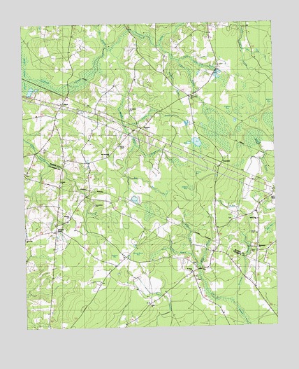
Emerson, NC USGS Topographic Map
Click on map above to begin viewing in our Map Viewer.

This topographic map contains these locations and features:
Feature Name Type Latitude Longitude GNIS ID View Map
Bear PondSwampN34.4210°W78.5611°980731View Map
Bee Tree BranchStreamN34.4877°W78.5081°980892View Map
Benson BranchStreamN34.4585°W78.5683°981006View Map
Benson IsletIslandN34.4588°W78.5325°981012View Map
Big BaySwampN34.4132°W78.5014°981306View Map
Blank CemeteryCemeteryN34.4138°W78.5125°1025167View Map
Box BranchStreamN34.4371°W78.5731°981779View Map
Buie CemeteryCemeteryN34.4057°W78.5117°982190View Map
Central ChurchChurchN34.4354°W78.6064°982953View Map
Chancy BaySwampN34.4343°W78.5411°982998View Map
Clark MillpondReservoirN34.4511°W78.5383°1025245View Map
Cypress BaySwampN34.4632°W78.5181°983869View Map
Dam BranchStreamN34.4235°W78.5186°983921View Map
Drinking PondSwampN34.4299°W78.5400°984331View Map
Eastern Prong Middle SwampStreamN34.4504°W78.5686°1025300View Map
Elkins FieldAirportN34.4621°W78.6187°2679139View Map
ElktonPopulated PlaceN34.4668°W78.6053°1006197View Map
Elkton ChurchChurchN34.4624°W78.6078°984716View Map
EmersonPopulated PlaceN34.4579°W78.5664°1006336View Map
Farmers UnionPopulated PlaceN34.4152°W78.6092°1004489View Map
Hasket BaySwampN34.4288°W78.5461°986483View Map
Holy Cross CemeteryCemeteryN34.4077°W78.5092°1004490View Map
Horseshoe SwampStreamN34.4993°W78.5692°1025407View Map
Little Horseshoe BaySwampN34.4749°W78.5014°988665View Map
Little Pine Log SwampStreamN34.4849°W78.5467°1025480View Map
Meares BaySwampN34.4324°W78.5364°989689View Map
Middle SwampStreamN34.4893°W78.5806°1025520View Map
Mill BranchStreamN34.4913°W78.5828°989882View Map
Mitchellfield CemeteryCemeteryN34.4254°W78.5900°990102View Map
New Jerusalem ChurchChurchN34.4463°W78.5817°1004487View Map
Old Bethel CemeteryCemeteryN34.4649°W78.5720°991530View Map
Philadelphia ChurchChurchN34.4074°W78.5086°1004491View Map
Pierces ChapelChurchN34.4502°W78.5764°992176View Map
Pine Log SwampStreamN34.4913°W78.5556°1025611View Map
Porterville SchoolSchoolN34.4499°W78.5767°1023577View Map
Reedy BranchStreamN34.3988°W78.5378°1025641View Map
Rehoboth ChurchChurchN34.4210°W78.6022°1004488View Map
Richlands BranchStreamN34.3838°W78.5200°993324View Map
RicoPopulated PlaceN34.4388°W78.6239°993331View Map
RosindalePopulated PlaceN34.4410°W78.5270°1006356View Map
Saint James ChurchChurchN34.3979°W78.5417°993900View Map
Saint James Volunteer Fire DepartmentBuildingN34.3974°W78.5427°2638615View Map
Sandy Plain ChurchChurchN34.4118°W78.6245°1025679View Map
Sawhorn BaySwampN34.4060°W78.5797°994389View Map
Shady Grove ChurchChurchN34.4196°W78.5089°994536View Map
Shipman BranchStreamN34.4854°W78.5500°1025696View Map
Slap BranchStreamN34.4043°W78.5411°994902View Map
Township of Whites CreekCivilN34.4841°W78.5270°1026435View Map
Union ChurchChurchN34.3843°W78.5631°996445View Map
Ward BranchStreamN34.3988°W78.5378°1025772View Map
White Plains ChurchChurchN34.4699°W78.5411°997195View Map
Wildcat BaySwampN34.4668°W78.5006°997304View Map
Winnie Moore BaySwampN34.4071°W78.5675°997494View Map

Note: Coordinates in the location and feature list above are referenced to NAD83 datum.


Copyright (C) 2008-2024 Ryan Niemi / Sunset Dynamics ... All Rights Reserved