TopoQuest Logo
Do you find TopoQuest useful?
Help keep TopoQuest running and adding new maps/features by donating!
Bitcoin:  19c7KJd3qBynnjoSw5npx9KScwjBe4ifkT
Litecoin:  LXs6TkuXGGXo1vDsWCkWVdjQX94eUKd6ui
Home View Maps Find Maps Find Places Resources & Links


County Line, Georgia Topographic Map

USGS Map Title: County Line, GA
USGS Map MRC: 31084H7
DRG (GeoTIFF) Download: o31084h7.tif


Neighboring USGS Topographic Map Quads:


  Lumpkin SW, GA  
32084A8
 

  Lumpkin, GA  
32084A7
 

  Richland, GA  
32084A6
 

  Sanford, GA  
31084H8
 

  County Line, GA  
31084H7
 

  Benevolence, GA  
31084H6
 

  Morris, GA  
31084G8
 

  Cuthbert, GA  
31084G7
 

  Brooksville, GA  
31084G6


Map MRC Location:

N32°
W85°
N32°
W84°
H8 H7 H6 H5 H4 H3 H2 H1
G8 G7 G6 G5 G4 G3 G2 G1
F8 F7 F6 F5 F4 F3 F2 F1
E8 E7 E6 E5 E4 E3 E2 E1
D8 D7 D6 D5 D4 D3 D2 D1
C8 C7 C6 C5 C4 C3 C2 C1
B8 B7 B6 B5 B4 B3 B2 B1
A8 A7 A6 A5 A4 A3 A2 A1
N31°
W85°
N31°
W84°

County Line, GA USGS 1:24K Topographic Map Preview:
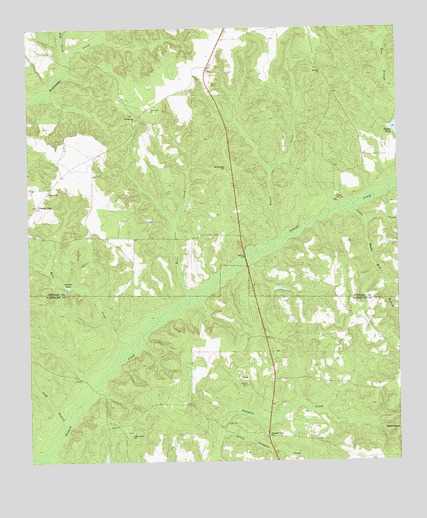
County Line, GA USGS Topographic Map
Click on map above to begin viewing in our Map Viewer.

This topographic map contains these locations and features:
Feature Name Type Latitude Longitude GNIS ID View Map
Beaver CreekStreamN31.9388°W84.7896°310974View Map
Benevolence DivisionCivilN31.8803°W84.7518°1936107View Map
Brier CreekStreamN31.9202°W84.8205°311793View Map
Carters PondLakeN31.9257°W84.8617°355014View Map
County LineLocaleN31.9488°W84.8721°355332View Map
Day CreekStreamN31.9913°W84.8608°355456View Map
Fort BranchStreamN31.9815°W84.7508°314285View Map
Lies LakeReservoirN31.8761°W84.8493°342070View Map
Lies Lake DamDamN31.8752°W84.8483°342069View Map
Little CreekStreamN31.9504°W84.7646°317028View Map
Little Pumpkin CreekStreamN31.8824°W84.8113°317152View Map
Long BranchStreamN31.8846°W84.8638°317338View Map
Meal CreekStreamN31.9052°W84.8427°317984View Map
Mill BranchStreamN31.8760°W84.8127°318179View Map
Mossy BranchStreamN31.8763°W84.8744°318534View Map
Mount Zion (historical)Populated PlaceN31.9899°W84.7769°347325View Map
Mount Zion ChurchChurchN31.9877°W84.7755°318965View Map
Philadelphia ChurchChurchN31.9752°W84.8380°320432View Map
Piney Grove ChurchChurchN31.8832°W84.8396°320706View Map
Pumpkin Town ChurchChurchN31.8824°W84.7938°321231View Map
PumpkintownPopulated PlaceN31.8821°W84.7946°344758View Map
Robinson School (historical)SchoolN31.9704°W84.8394°347346View Map
Scienceville ChurchChurchN31.9524°W84.8683°322634View Map
Summerfield BridgeBridgeN31.9340°W84.8016°347365View Map
Tilley (historical)Populated PlaceN31.9890°W84.8138°347369View Map
Ward BranchStreamN31.9229°W84.8183°344778View Map
Wards Mill BranchStreamN31.9446°W84.7596°324843View Map
Zion Watch ChurchChurchN31.9599°W84.8074°325719View Map

Note: Coordinates in the location and feature list above are referenced to NAD83 datum.


Copyright (C) 2008-2025 Ryan Niemi / Sunset Dynamics ... All Rights Reserved