TopoQuest Logo
Do you find TopoQuest useful?
Help keep TopoQuest running and adding new maps/features by donating!
Bitcoin:  19c7KJd3qBynnjoSw5npx9KScwjBe4ifkT
Litecoin:  LXs6TkuXGGXo1vDsWCkWVdjQX94eUKd6ui
Home View Maps Find Maps Find Places Resources & Links


Sanford, Georgia Topographic Map

USGS Map Title: Sanford, GA
USGS Map MRC: 31084H8
DRG (GeoTIFF) Download: o31084h8.tif


Neighboring USGS Topographic Map Quads:


  Twin Springs, AL  
32085A1
 

  Lumpkin SW, GA  
32084A8
 

  Lumpkin, GA  
32084A7
 

  Georgetown, GA  
31085H1
 

  Sanford, GA  
31084H8
 

  County Line, GA  
31084H7
 

  Hatcher, GA  
31085G1
 

  Morris, GA  
31084G8
 

  Cuthbert, GA  
31084G7


Map MRC Location:

N32°
W85°
N32°
W84°
H8 H7 H6 H5 H4 H3 H2 H1
G8 G7 G6 G5 G4 G3 G2 G1
F8 F7 F6 F5 F4 F3 F2 F1
E8 E7 E6 E5 E4 E3 E2 E1
D8 D7 D6 D5 D4 D3 D2 D1
C8 C7 C6 C5 C4 C3 C2 C1
B8 B7 B6 B5 B4 B3 B2 B1
A8 A7 A6 A5 A4 A3 A2 A1
N31°
W85°
N31°
W84°

Sanford, GA USGS 1:24K Topographic Map Preview:
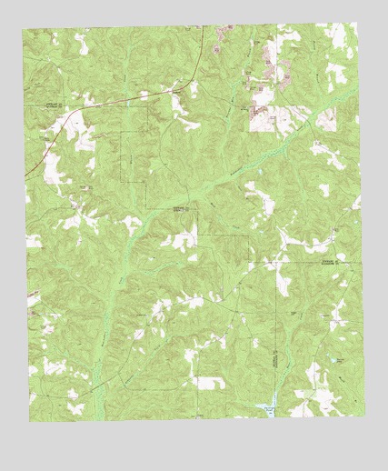
Sanford, GA USGS Topographic Map
Click on map above to begin viewing in our Map Viewer.

This topographic map contains these locations and features:
Feature Name Type Latitude Longitude GNIS ID View Map
Arkansas CreekStreamN31.8782°W84.9727°310611View Map
Bladen CreekStreamN31.9371°W84.9555°354763View Map
County Line Baptist ChurchChurchN31.9410°W84.8791°347284View Map
County Line CemeteryCemeteryN31.9404°W84.8794°347285View Map
Crumley Store (historical)LocaleN31.9329°W84.8860°347286View Map
Davis ChapelChurchN31.9649°W84.9927°313344View Map
Dorsey BranchStreamN31.9727°W84.8880°313553View Map
Foreman Mill BranchStreamN31.9504°W84.9263°314263View Map
Hogan CemeteryCemeteryN31.9685°W84.9902°350541View Map
Hopewill ChurchChurchN31.9082°W84.9549°315669View Map
Lawson BridgeBridgeN31.9690°W84.8944°347312View Map
Lumpkin DivisionCivilN31.9999°W84.8882°1936379View Map
Mill Bethel ChurchChurchN31.9738°W84.9155°318160View Map
Pearces PondLakeN31.8930°W84.8864°320319View Map
Ray BridgeBridgeN31.9452°W84.9388°347342View Map
Sand BranchStreamN31.9521°W84.9227°322404View Map
SanfordPopulated PlaceN31.9796°W84.9435°332976View Map
Sharon ChurchChurchN31.9071°W84.8908°322781View Map
Sugar HillCapeN31.9079°W84.9021°323722View Map
Sunlight (historical)Populated PlaceN31.9990°W84.9052°347366View Map
UnionPopulated PlaceN31.8757°W84.9377°333304View Map
Union ChurchChurchN31.8757°W84.9380°350553View Map
Wolf CreekStreamN31.9452°W84.9380°325482View Map

Note: Coordinates in the location and feature list above are referenced to NAD83 datum.


Copyright (C) 2008-2025 Ryan Niemi / Sunset Dynamics ... All Rights Reserved