TopoQuest Logo
Do you find TopoQuest useful?
Help keep TopoQuest running and adding new maps/features by donating!
Bitcoin:  19c7KJd3qBynnjoSw5npx9KScwjBe4ifkT
Litecoin:  LXs6TkuXGGXo1vDsWCkWVdjQX94eUKd6ui
Home View Maps Find Maps Find Places Resources & Links


Aniwa, Wisconsin Topographic Map

USGS Map Title: Aniwa, WI
USGS Map MRC: 45089A2
DRG (GeoTIFF) Download: o45089a2.tif


Neighboring USGS Topographic Map Quads:


  Black Brook, WI  
45089B3
 

  Antigo, WI  
45089B2
 

  Bryant, WI  
45089B1
 

  Hogarty, WI  
45089A3
 

  Aniwa, WI  
45089A2
 

  Mattoon, WI  
45089A1
 

  Hatley, WI  
44089H3
 

  Birnamwood, WI  
44089H2
 

  Regina, WI  
44089H1


Map MRC Location:

N46°
W90°
N46°
W89°
H8 H7 H6 H5 H4 H3 H2 H1
G8 G7 G6 G5 G4 G3 G2 G1
F8 F7 F6 F5 F4 F3 F2 F1
E8 E7 E6 E5 E4 E3 E2 E1
D8 D7 D6 D5 D4 D3 D2 D1
C8 C7 C6 C5 C4 C3 C2 C1
B8 B7 B6 B5 B4 B3 B2 B1
A8 A7 A6 A5 A4 A3 A2 A1
N45°
W90°
N45°
W89°

Aniwa, WI USGS 1:24K Topographic Map Preview:
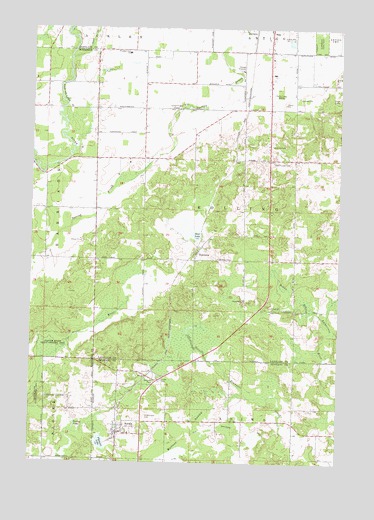
Aniwa, WI USGS Topographic Map
Click on map above to begin viewing in our Map Viewer.

This topographic map contains these locations and features:
Feature Name Type Latitude Longitude GNIS ID View Map
AniwaPopulated PlaceN45.0086°W89.2143°1560877View Map
Antigo Air Force Station (historical)MilitaryN45.0492°W89.2344°2086833View Map
Antigo City LandfillLocaleN45.1006°W89.1414°2635569View Map
Bear LakeLakeN45.0654°W89.1829°1561381View Map
Eau Claire Valley School (historical)SchoolN45.0727°W89.2448°1844098View Map
ElmhurstPopulated PlaceN45.0583°W89.1843°1564576View Map
Fernwood School (historical)SchoolN45.0944°W89.2054°1840763View Map
Hall Pioneer CemeteryCemeteryN45.0872°W89.1518°1565987View Map
Mattoon SwampSwampN45.0036°W89.1890°1569129View Map
Oldens CreekStreamN45.1161°W89.2348°1570961View Map
Pleasant LakeLakeN45.0053°W89.2209°1571612View Map
Pleasant View Elementary SchoolSchoolN45.1179°W89.2114°1571677View Map
Rolling CemeteryCemeteryN45.0588°W89.1746°1572548View Map
Rolling TownhallBuildingN45.1022°W89.1587°1840800View Map
Saint Boniface CemeteryCemeteryN45.0122°W89.2026°1572868View Map
Spring LakeLakeN45.0100°W89.2319°1574669View Map
Sunnyside School (historical)SchoolN45.1022°W89.1587°1840819View Map
Town of RollingCivilN45.0738°W89.1634°1584059View Map
Village of AniwaCivilN45.0115°W89.2089°1582697View Map
WATK-AM (Antigo)TowerN45.1139°W89.1390°1582542View Map

Note: Coordinates in the location and feature list above are referenced to NAD83 datum.


Copyright (C) 2008-2025 Ryan Niemi / Sunset Dynamics ... All Rights Reserved