TopoQuest Logo
Do you find TopoQuest useful?
Help keep TopoQuest running and adding new maps/features by donating!
Bitcoin:  19c7KJd3qBynnjoSw5npx9KScwjBe4ifkT
Litecoin:  LXs6TkuXGGXo1vDsWCkWVdjQX94eUKd6ui
Home View Maps Find Maps Find Places Resources & Links


Crawfish Lake, Oregon Topographic Map

USGS Map Title: Crawfish Lake, OR
USGS Map MRC: 44118H3
DRG (GeoTIFF) Download: o44118h3.tif


Neighboring USGS Topographic Map Quads:


  Fly Valley, OR  
45118A4
 

  Limber Jim Creek, OR  
45118A3
 

  Anthony Butte, OR  
45118A2
 

  Trout Meadows, OR  
44118H4
 

  Crawfish Lake, OR  
44118H3
 

  Anthony Lakes, OR  
44118H2
 

  Granite, OR  
44118G4
 

  Mount Ireland, OR  
44118G3
 

  Bourne, OR  
44118G2


Map MRC Location:

N45°
W119°
N45°
W118°
H8 H7 H6 H5 H4 H3 H2 H1
G8 G7 G6 G5 G4 G3 G2 G1
F8 F7 F6 F5 F4 F3 F2 F1
E8 E7 E6 E5 E4 E3 E2 E1
D8 D7 D6 D5 D4 D3 D2 D1
C8 C7 C6 C5 C4 C3 C2 C1
B8 B7 B6 B5 B4 B3 B2 B1
A8 A7 A6 A5 A4 A3 A2 A1
N44°
W119°
N44°
W118°

Crawfish Lake, OR USGS 1:24K Topographic Map Preview:
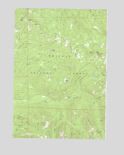
Crawfish Lake, OR USGS Topographic Map
Click on map above to begin viewing in our Map Viewer.

This topographic map contains these locations and features:
Feature Name Type Latitude Longitude GNIS ID View Map
Baby McKee MineMineN44.8815°W118.2569°1137372View Map
Badger ButteSummitN44.9310°W118.3063°1137389View Map
Baldy CreekStreamN44.9096°W118.3186°1137473View Map
Bill Brown CoveValleyN44.9060°W118.2549°1138107View Map
Black ButteSummitN44.9599°W118.3244°1138178View Map
Bull CreekStreamN44.8965°W118.3074°1138901View Map
Cabell CityPopulated PlaceN44.8951°W118.3683°1139098View Map
Chicken HillSummitN44.9882°W118.3563°1139631View Map
Continental MineMineN44.8868°W118.3649°1140051View Map
Crawfish CreekStreamN44.9149°W118.2983°1140406View Map
Crawfish LakeLakeN44.9352°W118.2652°1140408View Map
Cunningham CreekStreamN44.9110°W118.2669°1140552View Map
French DiggingsAreaN44.9315°W118.3274°1142465View Map
Hoodoo CreekStreamN44.9629°W118.3708°1143713View Map
Labellevue MineMineN44.8888°W118.3361°1144729View Map
Limber CreekStreamN44.8901°W118.2972°1145018View Map
Loa Mae MineMineN44.8799°W118.2838°1145307View Map
Long MeadowFlatN44.9568°W118.2927°1116624View Map
Long Meadow CreekStreamN44.9432°W118.2947°1145425View Map
Lookout SpringSpringN44.9847°W118.3438°1145482View Map
Middle Trail CreekStreamN44.9360°W118.3622°1146185View Map
North Fork MeadowFlatN44.9146°W118.3041°1146980View Map
Peavy CabinBuildingN44.9099°W118.2652°1147548View Map
Peavy Cabin Recreation SiteLocaleN44.9096°W118.2644°1156471View Map
Peavy CreekStreamN44.9090°W118.2808°1158707View Map
Standard MineMineN44.8826°W118.3716°1150334View Map
Whitman National ForestForestN44.9160°W118.2904°1851863View Map

Note: Coordinates in the location and feature list above are referenced to NAD83 datum.


Copyright (C) 2008-2024 Ryan Niemi / Sunset Dynamics ... All Rights Reserved