TopoQuest Logo
Do you find TopoQuest useful?
Help keep TopoQuest running and adding new maps/features by donating!
Bitcoin:  19c7KJd3qBynnjoSw5npx9KScwjBe4ifkT
Litecoin:  LXs6TkuXGGXo1vDsWCkWVdjQX94eUKd6ui
Home View Maps Find Maps Find Places Resources & Links


Bourne, Oregon Topographic Map

USGS Map Title: Bourne, OR
USGS Map MRC: 44118G2
DRG (GeoTIFF) Download: o44118g2.tif


Neighboring USGS Topographic Map Quads:


  Crawfish Lake, OR  
44118H3
 

  Anthony Lakes, OR  
44118H2
 

  Rock Creek, OR  
44118H1
 

  Mount Ireland, OR  
44118G3
 

  Bourne, OR  
44118G2
 

  Elkhorn Peak, OR  
44118G1
 

  Whitney, OR  
44118F3
 

  Sumpter, OR  
44118F2
 

  Phillips Lake, OR  
44118F1


Map MRC Location:

N45°
W119°
N45°
W118°
H8 H7 H6 H5 H4 H3 H2 H1
G8 G7 G6 G5 G4 G3 G2 G1
F8 F7 F6 F5 F4 F3 F2 F1
E8 E7 E6 E5 E4 E3 E2 E1
D8 D7 D6 D5 D4 D3 D2 D1
C8 C7 C6 C5 C4 C3 C2 C1
B8 B7 B6 B5 B4 B3 B2 B1
A8 A7 A6 A5 A4 A3 A2 A1
N44°
W119°
N44°
W118°

Bourne, OR USGS 1:24K Topographic Map Preview:
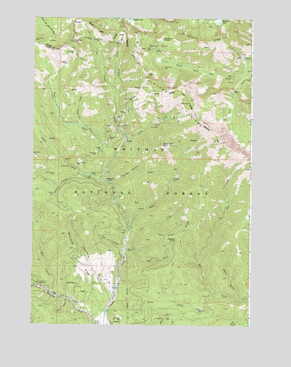
Bourne, OR USGS Topographic Map
Click on map above to begin viewing in our Map Viewer.

This topographic map contains these locations and features:
Feature Name Type Latitude Longitude GNIS ID View Map
Amazon MineMineN44.8143°W118.2291°1116908View Map
Analulu MineMineN44.8032°W118.2380°1116921View Map
Argonaut MineMineN44.8563°W118.2313°1117035View Map
Bear CanyonValleyN44.7627°W118.2386°1117346View Map
Borden GulchValleyN44.8074°W118.2047°1117949View Map
BournePopulated PlaceN44.8243°W118.1974°1136088View Map
Bourne Post Office (historical)Post OfficeN44.8243°W118.1974°1164945View Map
Brooklyn MineMineN44.8171°W118.2319°1118108View Map
Buck GulchValleyN44.7654°W118.2461°1138791View Map
Buckeye MineMineN44.8414°W118.1635°1118227View Map
Bunker Hill MineMineN44.8113°W118.2380°1118316View Map
Chloride MineMineN44.8590°W118.1297°1118926View Map
Chloride Post Office (historical)Post OfficeN44.8596°W118.1294°1164270View Map
Chloride RidgeRidgeN44.8688°W118.1663°1118927View Map
Cleveland (historical)LocaleN44.8115°W118.2205°1131968View Map
Columbia HillSummitN44.8654°W118.2280°1136165View Map
Columbia MineMineN44.8263°W118.2072°1119169View Map
Corey GulchValleyN44.7607°W118.2299°1119281View Map
Cracker CampLocaleN44.8660°W118.2169°1119495View Map
Cracker City (historical)Populated PlaceN44.8238°W118.2066°1158861View Map
Cracker Post Office (historical)Post OfficeN44.8238°W118.2066°1165100View Map
E and E MineMineN44.8307°W118.2011°1120251View Map
East Fork Pole CreekStreamN44.7818°W118.1933°1120319View Map
Elkhorn MountainsSummitN44.8721°W118.1927°1738077View Map
Esmeralda MineMineN44.8663°W118.2174°1120520View Map
Eureka Post Office (historical)Post OfficeN44.8185°W118.2047°1164345View Map
Flowing WellWellN44.8217°W118.2114°1120848View Map
Fruit CreekStreamN44.8088°W118.2119°1121012View Map
Golconda MineMineN44.8201°W118.2147°1121189View Map
Hanover (historical)LocaleN44.8090°W118.2080°1121566View Map
Hanover Post Office (historical)Post OfficeN44.8090°W118.2080°1165366View Map
Horse CreekStreamN44.8299°W118.2202°1121992View Map
Kelly MineMineN44.8526°W118.1852°1122672View Map
Killamacue LakeLakeN44.8735°W118.1449°1122730View Map
Little Cracker CreekStreamN44.8254°W118.1966°1123165View Map
Mayflower MeadowSwampN44.8665°W118.1778°1123872View Map
McCully Recreation SiteLocaleN44.7671°W118.2472°1123928View Map
Molly Gibson MineMineN44.8657°W118.2497°1124284View Map
Morning Star MineMineN44.8188°W118.2491°1158382View Map
Mountain Belle MineMineN44.8154°W118.2252°1124419View Map
Mountain View MineMineN44.8649°W118.2013°1124431View Map
North Fork Rock CreekStreamN44.8557°W118.1252°1124804View Map
North Pole MineMineN44.8424°W118.1941°1124832View Map
Pinegrass SpringSpringN44.7849°W118.1681°1125417View Map
Pole CreekStreamN44.7810°W118.1972°1125521View Map
Pole Creek CampLocaleN44.7807°W118.1958°1125532View Map
Pole Creek RidgeRidgeN44.7885°W118.1616°1125534View Map
Rock Creek Lake TrailTrailN44.8363°W118.1338°1126176View Map
Sardine GulchValleyN44.8457°W118.2049°1126605View Map
Sheep CreekStreamN44.7624°W118.1433°1126816View Map
Silver CreekStreamN44.8085°W118.2077°1126963View Map
Silver Creek CampLocaleN44.8107°W118.2166°1126965View Map
Silver Dick MineMineN44.8115°W118.2163°1126967View Map
Slim CreekStreamN44.7801°W118.1980°1127087View Map
Snell HollowValleyN44.8107°W118.2208°1127156View Map
South Pole MineMineN44.8551°W118.1769°1127337View Map
Spaulding GulchValleyN44.7599°W118.2047°1127372View Map
Spaulding RidgeRidgeN44.7949°W118.2388°1127373View Map
Sumpter ReservoirReservoirN44.7523°W118.1989°1127724View Map
Wahoo GulchValleyN44.7602°W118.1297°1128577View Map
Western Union BasinBasinN44.8626°W118.1786°1128912View Map
Western Union MineMineN44.8624°W118.1833°1128913View Map
Wind CreekStreamN44.7899°W118.1947°1129213View Map
Wind Creek PeakSummitN44.8232°W118.1763°1129214View Map

Note: Coordinates in the location and feature list above are referenced to NAD83 datum.


Copyright (C) 2008-2024 Ryan Niemi / Sunset Dynamics ... All Rights Reserved