TopoQuest Logo
Do you find TopoQuest useful?
Help keep TopoQuest running and adding new maps/features by donating!
Bitcoin:  19c7KJd3qBynnjoSw5npx9KScwjBe4ifkT
Litecoin:  LXs6TkuXGGXo1vDsWCkWVdjQX94eUKd6ui
Home View Maps Find Maps Find Places Resources & Links


Blossburg, Pennsylvania Topographic Map

USGS Map Title: Blossburg, PA
USGS Map MRC: 41077F1
DRG (GeoTIFF) Download: o41077f1.tif


Neighboring USGS Topographic Map Quads:


  Crooked Creek, PA  
41077G2
 

  Mansfield, PA  
41077G1
 

  Roseville, PA  
41076G8
 

  Cherry Flats, PA  
41077F2
 

  Blossburg, PA  
41077F1
 

  Gleason, PA  
41076F8
 

  Nauvoo, PA  
41077E2
 

  Liberty, PA  
41077E1
 

  Ralston, PA  
41076E8


Map MRC Location:

N42°
W78°
N42°
W77°
H8 H7 H6 H5 H4 H3 H2 H1
G8 G7 G6 G5 G4 G3 G2 G1
F8 F7 F6 F5 F4 F3 F2 F1
E8 E7 E6 E5 E4 E3 E2 E1
D8 D7 D6 D5 D4 D3 D2 D1
C8 C7 C6 C5 C4 C3 C2 C1
B8 B7 B6 B5 B4 B3 B2 B1
A8 A7 A6 A5 A4 A3 A2 A1
N41°
W78°
N41°
W77°

Blossburg, PA USGS 1:24K Topographic Map Preview:
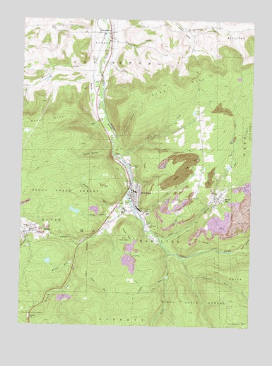
Blossburg, PA USGS Topographic Map
Click on map above to begin viewing in our Map Viewer.

This topographic map contains these locations and features:
Feature Name Type Latitude Longitude GNIS ID View Map
Arbon CemeteryCemeteryN41.6709°W77.0558°1168367View Map
ArnotPopulated PlaceN41.6626°W77.1230°1168418View Map
Arnot Census Designated PlaceCensusN41.6623°W77.1222°2634204View Map
Arnot Post OfficePost OfficeN41.6627°W77.1224°2772577View Map
Baity School (historical)SchoolN41.7462°W77.0055°1197650View Map
Barneys HillSummitN41.6898°W77.0341°1198361View Map
Bear CreekStreamN41.6834°W77.0641°1168859View Map
Bellman RunStreamN41.6609°W77.0858°1169179View Map
BlakesPopulated PlaceN41.6912°W77.0264°1198018View Map
BlossburgPopulated PlaceN41.6795°W77.0639°1213950View Map
Blossburg City Police DepartmentBuildingN41.6808°W77.0650°2775180View Map
Blossburg Firemens Ambulance AssociationBuildingN41.6744°W77.0630°2653045View Map
Blossburg Post OfficePost OfficeN41.6798°W77.0659°2772609View Map
Blossburg Volunteer Fire DepartmentBuildingN41.6832°W77.0633°2653024View Map
Boone RunStreamN41.6737°W77.0700°1169994View Map
Borough of BlossburgCivilN41.6795°W77.0690°1215620View Map
Carpenter RunStreamN41.6529°W77.0355°1171247View Map
Coal CreekStreamN41.6715°W77.0614°1172051View Map
Copp HollowValleyN41.7302°W77.0897°1172442View Map
CovingtonPopulated PlaceN41.7448°W77.0772°1172540View Map
Covington Post OfficePost OfficeN41.7443°W77.0772°2773106View Map
Dibble RunStreamN41.6448°W77.0452°1173235View Map
East Creek Tioga RiverStreamN41.6940°W77.0722°1173793View Map
Fall BrookStreamN41.6570°W77.0039°1174576View Map
Flower RunStreamN41.6529°W77.0944°1174919View Map
Frost HollowValleyN41.6986°W77.0764°1175298View Map
Frost Settlement CemeteryCemeteryN41.7459°W77.0326°1175299View Map
Gray CemeteryCemeteryN41.7336°W77.0858°1176022View Map
Helen Lutes Softball FieldParkN41.6403°W77.0686°2114726View Map
Huckleberry MountainSummitN41.6259°W77.0014°1177488View Map
Johnson CreekStreamN41.6779°W77.0680°1178112View Map
Limekiln HollowValleyN41.7019°W77.0730°1179351View Map
Long RunStreamN41.6454°W77.0961°1179888View Map
Marvin CreekStreamN41.7292°W77.0839°1180510View Map
Mills CreekStreamN41.6690°W77.0752°1181280View Map
Morris RunPopulated PlaceN41.6773°W77.0180°1181572View Map
Morris RunStreamN41.6631°W77.0525°1181576View Map
Morris Run - Lutheran Community CemeteryCemeteryN41.6833°W77.0139°2774832View Map
Morris Run Mine Dam Number ThreeDamN41.6901°W77.0147°1195737View Map
Morris Run Post OfficePost OfficeN41.6778°W77.0190°2773214View Map
Morris Run ReservoirReservoirN41.6904°W77.0121°1195738View Map
Old Settlers CemeteryCemeteryN41.7344°W77.0786°2774817View Map
Pig HillSummitN41.6637°W77.0933°1183706View Map
Pig Hill TrailTrailN41.6690°W77.1055°1205899View Map
Pine HillSummitN41.7162°W77.0647°1183833View Map
President's House - Mansfield UniversityBuildingN41.6394°W77.0744°2114736View Map
Saint Andrews CemeteryCemeteryN41.6660°W77.0560°1185756View Map
Saint Josephs CemeteryCemeteryN41.6749°W77.0139°2774847View Map
Saint Mary's CemeteryCemeteryN41.6721°W77.0583°1186403View Map
Sawmill CreekStreamN41.6634°W77.1180°1187021View Map
South MountainSummitN41.6609°W77.0658°1188092View Map
Swedish Lutheran CemeteryCemeteryN41.6547°W77.1186°2774857View Map
Tan CreekStreamN41.7309°W77.0830°1189254View Map
Taylor RunStreamN41.6587°W77.0480°1189315View Map
Township of CovingtonCivilN41.7290°W77.0996°1217104View Map
Township of HamiltonCivilN41.6643°W77.0421°1217112View Map
Township of PutnamCivilN41.7438°W77.0817°1215626View Map
Union CemeteryCemeteryN41.6668°W77.0567°1190117View Map
Wilson CreekStreamN41.7492°W77.0800°1191533View Map

Note: Coordinates in the location and feature list above are referenced to NAD83 datum.


Copyright (C) 2008-2025 Ryan Niemi / Sunset Dynamics ... All Rights Reserved