TopoQuest Logo
Do you find TopoQuest useful?
Help keep TopoQuest running and adding new maps/features by donating!
Bitcoin:  19c7KJd3qBynnjoSw5npx9KScwjBe4ifkT
Litecoin:  LXs6TkuXGGXo1vDsWCkWVdjQX94eUKd6ui
Home View Maps Find Maps Find Places Resources & Links


Cherry Flats, Pennsylvania Topographic Map

USGS Map Title: Cherry Flats, PA
USGS Map MRC: 41077F2
DRG (GeoTIFF) Download: o41077f2.tif


Neighboring USGS Topographic Map Quads:


  Keeneyville, PA  
41077G3
 

  Crooked Creek, PA  
41077G2
 

  Mansfield, PA  
41077G1
 

  Antrim, PA  
41077F3
 

  Cherry Flats, PA  
41077F2
 

  Blossburg, PA  
41077F1
 

  Morris, PA  
41077E3
 

  Nauvoo, PA  
41077E2
 

  Liberty, PA  
41077E1


Map MRC Location:

N42°
W78°
N42°
W77°
H8 H7 H6 H5 H4 H3 H2 H1
G8 G7 G6 G5 G4 G3 G2 G1
F8 F7 F6 F5 F4 F3 F2 F1
E8 E7 E6 E5 E4 E3 E2 E1
D8 D7 D6 D5 D4 D3 D2 D1
C8 C7 C6 C5 C4 C3 C2 C1
B8 B7 B6 B5 B4 B3 B2 B1
A8 A7 A6 A5 A4 A3 A2 A1
N41°
W78°
N41°
W77°

Cherry Flats, PA USGS 1:24K Topographic Map Preview:
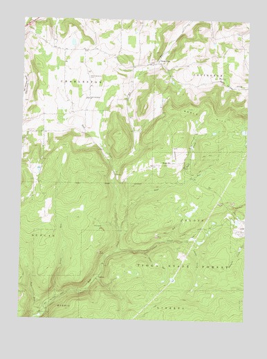
Cherry Flats, PA USGS Topographic Map
Click on map above to begin viewing in our Map Viewer.

This topographic map contains these locations and features:
Feature Name Type Latitude Longitude GNIS ID View Map
Buckus Family / Round Top CemeteryCemeteryN41.7155°W77.2490°2770029View Map
Cherry FlatsPopulated PlaceN41.7317°W77.1747°1203257View Map
Cherry Flats Baptist CemeteryCemeteryN41.7322°W77.1791°2774808View Map
Cherry Flats Methodist CemeteryCemeteryN41.7312°W77.1736°2774809View Map
Culver School (historical)SchoolN41.7120°W77.2147°1197645View Map
Dyke CreekStreamN41.6826°W77.1627°1173683View Map
Fisher TrailTrailN41.6309°W77.1291°1205901View Map
Hi Line Lodge Airport (historical)AirportN41.6945°W77.1650°1194273View Map
Klondike (historical)Populated PlaceN41.6609°W77.1733°1197648View Map
LandrusPopulated PlaceN41.6423°W77.2061°1203979View Map
Lick CreekStreamN41.6542°W77.1941°1179279View Map
Maple HillPopulated PlaceN41.6901°W77.1658°1204096View Map
Maple HillSummitN41.7129°W77.1566°1180345View Map
Maple Hill CemeteryCemeteryN41.6897°W77.1705°2774833View Map
Maple Hill Fire TowerTowerN41.6923°W77.1772°1213436View Map
Maple Hill SchoolSchoolN41.6967°W77.1566°1197646View Map
Nickel RunStreamN41.6334°W77.2297°1182448View Map
Red RunStreamN41.6579°W77.1680°1193177View Map
Sand RunStreamN41.6615°W77.1939°1186917View Map
Silver RunStreamN41.6531°W77.1797°1187690View Map
South CreekStreamN41.6579°W77.1511°1188052View Map
Township of BlossCivilN41.6633°W77.1459°1217099View Map
Welsh Settlement CemeteryCemeteryN41.7260°W77.2129°1190820View Map
Welsh Settlement ChurchChurchN41.7170°W77.2125°1190821View Map

Note: Coordinates in the location and feature list above are referenced to NAD83 datum.


Copyright (C) 2008-2024 Ryan Niemi / Sunset Dynamics ... All Rights Reserved