TopoQuest Logo
Do you find TopoQuest useful?
Help keep TopoQuest running and adding new maps/features by donating!
Bitcoin:  19c7KJd3qBynnjoSw5npx9KScwjBe4ifkT
Litecoin:  LXs6TkuXGGXo1vDsWCkWVdjQX94eUKd6ui
Home View Maps Find Maps Find Places Resources & Links


Crooked Creek Valley, Oregon Topographic Map

USGS Map Title: Crooked Creek Valley, OR
USGS Map MRC: 42120C3
DRG (GeoTIFF) Download: o42120c3.tif


Neighboring USGS Topographic Map Quads:


  Clover Flat, OR  
42120D4
 

  Valley Falls, OR  
42120D3
 

  Little Honey Creek, OR  
42120D2
 

  Big Baldy, OR  
42120C4
 

  Crooked Creek Valley, OR  
42120C3
 

  Crook Peak, OR  
42120C2
 

  Lakeview Airport, OR  
42120B4
 

  Lakeview, OR  
42120B3
 

  Horse Prairie, OR  
42120B2


Map MRC Location:

N43°
W121°
N43°
W120°
H8 H7 H6 H5 H4 H3 H2 H1
G8 G7 G6 G5 G4 G3 G2 G1
F8 F7 F6 F5 F4 F3 F2 F1
E8 E7 E6 E5 E4 E3 E2 E1
D8 D7 D6 D5 D4 D3 D2 D1
C8 C7 C6 C5 C4 C3 C2 C1
B8 B7 B6 B5 B4 B3 B2 B1
A8 A7 A6 A5 A4 A3 A2 A1
N42°
W121°
N42°
W120°

Crooked Creek Valley, OR USGS 1:24K Topographic Map Preview:
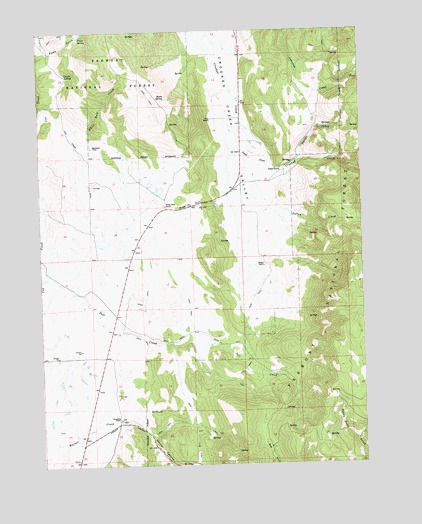
Crooked Creek Valley, OR USGS Topographic Map
Click on map above to begin viewing in our Map Viewer.

This topographic map contains these locations and features:
Feature Name Type Latitude Longitude GNIS ID View Map
Antler Post Office (historical)Post OfficeN42.3402°W120.2969°1164844View Map
Basin SpringSpringN42.3553°W120.3271°1117298View Map
Chambers RanchLocaleN42.2632°W120.3455°1118808View Map
Colvert SpringSpringN42.3626°W120.3653°1119173View Map
Cory ReservoirReservoirN42.3249°W120.3074°1161726View Map
Fawn SpringSpringN42.3737°W120.3589°1120651View Map
Fisk HillSummitN42.3246°W120.3169°1136290View Map
Gunkel RanchLocaleN42.3346°W120.2822°1121488View Map
Jones CreekStreamN42.3407°W120.3013°1122506View Map
Kittleson PlaceLocaleN42.3418°W120.3547°1136444View Map
Little Cove CreekStreamN42.3343°W120.2511°1123162View Map
Loftus CreekStreamN42.3332°W120.3016°1123345View Map
Lower ReservoirReservoirN42.2604°W120.3293°1131000View Map
Mill TrailheadLocaleN42.3379°W120.2622°2548764View Map
Parker CreekStreamN42.3374°W120.2738°1125183View Map
Rehart RanchLocaleN42.3071°W120.2891°1125937View Map
Rehart-Salt Creek DitchCanalN42.3138°W120.2997°1130997View Map
Upper ReservoirReservoirN42.2622°W120.3261°1131001View Map
Weir RanchLocaleN42.3490°W120.3086°1128779View Map
White Rock DamDamN42.3282°W120.3311°1131558View Map
White Rock RanchLocaleN42.3243°W120.3269°1128995View Map
White Rock ReservoirsReservoirN42.3308°W120.3330°1130996View Map
Wilcox DitchCanalN42.2568°W120.3511°1130999View Map
Wilson DitchCanalN42.3221°W120.3738°1130995View Map

Note: Coordinates in the location and feature list above are referenced to NAD83 datum.


Copyright (C) 2008-2025 Ryan Niemi / Sunset Dynamics ... All Rights Reserved