TopoQuest Logo
Do you find TopoQuest useful?
Help keep TopoQuest running and adding new maps/features by donating!
Bitcoin:  19c7KJd3qBynnjoSw5npx9KScwjBe4ifkT
Litecoin:  LXs6TkuXGGXo1vDsWCkWVdjQX94eUKd6ui
Home View Maps Find Maps Find Places Resources & Links


Crown King, Arizona Topographic Map

USGS Map Title: Crown King, AZ
USGS Map MRC: 34112B3
DRG (GeoTIFF) Download: o34112b3.tif


Neighboring USGS Topographic Map Quads:


  Battleship Butte, AZ  
34112C4
 

  Battle Flat, AZ  
34112C3
 

  Cleator, AZ  
34112C2
 

  Minnehaha, AZ  
34112B4
 

  Crown King, AZ  
34112B3
 

  Bumble Bee, AZ  
34112B2
 

  Copperopolis, AZ  
34112A4
 

  Columbia, AZ  
34112A3
 

  Black Canyon City, AZ  
34112A2


Map MRC Location:

N35°
W113°
N35°
W112°
H8 H7 H6 H5 H4 H3 H2 H1
G8 G7 G6 G5 G4 G3 G2 G1
F8 F7 F6 F5 F4 F3 F2 F1
E8 E7 E6 E5 E4 E3 E2 E1
D8 D7 D6 D5 D4 D3 D2 D1
C8 C7 C6 C5 C4 C3 C2 C1
B8 B7 B6 B5 B4 B3 B2 B1
A8 A7 A6 A5 A4 A3 A2 A1
N34°
W113°
N34°
W112°

Crown King, AZ USGS 1:24K Topographic Map Preview:
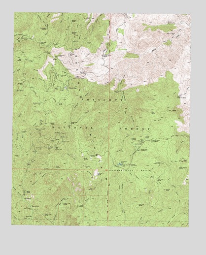
Crown King, AZ USGS Topographic Map
Click on map above to begin viewing in our Map Viewer.

This topographic map contains these locations and features:
Feature Name Type Latitude Longitude GNIS ID View Map
Algonquin MineMineN34.2039°W112.3013°25584View Map
Algonquin TrailTrailN34.1981°W112.2971°38207View Map
Ash SpringSpringN34.2223°W112.3701°25800View Map
Barney Williams Dam TankReservoirN34.1289°W112.3007°38243View Map
Bartol SpringSpringN34.1645°W112.3252°26015View Map
Bens SpringSpringN34.1540°W112.2756°26220View Map
Bradshaw CityPopulated PlaceN34.1967°W112.3557°26704View Map
Bradshaw City CemeteryCemeteryN34.1919°W112.3562°26705View Map
Bull Run TrailTrailN34.2398°W112.3377°26971View Map
Burnt Ground SpringSpringN34.1597°W112.2583°27026View Map
Burro JohnPopulated PlaceN34.1303°W112.3610°27047View Map
Castle Creek WildernessReserveN34.1935°W112.2651°41850View Map
Castle RockSummitN34.1606°W112.3646°27351View Map
Charcoal GulchValleyN34.1598°W112.3652°27508View Map
Coal Camp SpringSpringN34.1531°W112.2740°27750View Map
Copper BasinBasinN34.1384°W112.3418°27895View Map
Copper Basin SpringSpringN34.1315°W112.3529°27898View Map
Copper Creek SpringSpringN34.1380°W112.3394°27914View Map
Corral SpringSpringN34.1965°W112.3436°27978View Map
Cougar MineMineN34.1839°W112.3360°28065View Map
Crown KingPopulated PlaceN34.2056°W112.3385°28197View Map
Crown King CemeteryCemeteryN34.2128°W112.3427°28198View Map
Crown King Elementary SchoolSchoolN34.2075°W112.3392°38385View Map
Crown King Fire DepartmentBuildingN34.2057°W112.3391°2672354View Map
Crown King MineMineN34.2248°W112.3438°28199View Map
Crown King Post OfficePost OfficeN34.2056°W112.3387°44885View Map
Crown King Ranger StationLocaleN34.2042°W112.3399°38386View Map
Dannys Lower SpringSpringN34.2441°W112.2674°28273View Map
Del Pasco MineMineN34.2311°W112.3463°28407View Map
Eagle Tail MineMineN34.2261°W112.3521°28728View Map
East FortPopulated PlaceN34.1636°W112.2552°28769View Map
Fat Jack MineMineN34.1598°W112.3238°28960View Map
Fort MiseryPopulated PlaceN34.1403°W112.3666°29118View Map
Gazelle MineMineN34.1681°W112.3588°29284View Map
Gladiator MineMineN34.2331°W112.3338°29334View Map
Gladiator SpringSpringN34.2382°W112.3350°29335View Map
Hazlett Hollow CampgroundLocaleN34.1695°W112.2852°29825View Map
Hells HoleBendN34.2050°W112.3002°29873View Map
Hells Hole OverlookLocaleN34.1678°W112.3171°41137View Map
Horsethief BasinBasinN34.1578°W112.2896°30204View Map
Horsethief Basin Recreation AreaParkN34.1723°W112.2804°38519View Map
Horsethief Boat LaunchLocaleN34.1613°W112.2986°2669946View Map
Horsethief CanyonValleyN34.2120°W112.3002°30206View Map
Horsethief CreekStreamN34.2259°W112.2863°42745View Map
Horsethief DamDamN34.1617°W112.2991°38520View Map
Horsethief Guard StationLocaleN34.1611°W112.2924°30208View Map
Horsethief LakeReservoirN34.1616°W112.2997°30209View Map
Horsethief Lookout Picnic AreaLocaleN34.1625°W112.2705°2669528View Map
Horsethief Lookout TowerTowerN34.1625°W112.2704°38521View Map
Iron SpringSpringN34.2039°W112.3732°30426View Map
Jerky Dam SpringSpringN34.1992°W112.2743°38538View Map
Jim Creek SpringSpringN34.1378°W112.2865°30537View Map
Jim Creek Trail Number Two Hundred Thirty FiveTrailN34.1375°W112.2746°38542View Map
Joes RidgeRidgeN34.1275°W112.2641°30560View Map
Jones GulchValleyN34.1414°W112.3682°30604View Map
Juniper MineMineN34.1656°W112.3707°30664View Map
Juniper RidgeRidgeN34.1895°W112.3268°30668View Map
Kane SpringSpringN34.1920°W112.2780°30704View Map
Kentuch SpringSpringN34.1759°W112.2793°41136View Map
Kentuck Spring CampgroundLocaleN34.1753°W112.2771°30751View Map
Kentucks CabinLocaleN34.1348°W112.3618°30752View Map
Kentucks GraveCemeteryN34.1359°W112.3610°30753View Map
Lane MountainSummitN34.1534°W112.3199°30870View Map
Lane Mountain TrailTrailN34.1423°W112.3199°30871View Map
Lane SpringSpringN34.1373°W112.3251°30873View Map
Lincoln MineMineN34.2323°W112.3241°30997View Map
Lion SpringSpringN34.1466°W112.3185°31018View Map
Lorena GulchValleyN34.2089°W112.3196°31287View Map
Lukes Hoist DivideRidgeN34.1848°W112.3349°41135View Map
Lukes Hoist MineMineN34.1817°W112.3379°38599View Map
Marceds GulchValleyN34.2064°W112.3379°41130View Map
Mascot MineMineN34.1748°W112.3460°31558View Map
Misery SpringSpringN34.1444°W112.3654°31932View Map
New Jersey MineMineN34.1786°W112.3424°32290View Map
New Savoy MineMineN34.1773°W112.3404°32295View Map
Oro (historical)LocaleN34.1709°W112.3479°42750View Map
Oro Belle MineMineN34.1692°W112.3457°32555View Map
Perkins Tunnel SpringSpringN34.2253°W112.3129°32802View Map
Philadelphia MineMineN34.2161°W112.3396°32846View Map
Pine SpringSpringN34.1589°W112.3449°32969View Map
Pipeline CanyonValleyN34.1445°W112.3666°33026View Map
Poland Vista PointSummitN34.2164°W112.3102°41131View Map
Porphry MountainSummitN34.2134°W112.3641°41129View Map
Rainbow SpringSpringN34.2452°W112.3351°33341View Map
Rapid Transit MineMineN34.1742°W112.3404°33377View Map
Savoy MineMineN34.1789°W112.3393°34098View Map
Shurtlett SpringSpringN34.2150°W112.3250°34401View Map
Silver Christmas MineMineN34.2384°W112.2624°34429View Map
Silver CreekStreamN34.1289°W112.3604°34434View Map
South FortPopulated PlaceN34.1467°W112.2671°34671View Map
Springfield MineMineN34.2078°W112.3688°34748View Map
Standard MineMineN34.1795°W112.3688°34796View Map
Sullivan SpringSpringN34.1558°W112.3156°34934View Map
Taylor GulchValleyN34.1528°W112.3663°35164View Map
Tiger CreekStreamN34.1600°W112.3652°35318View Map
Tiger MineMineN34.1850°W112.3563°35319View Map
Tiptop TrailTrailN34.1456°W112.3002°35353View Map
Towers MountainSummitN34.2342°W112.3679°35423View Map
Tunnel MineMineN34.1814°W112.3574°35522View Map
Turney Gulch CampgroundLocaleN34.1734°W112.2891°35591View Map
Twin PeaksSummitN34.1928°W112.2649°35624View Map
Twin Peaks TrailTrailN34.2003°W112.2624°35625View Map
Union MineMineN34.2148°W112.3485°38901View Map
Upper Dead Cow SpringSpringN34.2020°W112.2597°35681View Map
Upper Peck SpringSpringN34.2468°W112.3214°35704View Map
War Eagle MineMineN34.2261°W112.3363°35890View Map
Wasson PeakSummitN34.1848°W112.3454°35914View Map
Waterhole SpringSpringN34.1339°W112.2810°38929View Map
Watson PeakSummitN34.1534°W112.3204°41138View Map
Whiskey SpringSpringN34.1660°W112.3173°36055View Map
Wild Flower MineMineN34.2359°W112.3554°38951View Map
Wild Flower SaddleGapN34.2317°W112.3574°36161View Map
Wild Pigeon SpringSpringN34.2404°W112.3530°36173View Map
Willow Spring TrailTrailN34.1456°W112.2607°36273View Map

Note: Coordinates in the location and feature list above are referenced to NAD83 datum.


Copyright (C) 2008-2025 Ryan Niemi / Sunset Dynamics ... All Rights Reserved