TopoQuest Logo
Do you find TopoQuest useful?
Help keep TopoQuest running and adding new maps/features by donating!
Bitcoin:  19c7KJd3qBynnjoSw5npx9KScwjBe4ifkT
Litecoin:  LXs6TkuXGGXo1vDsWCkWVdjQX94eUKd6ui
Home View Maps Find Maps Find Places Resources & Links


Cynthiana, Indiana Topographic Map

USGS Map Title: Cynthiana, IN
USGS Map MRC: 38087B6
DRG (GeoTIFF) Download: o38087b6.tif


Neighboring USGS Topographic Map Quads:


  Keensburg, IL  
38087C7
 

  Owensville, IN  
38087C6
 

  Princeton, IN  
38087C5
 

  Poseyville, IN  
38087B7
 

  Cynthiana, IN  
38087B6
 

  Haubstadt, IN  
38087B5
 

  Wadesville, IN  
38087A7
 

  Kasson, IN  
38087A6
 

  Evansville North, IN  
38087A5


Map MRC Location:

N39°
W88°
N39°
W87°
H8 H7 H6 H5 H4 H3 H2 H1
G8 G7 G6 G5 G4 G3 G2 G1
F8 F7 F6 F5 F4 F3 F2 F1
E8 E7 E6 E5 E4 E3 E2 E1
D8 D7 D6 D5 D4 D3 D2 D1
C8 C7 C6 C5 C4 C3 C2 C1
B8 B7 B6 B5 B4 B3 B2 B1
A8 A7 A6 A5 A4 A3 A2 A1
N38°
W88°
N38°
W87°

Cynthiana, IN USGS 1:24K Topographic Map Preview:
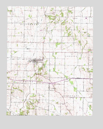
Cynthiana, IN USGS Topographic Map
Click on map above to begin viewing in our Map Viewer.

This topographic map contains these locations and features:
Feature Name Type Latitude Longitude GNIS ID View Map
Antioch ChurchChurchN38.2323°W87.7253°430206View Map
Barr CreekStreamN38.1498°W87.7170°430518View Map
Benson CemeteryCemeteryN38.2384°W87.6936°430825View Map
Blythe ChapelChurchN38.2364°W87.6525°431267View Map
Calverts ChapelChurchN38.1564°W87.6809°431991View Map
Clay Hill Jersey FarmLocaleN38.1283°W87.7167°2628447View Map
CynthianaPopulated PlaceN38.1875°W87.7103°433272View Map
Cynthiana Police DepartmentBuildingN38.1876°W87.7085°2758232View Map
Hepler AirportAirportN38.1353°W87.6717°449333View Map
Jordan CreekStreamN38.1700°W87.6653°437115View Map
Knowles CemeteryCemeteryN38.2056°W87.7253°437412View Map
McGray DitchCanalN38.2445°W87.6417°438877View Map
Mount Mariah CemeteryCemeteryN38.2203°W87.6381°439599View Map
Mount Pleasant ChurchChurchN38.1506°W87.7439°439671View Map
MountsPopulated PlaceN38.2306°W87.7064°439783View Map
New Liberty ChurchChurchN38.1975°W87.6514°440075View Map
Newman LateralCanalN38.1889°W87.6809°440146View Map
NisbetPopulated PlaceN38.1462°W87.6528°440182View Map
Powell CemeteryCemeteryN38.1723°W87.6286°441516View Map
Smith Township Volunteer Fire DepartmentBuildingN38.1864°W87.7142°2701367View Map
Town of CynthianaCivilN38.1873°W87.7085°2396673View Map
Township of ArmstrongCivilN38.1257°W87.6472°453091View Map
Township of SmithCivilN38.1632°W87.7256°453852View Map
Williams CemeteryCemeteryN38.1886°W87.6306°446060View Map
Wilson CemeteryCemeteryN38.2153°W87.7139°446124View Map

Note: Coordinates in the location and feature list above are referenced to NAD83 datum.


Copyright (C) 2008-2024 Ryan Niemi / Sunset Dynamics ... All Rights Reserved