TopoQuest Logo
Do you find TopoQuest useful?
Help keep TopoQuest running and adding new maps/features by donating!
Bitcoin:  19c7KJd3qBynnjoSw5npx9KScwjBe4ifkT
Litecoin:  LXs6TkuXGGXo1vDsWCkWVdjQX94eUKd6ui
Home View Maps Find Maps Find Places Resources & Links


Poseyville, Indiana Topographic Map

USGS Map Title: Poseyville, IN
USGS Map MRC: 38087B7
DRG (GeoTIFF) Download: o38087b7.tif


Neighboring USGS Topographic Map Quads:


  Grayville, IL  
38087C8
 

  Keensburg, IL  
38087C7
 

  Owensville, IN  
38087C6
 

  New Harmony, IN  
38087B8
 

  Poseyville, IN  
38087B7
 

  Cynthiana, IN  
38087B6
 

  Solitude, IN  
38087A8
 

  Wadesville, IN  
38087A7
 

  Kasson, IN  
38087A6


Map MRC Location:

N39°
W88°
N39°
W87°
H8 H7 H6 H5 H4 H3 H2 H1
G8 G7 G6 G5 G4 G3 G2 G1
F8 F7 F6 F5 F4 F3 F2 F1
E8 E7 E6 E5 E4 E3 E2 E1
D8 D7 D6 D5 D4 D3 D2 D1
C8 C7 C6 C5 C4 C3 C2 C1
B8 B7 B6 B5 B4 B3 B2 B1
A8 A7 A6 A5 A4 A3 A2 A1
N38°
W88°
N38°
W87°

Poseyville, IN USGS 1:24K Topographic Map Preview:
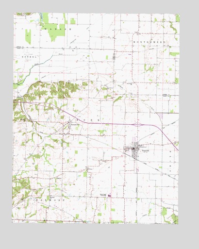
Poseyville, IN USGS Topographic Map
Click on map above to begin viewing in our Map Viewer.

This topographic map contains these locations and features:
Feature Name Type Latitude Longitude GNIS ID View Map
BarrettPopulated PlaceN38.2006°W87.8695°430532View Map
Bethlehem ChurchChurchN38.1573°W87.8192°430977View Map
Bethsaida ChurchChurchN38.1856°W87.8645°430990View Map
Black River ChurchChurchN38.2053°W87.8045°431140View Map
Bugtown AirportAirportN38.1521°W87.8409°2676884View Map
Cale CemeteryCemeteryN38.2092°W87.8342°431954View Map
Callahan CemeteryCemeteryN38.1442°W87.8595°431963View Map
Egg HarborPopulated PlaceN38.2287°W87.7906°452125View Map
Fitzgerrell CemeteryCemeteryN38.1998°W87.8014°434537View Map
Garrett FieldAirportN38.2391°W87.7886°2676986View Map
Hancock CemeteryCemeteryN38.1384°W87.8659°435662View Map
Homer CemeteryCemeteryN38.1334°W87.8692°436373View Map
Miller CemeteryCemeteryN38.1598°W87.8600°439185View Map
Nash ParkParkN38.1253°W87.8406°439941View Map
North Posey High SchoolSchoolN38.1413°W87.8013°440285View Map
North Posey Junior High SchoolSchoolN38.1416°W87.8026°447164View Map
Oak Grove CemeteryCemeteryN38.2381°W87.7828°440403View Map
Old Union CemeteryCemeteryN38.2025°W87.7842°440611View Map
Old Union ChurchChurchN38.2087°W87.7856°440617View Map
PoseyvillePopulated PlaceN38.1700°W87.7831°441477View Map
Poseyville Fire DepartmentBuildingN38.1705°W87.7876°2625964View Map
Poseyville Police DepartmentBuildingN38.1719°W87.7801°2758443View Map
Price CemeteryCemeteryN38.1653°W87.8603°441589View Map
Ralph E Koch AirportAirportN38.2081°W87.7738°2717332View Map
RapturePopulated PlaceN38.1523°W87.8420°441777View Map
Saint Francis CemeteryCemeteryN38.1620°W87.8034°442533View Map
Stallings CemeteryCemeteryN38.1448°W87.8547°444055View Map
StewartsvillePopulated PlaceN38.1848°W87.8328°444158View Map
Town of PoseyvilleCivilN38.1699°W87.7833°2396864View Map
Township of RobbCivilN38.1776°W87.8269°453805View Map
Winfield ChurchChurchN38.1398°W87.8470°446179View Map

Note: Coordinates in the location and feature list above are referenced to NAD83 datum.


Copyright (C) 2008-2025 Ryan Niemi / Sunset Dynamics ... All Rights Reserved