TopoQuest Logo
Do you find TopoQuest useful?
Help keep TopoQuest running and adding new maps/features by donating!
Bitcoin:  19c7KJd3qBynnjoSw5npx9KScwjBe4ifkT
Litecoin:  LXs6TkuXGGXo1vDsWCkWVdjQX94eUKd6ui
Home View Maps Find Maps Find Places Resources & Links


Wadesville, Indiana Topographic Map

USGS Map Title: Wadesville, IN
USGS Map MRC: 38087A7
DRG (GeoTIFF) Download: o38087a7.tif


Neighboring USGS Topographic Map Quads:


  New Harmony, IN  
38087B8
 

  Poseyville, IN  
38087B7
 

  Cynthiana, IN  
38087B6
 

  Solitude, IN  
38087A8
 

  Wadesville, IN  
38087A7
 

  Kasson, IN  
38087A6
 

  Mount Vernon, IN  
37087H8
 

  Caborn, IN  
37087H7
 

  West Franklin, IN  
37087H6


Map MRC Location:

N39°
W88°
N39°
W87°
H8 H7 H6 H5 H4 H3 H2 H1
G8 G7 G6 G5 G4 G3 G2 G1
F8 F7 F6 F5 F4 F3 F2 F1
E8 E7 E6 E5 E4 E3 E2 E1
D8 D7 D6 D5 D4 D3 D2 D1
C8 C7 C6 C5 C4 C3 C2 C1
B8 B7 B6 B5 B4 B3 B2 B1
A8 A7 A6 A5 A4 A3 A2 A1
N38°
W88°
N38°
W87°

Wadesville, IN USGS 1:24K Topographic Map Preview:
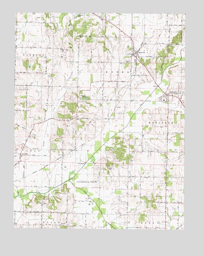
Wadesville, IN USGS Topographic Map
Click on map above to begin viewing in our Map Viewer.

This topographic map contains these locations and features:
Feature Name Type Latitude Longitude GNIS ID View Map
Black Township Fire Department and Rescue Station 2BuildingN38.0023°W87.8441°2625899View Map
BlairsvillePopulated PlaceN38.0789°W87.7620°431168View Map
Downen CemeteryCemeteryN38.0353°W87.8059°433670View Map
HepburnPopulated PlaceN38.0703°W87.8011°436047View Map
Knowles LakeLakeN38.0759°W87.8229°437413View Map
LaRoche LakeLakeN38.1237°W87.8298°437491View Map
Laurel Hill CemeteryCemeteryN38.0970°W87.7939°437655View Map
Lick CreekStreamN38.0523°W87.8053°437857View Map
LippePopulated PlaceN38.0153°W87.7539°437977View Map
Little CreekStreamN38.0278°W87.8353°438022View Map
McAdoo CreekStreamN38.0220°W87.8484°438776View Map
Mount Zion ChurchChurchN38.0595°W87.8367°439747View Map
Old Beech CreekStreamN38.0534°W87.8528°440534View Map
Old BrookStreamN38.0462°W87.8528°440544View Map
OliverPopulated PlaceN38.0434°W87.8392°440652View Map
Oliver Underground Gas Storage AreaOilfieldN38.0270°W87.8209°446881View Map
Posey CountyCivilN38.0219°W87.8685°450383View Map
Schroeder Private AirportAirportN38.0064°W87.7576°2676983View Map
South Terrace Elementary SchoolSchoolN38.0750°W87.7653°443860View Map
SpringfieldPopulated PlaceN38.0425°W87.8703°444010View Map
Stierley Airport (historical)AirportN38.1098°W87.8070°449284View Map
Township of CenterCivilN38.0882°W87.8076°453190View Map
Tri BrookStreamN38.0192°W87.8711°444873View Map
WadesvillePopulated PlaceN38.1025°W87.7861°445343View Map
Wadesville Center Township Volunteer Fire DepartmentBuildingN38.1025°W87.7865°2625726View Map

Note: Coordinates in the location and feature list above are referenced to NAD83 datum.


Copyright (C) 2008-2024 Ryan Niemi / Sunset Dynamics ... All Rights Reserved