TopoQuest Logo
Do you find TopoQuest useful?
Help keep TopoQuest running and adding new maps/features by donating!
Bitcoin:  19c7KJd3qBynnjoSw5npx9KScwjBe4ifkT
Litecoin:  LXs6TkuXGGXo1vDsWCkWVdjQX94eUKd6ui
Home View Maps Find Maps Find Places Resources & Links


Owensville, Indiana Topographic Map

USGS Map Title: Owensville, IN
USGS Map MRC: 38087C6
DRG (GeoTIFF) Download: o38087c6.tif


Neighboring USGS Topographic Map Quads:


  Mount Carmel, IL  
38087D7
 

  East Mount Carmel, IN  
38087D6
 

  Patoka, IN  
38087D5
 

  Keensburg, IL  
38087C7
 

  Owensville, IN  
38087C6
 

  Princeton, IN  
38087C5
 

  Poseyville, IN  
38087B7
 

  Cynthiana, IN  
38087B6
 

  Haubstadt, IN  
38087B5


Map MRC Location:

N39°
W88°
N39°
W87°
H8 H7 H6 H5 H4 H3 H2 H1
G8 G7 G6 G5 G4 G3 G2 G1
F8 F7 F6 F5 F4 F3 F2 F1
E8 E7 E6 E5 E4 E3 E2 E1
D8 D7 D6 D5 D4 D3 D2 D1
C8 C7 C6 C5 C4 C3 C2 C1
B8 B7 B6 B5 B4 B3 B2 B1
A8 A7 A6 A5 A4 A3 A2 A1
N38°
W88°
N38°
W87°

Owensville, IN USGS 1:24K Topographic Map Preview:
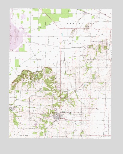
Owensville, IN USGS Topographic Map
Click on map above to begin viewing in our Map Viewer.

This topographic map contains these locations and features:
Feature Name Type Latitude Longitude GNIS ID View Map
Andrews RunStreamN38.2964°W87.6709°430172View Map
Barren CreekStreamN38.2823°W87.7472°430525View Map
Blair DitchCanalN38.3403°W87.7097°431165View Map
Book RunStreamN38.2745°W87.6570°431333View Map
Clark CemeteryCemeteryN38.2523°W87.6622°432549View Map
Clark RunStreamN38.2620°W87.6670°432564View Map
Coffee BayouGutN38.3434°W87.7397°432732View Map
Coon CreekStreamN38.3517°W87.7442°432930View Map
David RunStreamN38.2953°W87.6689°433333View Map
Emerson DitchCanalN38.3162°W87.7103°434156View Map
Gibson County Emergency Medical Services Station 5BuildingN38.2706°W87.6881°2719416View Map
Hand BranchStreamN38.2525°W87.7367°435668View Map
JohnsonPopulated PlaceN38.2778°W87.7459°437029View Map
Lillard DitchCanalN38.3739°W87.6656°437884View Map
Lilly RunStreamN38.3631°W87.6778°437890View Map
Loefler DitchCanalN38.2745°W87.6570°438218View Map
LylesPopulated PlaceN38.3703°W87.6592°438427View Map
Mauck CemeteryCemeteryN38.2848°W87.7228°438735View Map
Mauck RunStreamN38.2887°W87.7364°438736View Map
McCarty DitchCanalN38.3614°W87.6922°438787View Map
McGaryPopulated PlaceN38.2645°W87.6286°452100View Map
McGary DitchCanalN38.2564°W87.6334°438870View Map
Montgomery DitchCanalN38.2581°W87.6906°439367View Map
Owen RunStreamN38.2809°W87.7061°440793View Map
OwensvillePopulated PlaceN38.2720°W87.6878°440801View Map
Owensville - Montgomery Township Fire Protection District Owensville StationBuildingN38.2706°W87.6880°2626041View Map
Owensville Police DepartmentBuildingN38.2726°W87.6918°2758290View Map
Owensville Post OfficePost OfficeN38.2722°W87.6929°2775776View Map
Owensville Public SchoolSchoolN38.2698°W87.6939°446982View Map
Paper RunStreamN38.3184°W87.7403°440857View Map
Richland ChurchChurchN38.3395°W87.6509°441963View Map
Sand HillSummitN38.3562°W87.6559°442972View Map
Sand Hill CemeteryCemeteryN38.3603°W87.6536°442977View Map
Saunders DitchCanalN38.3637°W87.7056°443045View Map
Seed RunStreamN38.3398°W87.7050°443198View Map
Skelton BranchStreamN38.2792°W87.7211°443571View Map
Skelton CemeteryCemeteryN38.2686°W87.7250°443572View Map
Skelton CreekStreamN38.3381°W87.6920°443573View Map
Smith RunStreamN38.2950°W87.6786°443701View Map
Stormont DitchCanalN38.3398°W87.7425°444239View Map
Thompson DitchCanalN38.3267°W87.6914°444709View Map
Town of OwensvilleCivilN38.2717°W87.6920°2396843View Map
Township of MontgomeryCivilN38.2888°W87.7287°453649View Map
Watson LateralCanalN38.3231°W87.7428°445554View Map

Note: Coordinates in the location and feature list above are referenced to NAD83 datum.


Copyright (C) 2008-2025 Ryan Niemi / Sunset Dynamics ... All Rights Reserved