TopoQuest Logo
Do you find TopoQuest useful?
Help keep TopoQuest running and adding new maps/features by donating!
Bitcoin:  19c7KJd3qBynnjoSw5npx9KScwjBe4ifkT
Litecoin:  LXs6TkuXGGXo1vDsWCkWVdjQX94eUKd6ui
Home View Maps Find Maps Find Places Resources & Links


Dames Ferry, Georgia Topographic Map

USGS Map Title: Dames Ferry, GA
USGS Map MRC: 33083A6
DRG (GeoTIFF) Download: o33083a6.tif


Neighboring USGS Topographic Map Quads:


  Berner, GA  
33083B7
 

  Hillsboro, GA  
33083B6
 

  Stanfordville, GA  
33083B5
 

  East Juliette, GA  
33083A7
 

  Dames Ferry, GA  
33083A6
 

  Gray, GA  
33083A5
 

  Bolingbroke, GA  
32083H7
 

  Macon NW, GA  
32083H6
 

  Macon NE, GA  
32083H5


Map MRC Location:

N34°
W84°
N34°
W83°
H8 H7 H6 H5 H4 H3 H2 H1
G8 G7 G6 G5 G4 G3 G2 G1
F8 F7 F6 F5 F4 F3 F2 F1
E8 E7 E6 E5 E4 E3 E2 E1
D8 D7 D6 D5 D4 D3 D2 D1
C8 C7 C6 C5 C4 C3 C2 C1
B8 B7 B6 B5 B4 B3 B2 B1
A8 A7 A6 A5 A4 A3 A2 A1
N33°
W84°
N33°
W83°

Dames Ferry, GA USGS 1:24K Topographic Map Preview:
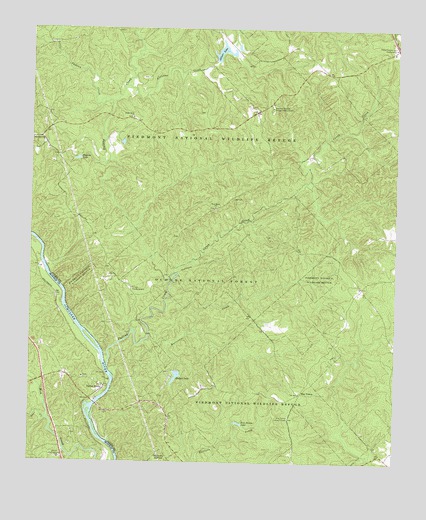
Dames Ferry, GA USGS Topographic Map
Click on map above to begin viewing in our Map Viewer.

This topographic map contains these locations and features:
Feature Name Type Latitude Longitude GNIS ID View Map
Allison Lake Wildlife TrailTrailN33.1174°W83.6818°345329View Map
Allisons CreekStreamN33.1082°W83.7177°326940View Map
Allisons LakeReservoirN33.1195°W83.6843°326941View Map
Barn BranchStreamN33.0199°W83.7224°345330View Map
Camp WillisLocaleN33.0021°W83.6993°345339View Map
Caney CreekStreamN33.0546°W83.7005°354979View Map
Church CampgroundLocaleN33.0012°W83.7396°355166View Map
Crutchfield (historical)Populated PlaceN33.1012°W83.6735°345344View Map
Crutchfield CemeteryCemeteryN33.1018°W83.6729°345345View Map
Dames FerryPopulated PlaceN33.0221°W83.7249°355434View Map
Dames Ferry (historical)CrossingN33.0210°W83.7224°343039View Map
Dames Ferry Baptist ChurchChurchN33.0246°W83.7318°343040View Map
Deer CreekStreamN33.0121°W83.7435°327624View Map
Falling CreekStreamN33.0274°W83.7230°355774View Map
Fippin (historical)Populated PlaceN33.0954°W83.6960°345349View Map
Five PointsPopulated PlaceN33.0196°W83.6571°331718View Map
Five Points LakeReservoirN33.0115°W83.6782°327829View Map
Five Points Lookout TowerTowerN33.0126°W83.6605°344238View Map
Green School (historical)SchoolN33.0046°W83.6443°345354View Map
Hilchiti Experimental ForestParkN33.0526°W83.6899°330620View Map
Hilchiti Experimental Forest StationBuildingN33.0504°W83.7157°330621View Map
Hitchiti Experimental ForestForestN33.0571°W83.6796°345358View Map
Hodges LakeReservoirN33.0247°W83.6998°328176View Map
Hodges Lake DamDamN33.0262°W83.6996°336165View Map
Holland B Speller CemeteryCemeteryN33.0520°W83.7181°345359View Map
Hurricane CreekStreamN33.0376°W83.7088°328262View Map
Jarell Historical PlantationLocaleN33.0529°W83.7235°330622View Map
Jarrell PlantationLocaleN33.0526°W83.7249°345363View Map
Jarrell Plantation State Historic SiteParkN33.0526°W83.7249°345364View Map
Lewis Loyd CemeteryCemeteryN33.0651°W83.6993°345373View Map
Liberty School (historical)SchoolN33.0168°W83.7052°345374View Map
Little Falling CreekStreamN33.1037°W83.7224°328546View Map
Little Rock ChurchChurchN33.0996°W83.7155°328571View Map
Macedonia Church (historical)ChurchN33.0657°W83.7285°345377View Map
Mitchell LakeReservoirN33.0584°W83.7393°336160View Map
Mitchell Lake DamDamN33.0568°W83.7399°336159View Map
Mount Zion Church (historical)ChurchN33.0296°W83.6516°345378View Map
National Wildlife Refuge HeadquartersBuildingN33.1026°W83.6677°330685View Map
New Hope CemeteryCemeteryN33.0737°W83.6879°345380View Map
New Hope ChurchChurchN33.0735°W83.6868°329001View Map
Piedmont National Wildlife RefugeParkN33.1064°W83.6987°330550View Map
Piney Grove Church (historical)ChurchN33.0343°W83.6657°345384View Map
Pippins LakeReservoirN33.0874°W83.7342°329243View Map
Round Oak Lookout TowerTowerN33.1207°W83.6257°344388View Map
S A Hodge Senior BridgeBridgeN33.0168°W83.7274°343101View Map
Smalls Crossing (historical)Populated PlaceN33.0507°W83.6363°345394View Map
State Forestry Unit HeadquartersBuildingN33.1190°W83.6263°330686View Map
Steed LakeReservoirN33.1061°W83.6812°340763View Map
Steed Lake DamDamN33.1068°W83.6832°340762View Map
Zion Hill ChurchChurchN33.0929°W83.7460°330425View Map

Note: Coordinates in the location and feature list above are referenced to NAD83 datum.


Copyright (C) 2008-2025 Ryan Niemi / Sunset Dynamics ... All Rights Reserved