TopoQuest Logo
Do you find TopoQuest useful?
Help keep TopoQuest running and adding new maps/features by donating!
Bitcoin:  19c7KJd3qBynnjoSw5npx9KScwjBe4ifkT
Litecoin:  LXs6TkuXGGXo1vDsWCkWVdjQX94eUKd6ui
Home View Maps Find Maps Find Places Resources & Links


Bolingbroke, Georgia Topographic Map

USGS Map Title: Bolingbroke, GA
USGS Map MRC: 32083H7
DRG (GeoTIFF) Download: o32083h7.tif


Neighboring USGS Topographic Map Quads:


  Forsyth, GA  
33083A8
 

  East Juliette, GA  
33083A7
 

  Dames Ferry, GA  
33083A6
 

  Smarr, GA  
32083H8
 

  Bolingbroke, GA  
32083H7
 

  Macon NW, GA  
32083H6
 

  Moran, GA  
32083G8
 

  Lizella, GA  
32083G7
 

  Macon West, GA  
32083G6


Map MRC Location:

N33°
W84°
N33°
W83°
H8 H7 H6 H5 H4 H3 H2 H1
G8 G7 G6 G5 G4 G3 G2 G1
F8 F7 F6 F5 F4 F3 F2 F1
E8 E7 E6 E5 E4 E3 E2 E1
D8 D7 D6 D5 D4 D3 D2 D1
C8 C7 C6 C5 C4 C3 C2 C1
B8 B7 B6 B5 B4 B3 B2 B1
A8 A7 A6 A5 A4 A3 A2 A1
N32°
W84°
N32°
W83°

Bolingbroke, GA USGS 1:24K Topographic Map Preview:
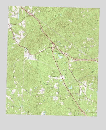
Bolingbroke, GA USGS Topographic Map
Click on map above to begin viewing in our Map Viewer.

This topographic map contains these locations and features:
Feature Name Type Latitude Longitude GNIS ID View Map
BolingbrokePopulated PlaceN32.9493°W83.8032°354808View Map
Bolingbroke Methodist ChurchChurchN32.9504°W83.8038°343021View Map
Bolingbroke Post OfficePost OfficeN32.9487°W83.8027°1744615View Map
Clay Lake NorthReservoirN32.8771°W83.8222°340929View Map
Clay Lake North DamDamN32.8768°W83.8232°340928View Map
Colaparchee ChurchChurchN32.9276°W83.7941°355228View Map
Colaparchee CreekStreamN32.8751°W83.7746°355229View Map
Deerlick Academy (historical)SchoolN32.9937°W83.8346°343042View Map
Evans LakeReservoirN32.9886°W83.8610°340095View Map
Evans Lake DamDamN32.9918°W83.8616°340094View Map
Exit 3CrossingN32.8799°W83.7693°1672110View Map
Exit 4CrossingN32.9515°W83.8124°1685685View Map
Exit 5CrossingN32.9574°W83.8127°1685686View Map
Exit 57CrossingN32.9399°W83.7791°1685670View Map
Exit 58CrossingN32.9582°W83.8124°1685671View Map
Exit 59CrossingN32.9912°W83.8444°1685672View Map
First South ChurchChurchN32.9410°W83.7630°343048View Map
Howard ChapelChurchN32.8882°W83.7749°315754View Map
Jobes ChapelChurchN32.9776°W83.7966°316118View Map
Lamon LakeReservoirN32.9078°W83.7865°340931View Map
Lamon Lake DamDamN32.9068°W83.7866°340930View Map
Little Tobesofkee CreekStreamN32.8854°W83.8546°317224View Map
LoranePopulated PlaceN32.9140°W83.7741°326376View Map
Macon - Bibb County Fire Department Station 108BuildingN32.8855°W83.7647°2604051View Map
Mceacherns LakeReservoirN32.9066°W83.8343°340410View Map
Mceacherns Lake DamDamN32.9051°W83.8349°340409View Map
Midway School (historical)SchoolN32.9868°W83.7849°343072View Map
Monroe County Fire Department Station 4BuildingN32.9493°W83.8018°2604818View Map
Mount Zion Academy (historical)SchoolN32.9374°W83.7927°343081View Map
Mount Zion CemeteryCemeteryN32.9269°W83.7861°343082View Map
Mount Zion ChurchChurchN32.9262°W83.7855°318988View Map
Mount Zion ChurchChurchN32.9371°W83.7927°318989View Map
Pleasant Grove CemeteryCemeteryN32.9304°W83.8643°334212View Map
Pleasant Grove ChurchChurchN32.9310°W83.8649°320820View Map
Rivoli PlantationPopulated PlaceN32.9051°W83.7513°1672269View Map
Rosenwall School (historical)SchoolN32.9793°W83.7949°334213View Map
Saint Paul ChurchChurchN32.9793°W83.8610°322237View Map
Salem CemeteryCemeteryN32.9860°W83.7857°343104View Map
Salem ChurchChurchN32.9865°W83.7849°322360View Map
Union Church (historical)ChurchN32.8893°W83.7980°1672321View Map
United ChurchChurchN32.8876°W83.7955°324593View Map
Wadley CemeteryCemeteryN32.9474°W83.8188°324740View Map
WFXM-FM (Forsyth)TowerN32.9754°W83.8696°352690View Map
William ChapelChurchN32.9057°W83.8735°325319View Map
Williamson LakeLakeN32.9436°W83.8023°325385View Map
Winn CemeteryCemeteryN32.9471°W83.8276°343117View Map

Note: Coordinates in the location and feature list above are referenced to NAD83 datum.


Copyright (C) 2008-2024 Ryan Niemi / Sunset Dynamics ... All Rights Reserved