TopoQuest Logo
Do you find TopoQuest useful?
Help keep TopoQuest running and adding new maps/features by donating!
Bitcoin:  19c7KJd3qBynnjoSw5npx9KScwjBe4ifkT
Litecoin:  LXs6TkuXGGXo1vDsWCkWVdjQX94eUKd6ui
Home View Maps Find Maps Find Places Resources & Links


Darbun, Mississippi Topographic Map

USGS Map Title: Darbun, MS
USGS Map MRC: 31090C1
DRG (GeoTIFF) Download: o31090c1.tif


Neighboring USGS Topographic Map Quads:


  Topeka, MS  
31090D2
 

  Tilton, MS  
31090D1
 

  Oak Vale, MS  
31089D8
 

  Jayess, MS  
31090C2
 

  Darbun, MS  
31090C1
 

  Morgantown, MS  
31089C8
 

  Mesa, MS  
31090B2
 

  Kokomo, MS  
31090B1
 

  Sandy Hook NW, MS  
31089B8


Map MRC Location:

N32°
W91°
N32°
W90°
H8 H7 H6 H5 H4 H3 H2 H1
G8 G7 G6 G5 G4 G3 G2 G1
F8 F7 F6 F5 F4 F3 F2 F1
E8 E7 E6 E5 E4 E3 E2 E1
D8 D7 D6 D5 D4 D3 D2 D1
C8 C7 C6 C5 C4 C3 C2 C1
B8 B7 B6 B5 B4 B3 B2 B1
A8 A7 A6 A5 A4 A3 A2 A1
N31°
W91°
N31°
W90°

Darbun, MS USGS 1:24K Topographic Map Preview:
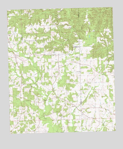
Darbun, MS USGS Topographic Map
Click on map above to begin viewing in our Map Viewer.

This topographic map contains these locations and features:
Feature Name Type Latitude Longitude GNIS ID View Map
3J Poultry RanchLocaleN31.2714°W90.0222°2664463View Map
4th District Volunteer Fire Department Station 1BuildingN31.3274°W90.1166°2667897View Map
4th District Volunteer Fire Department Station 3BuildingN31.2659°W90.0419°2667946View Map
Bethehelm Baptist ChurchChurchN31.2861°W90.0691°666988View Map
Bucking Spur RanchLocaleN31.2722°W90.0069°2664464View Map
DarbunPopulated PlaceN31.2763°W90.0470°669105View Map
Darbun CemeteryCemeteryN31.2666°W90.0637°709240View Map
Darbun CemeteryCemeteryN31.2682°W90.0384°710525View Map
Durban Mennonite ChurchChurchN31.2699°W90.0399°669106View Map
Latter Day Saints ChurchChurchN31.2666°W90.0634°672314View Map
Magees Creek CemeteryCemeteryN31.2818°W90.0848°709250View Map
Magees Creek ChurchChurchN31.2827°W90.0845°673062View Map
Pine Grove United Pentecostal ChurchChurchN31.3409°W90.0409°675824View Map
Rials FarmsLocaleN31.2536°W90.0331°2664465View Map
Salem ChurchChurchN31.3716°W90.0979°677270View Map
SartinvillePopulated PlaceN31.3271°W90.1162°692211View Map
Sartinville CemeteryCemeteryN31.3266°W90.1167°709261View Map
Sartinville ChurchChurchN31.3424°W90.1240°677424View Map
Sauls Valley CemeteryCemeteryN31.3732°W90.0615°677430View Map
Tilton Fire DepartmentBuildingN31.3722°W90.0626°2668035View Map

Note: Coordinates in the location and feature list above are referenced to NAD83 datum.


Copyright (C) 2008-2025 Ryan Niemi / Sunset Dynamics ... All Rights Reserved